Featured

Log: Waterfalls, R2AK, & Canadian stars

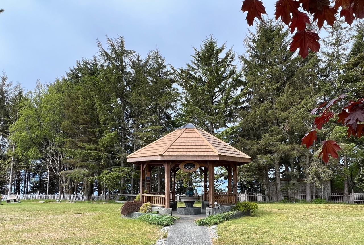
Prelude Beautiful anchorages on this leg, plus time at docks since gaps in my pre-departure prep have caught up with us. Problem-solving – done with the help and encouragement of many – not only fortify our patience but make this the most satisfying leg of the trip!

Sunday 18 June 2023 – Ell Cove 0800 departure, arrival 1800 N 57º11.9’ W 134º50.9’. 

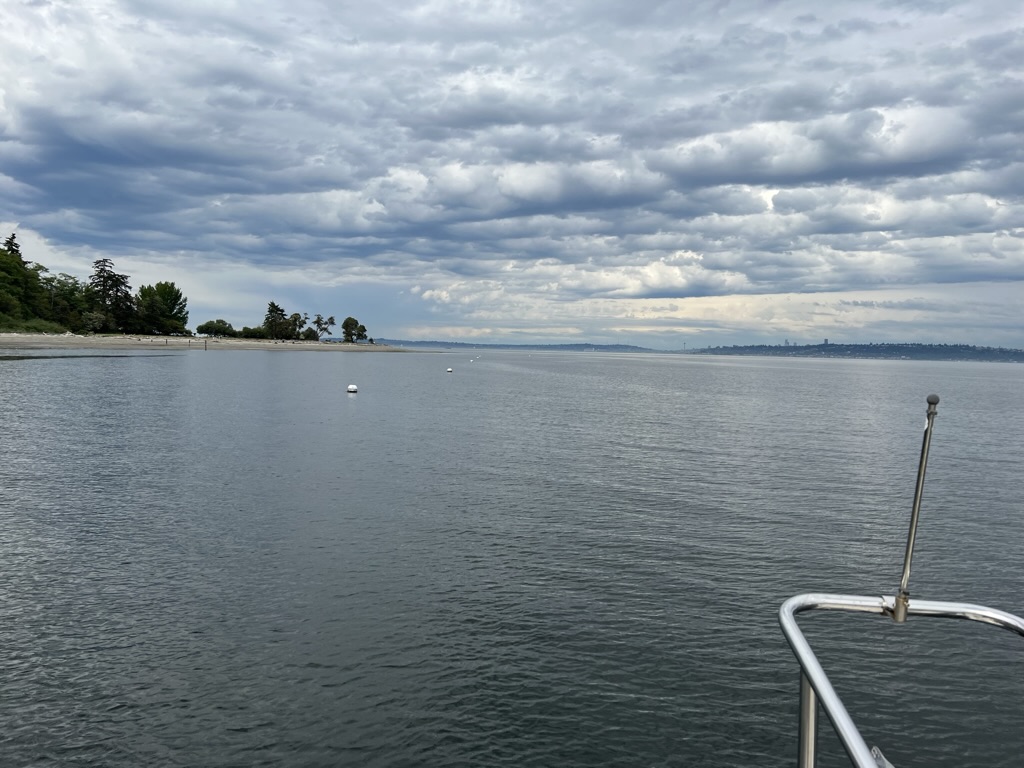
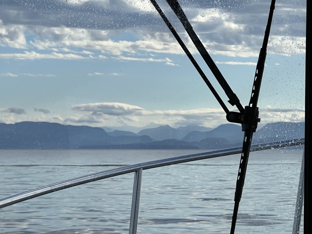
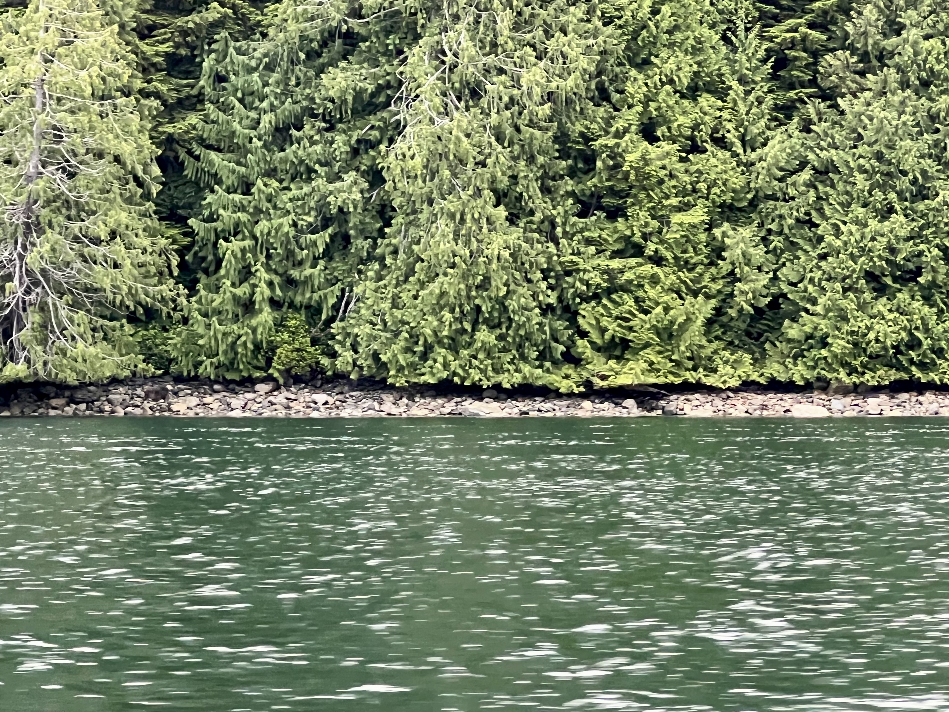
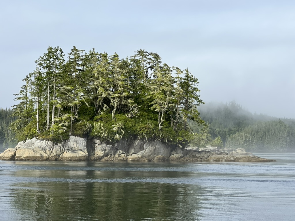
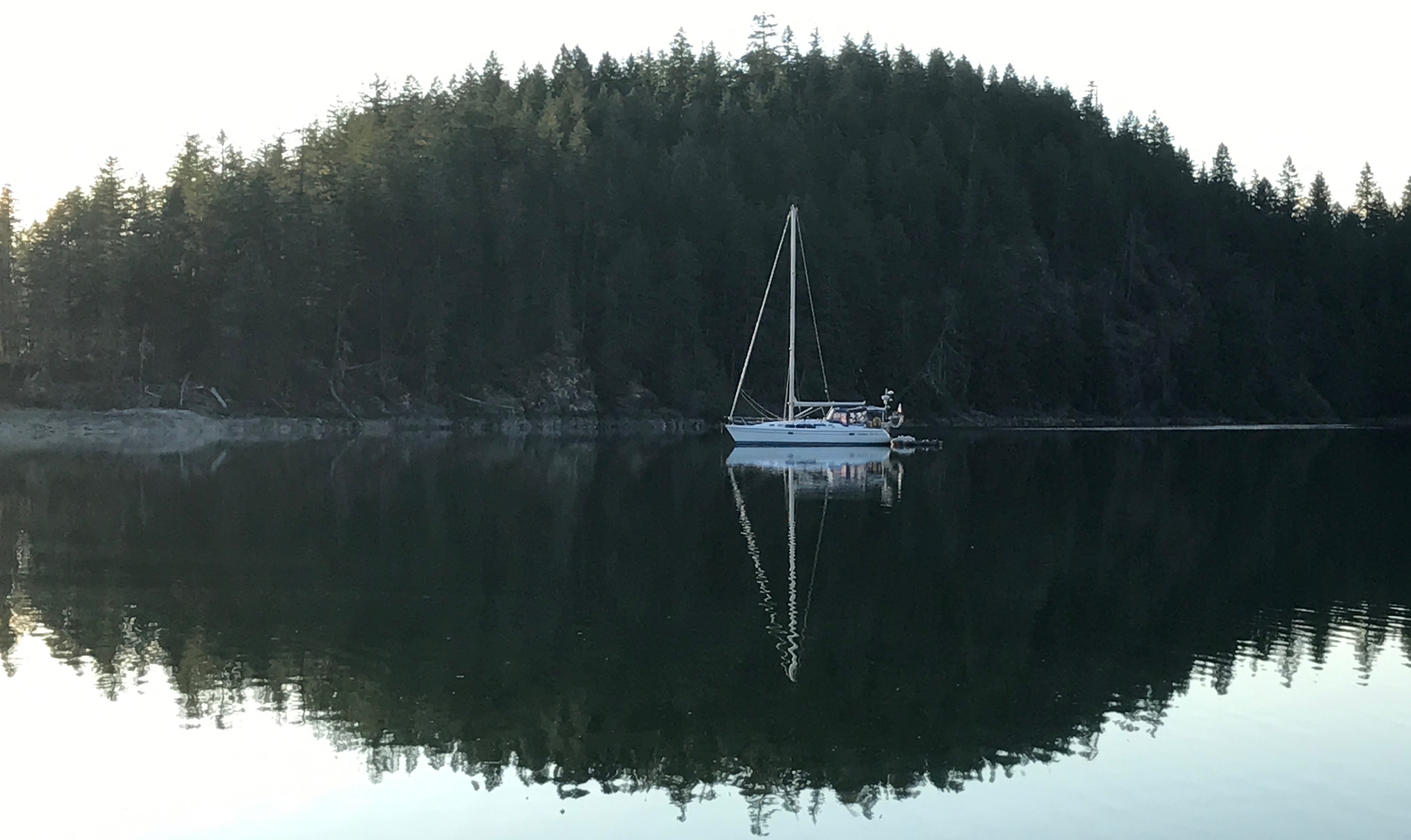
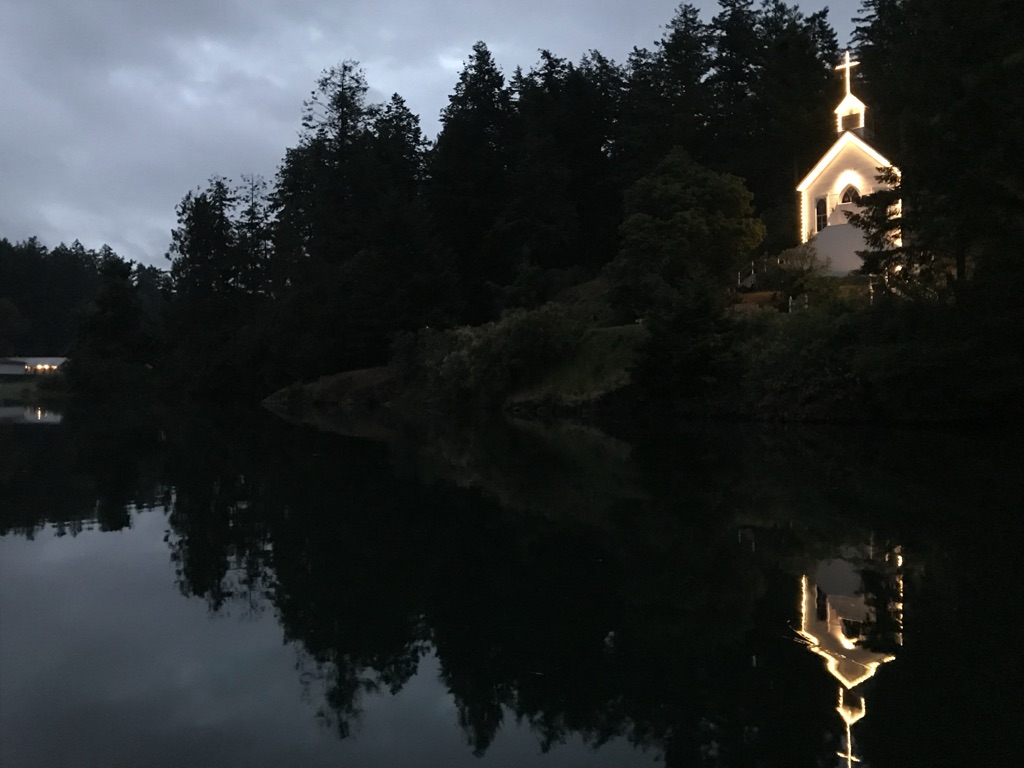
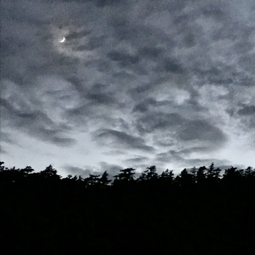
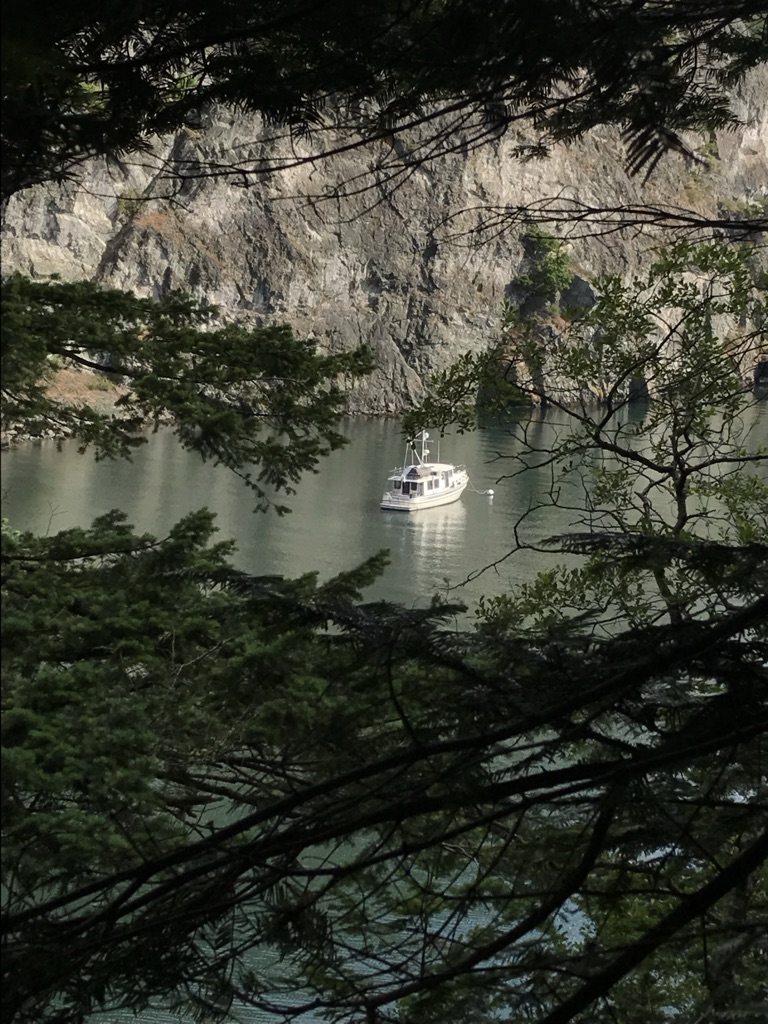
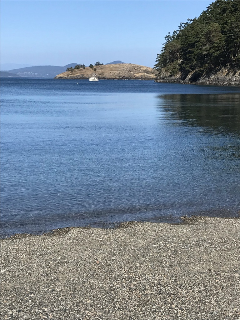
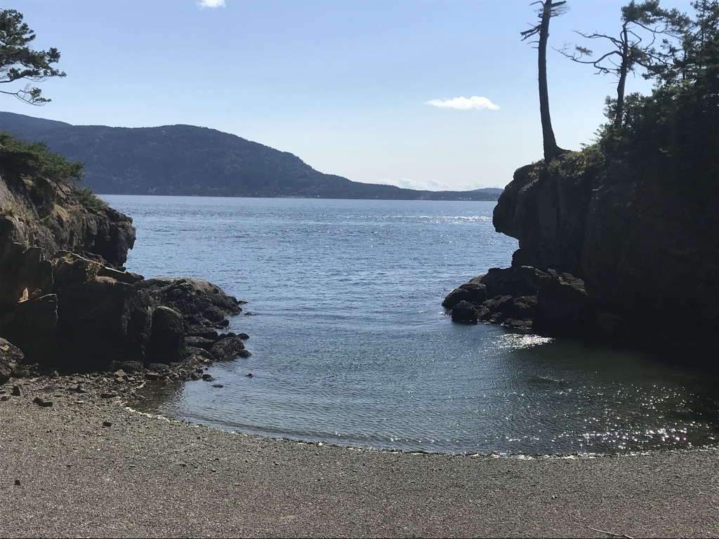
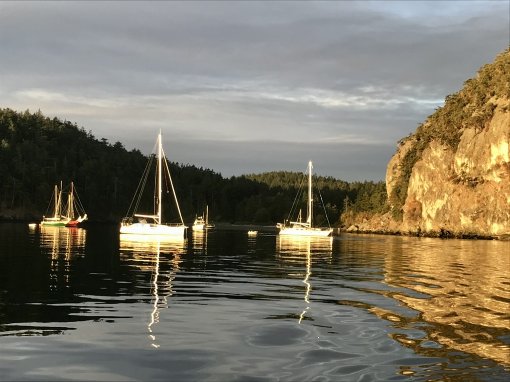
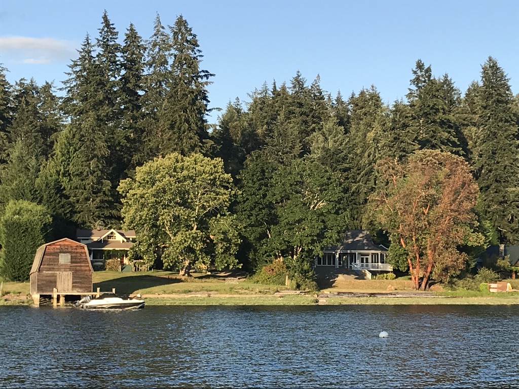
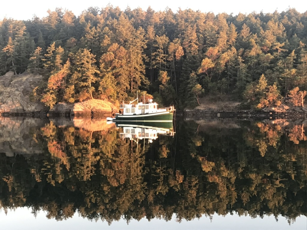
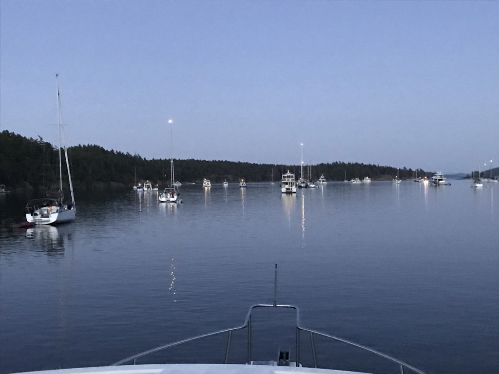
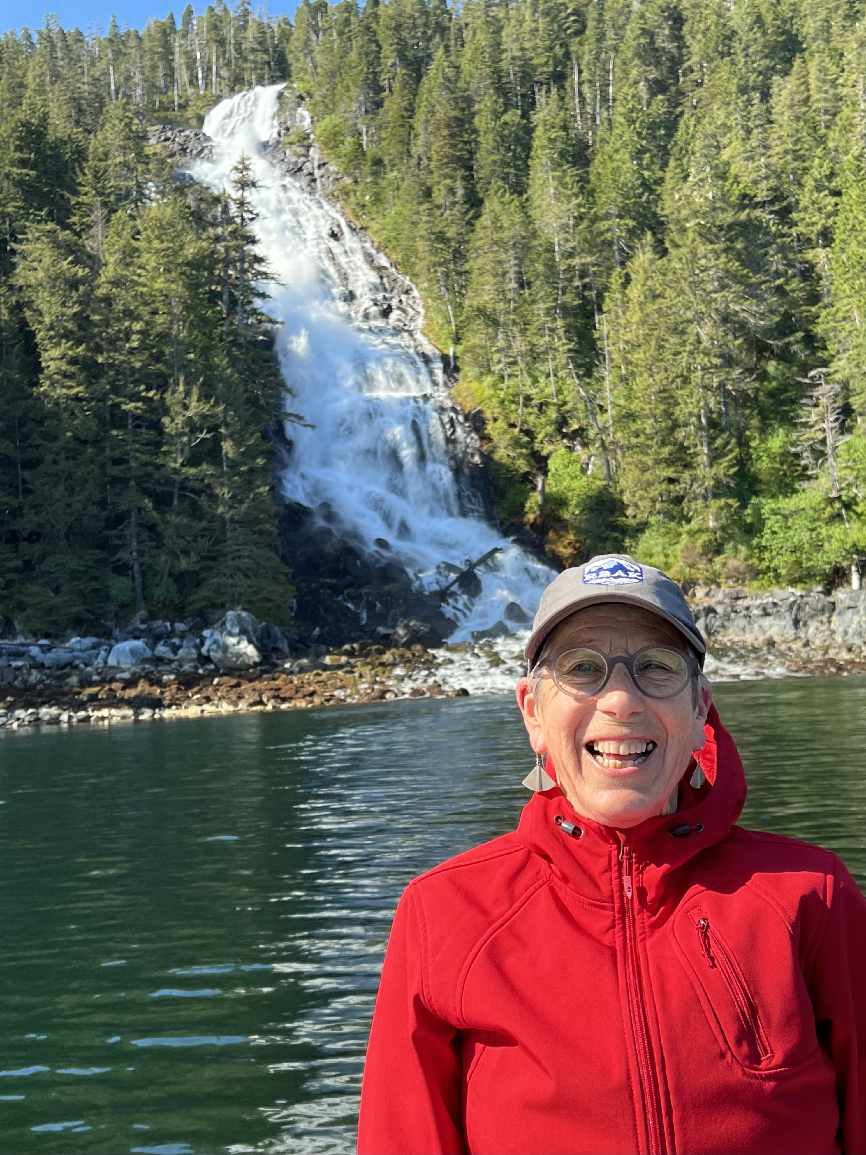
We time our departure to arrive at Sergius Narrows at slack and transit the length of Peril Strait in a day, before tucking into tiny Ell Cove, this year’s discovery. It’s not on our charts but for the spectacular Waterfall Coast of Baranof Island we trust Navionics. More and more each trip.

Kismet is there at anchor when we arrive. Before leaving, on the morning of our rest day, Tom and Michele come by to say hello and catch up on the news. These ebullient Floridians are cruising the Pacific Northwest through September. We’ve been crossing paths since meeting at Devil’s Bath Brewery in Port McNeill in May. The really interesting questions they kept asking persuaded me give up on daily blog writing. Now it’s Tom and Michele who tell us what’s up and where to go.

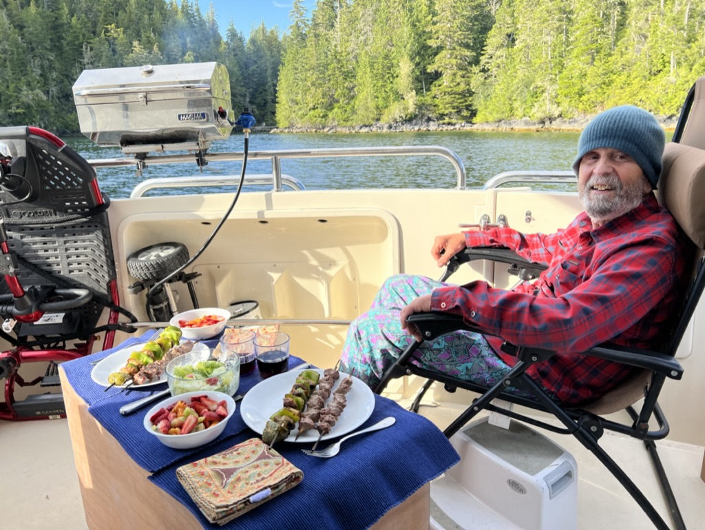
They invite me to hop into their Grady-White dinghy and off we go to the waterfalls, immediately south of Ell Cove. I have no idea how to take a selfie without throwing my phone in the drink, so they do it for me!

Tuesday 20 June 2023 – Ruth Island in Thomas Basin  0845 departure. Pt Gardner calm in good weather and slack current. 1730 arrival at N 56º 56’ W 132º 48’.

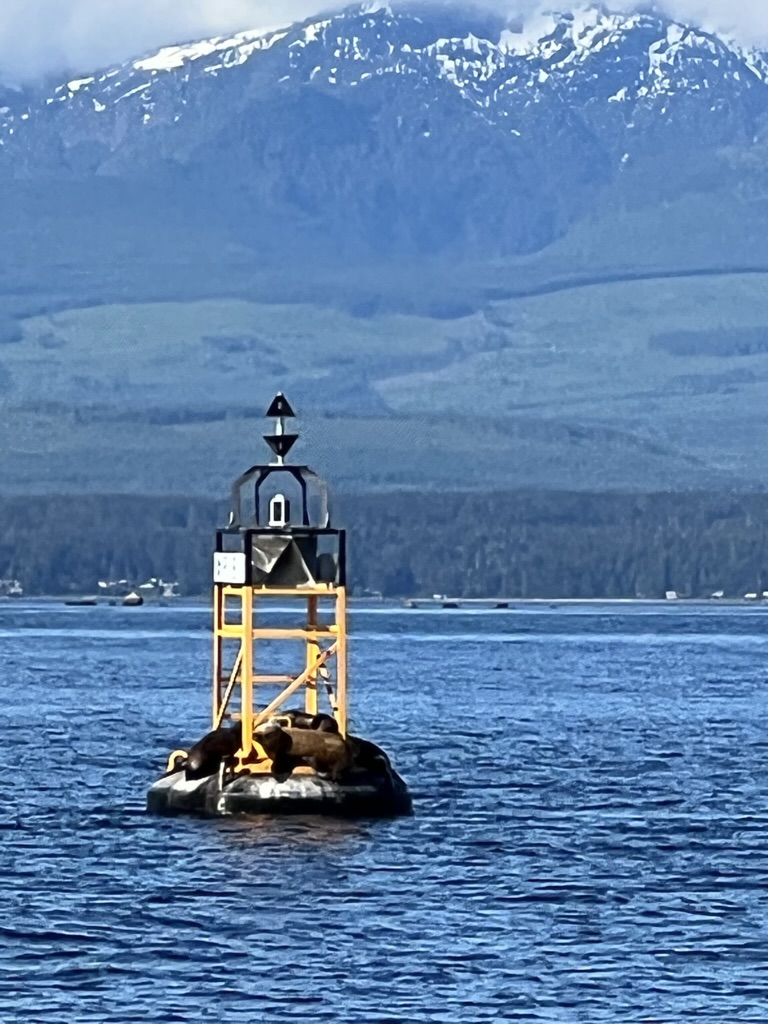
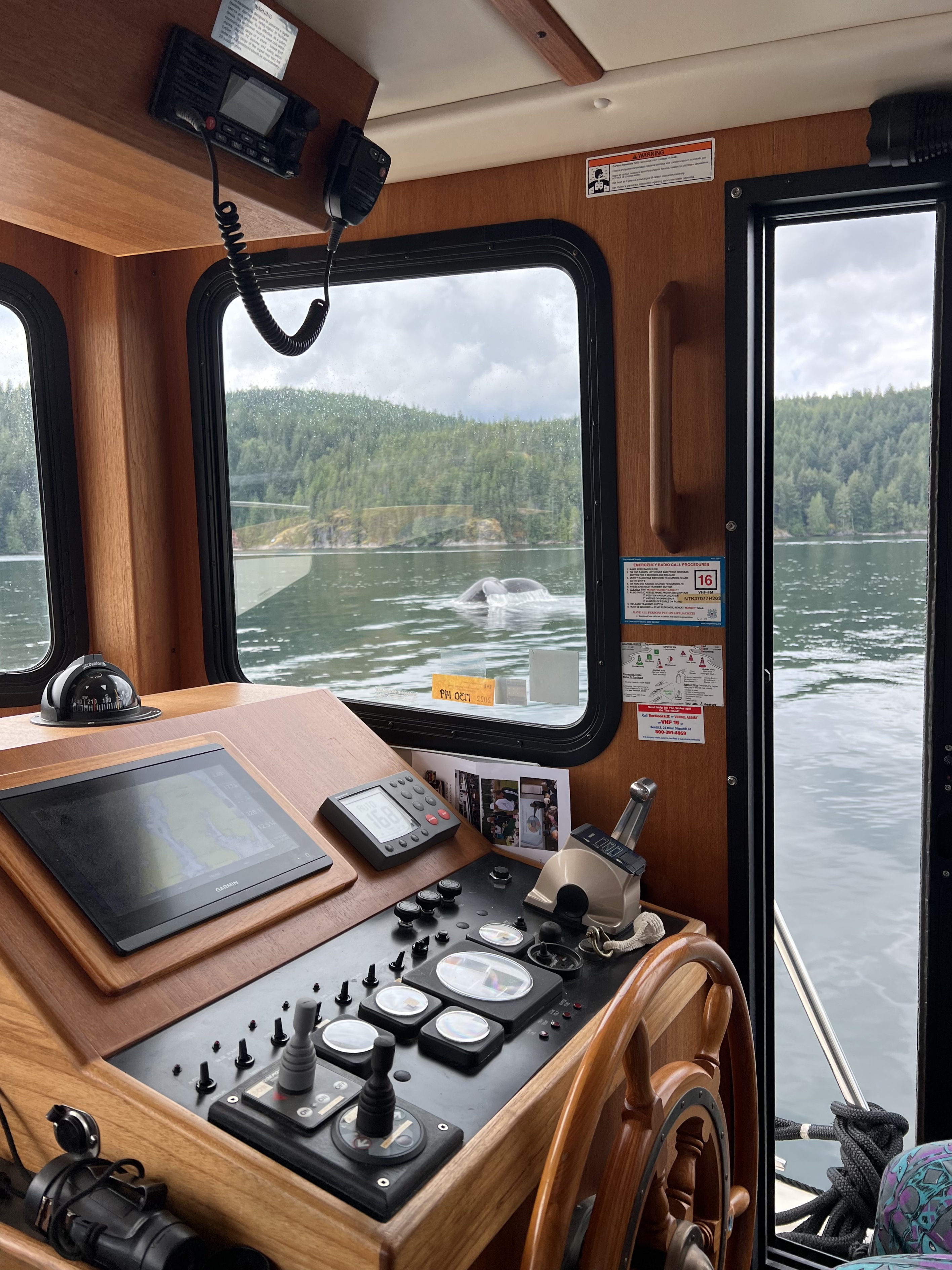
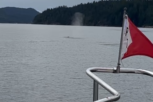
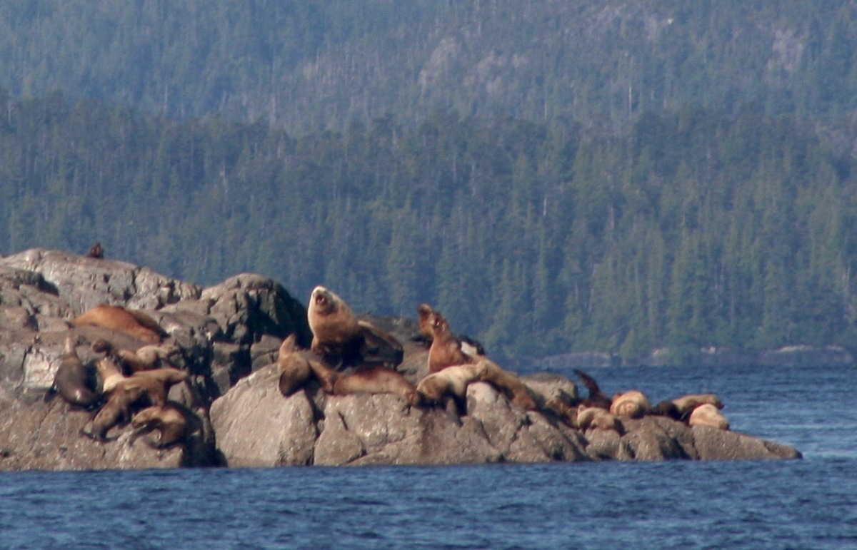
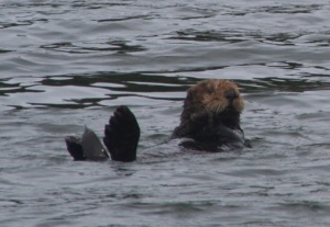
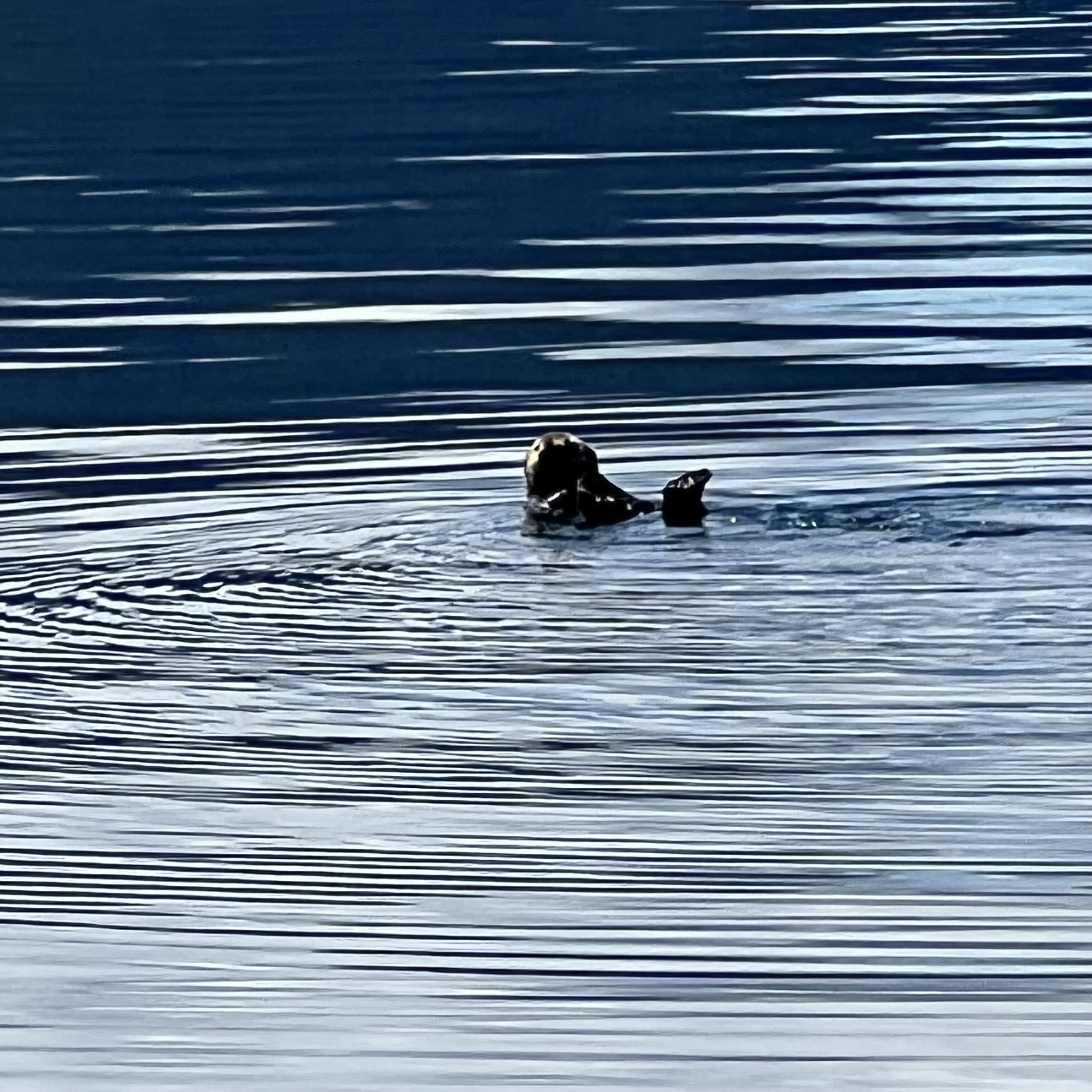
What a difference our rounding of Point Gardner is this time!  We take it at slack and spend the rest of the day on the big waters of Frederick Sound, remembering the year they were encumbered with dozens of sleeping humpbacks.  This time we see none, though the sea otters are back in force.

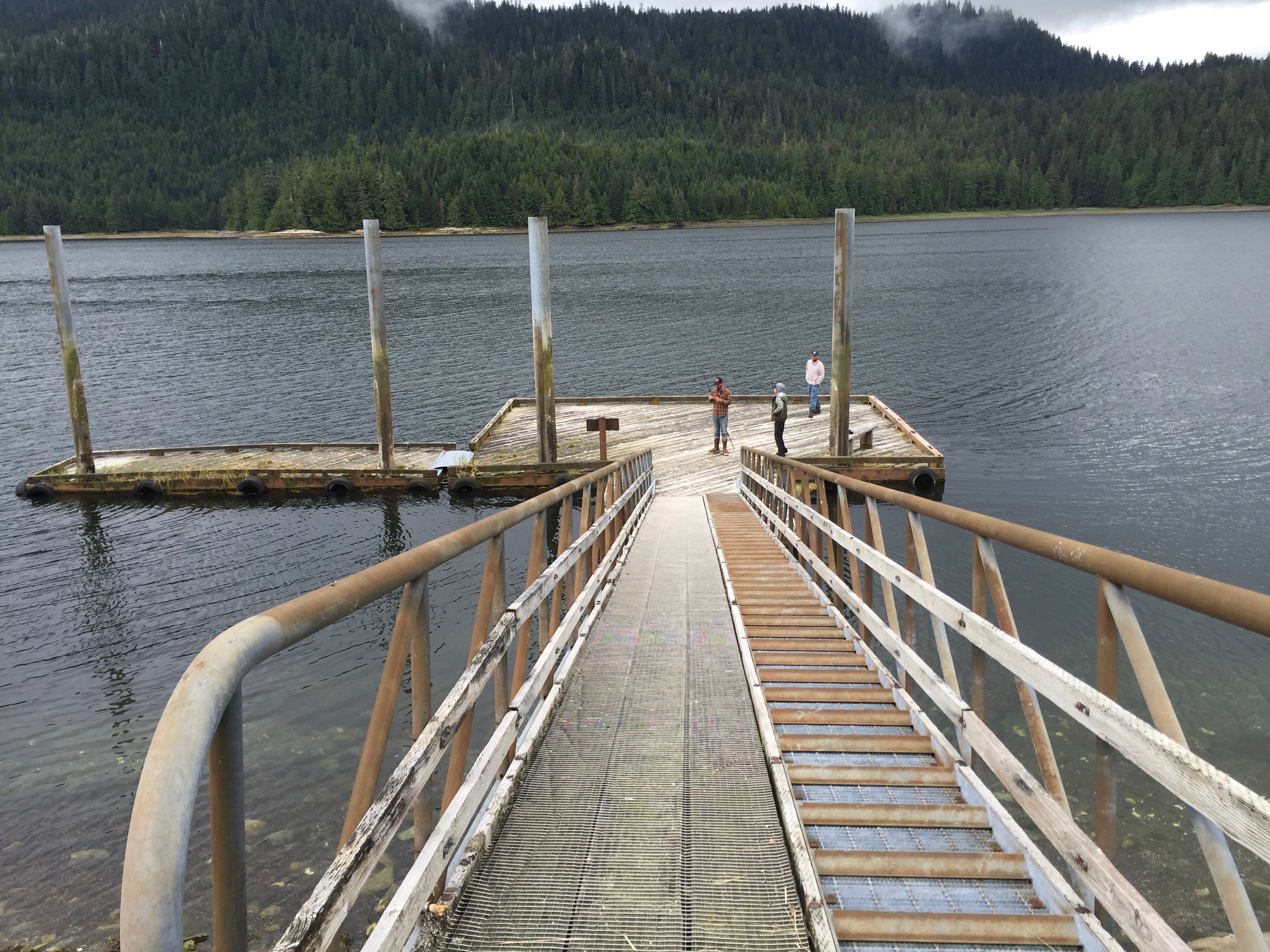
Jack surprises me with a stop in Thomas Bay, which he remembers from a previous trip but which seems completely new to me.  We drop anchor behind Ruth Island, which is empty save for forty or so shrimp pots.  At the end of a long day, fishermen arrive to pull them, empty the catch, rebait, and drop them again with speed and skill.  It’s a dance.

Wednesday 21 June 2023 – Petersburg Departure 0930 to tour Thomas Bay. Arrive at North Harbor 1300. 56° 48.16’ N 132° 56.31’W.

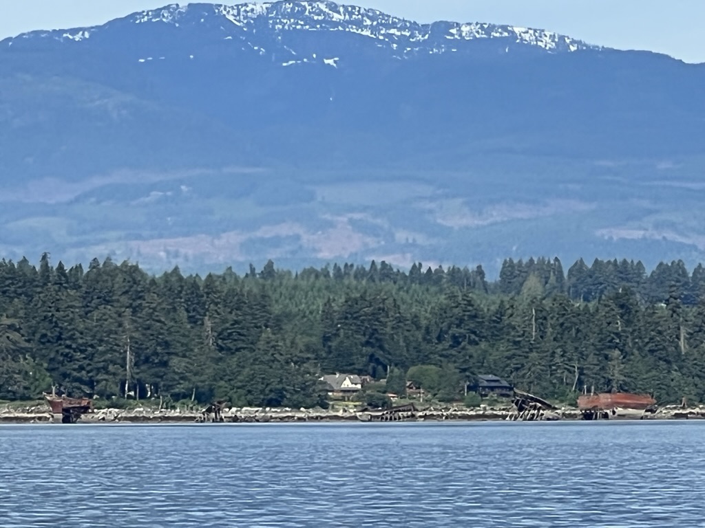
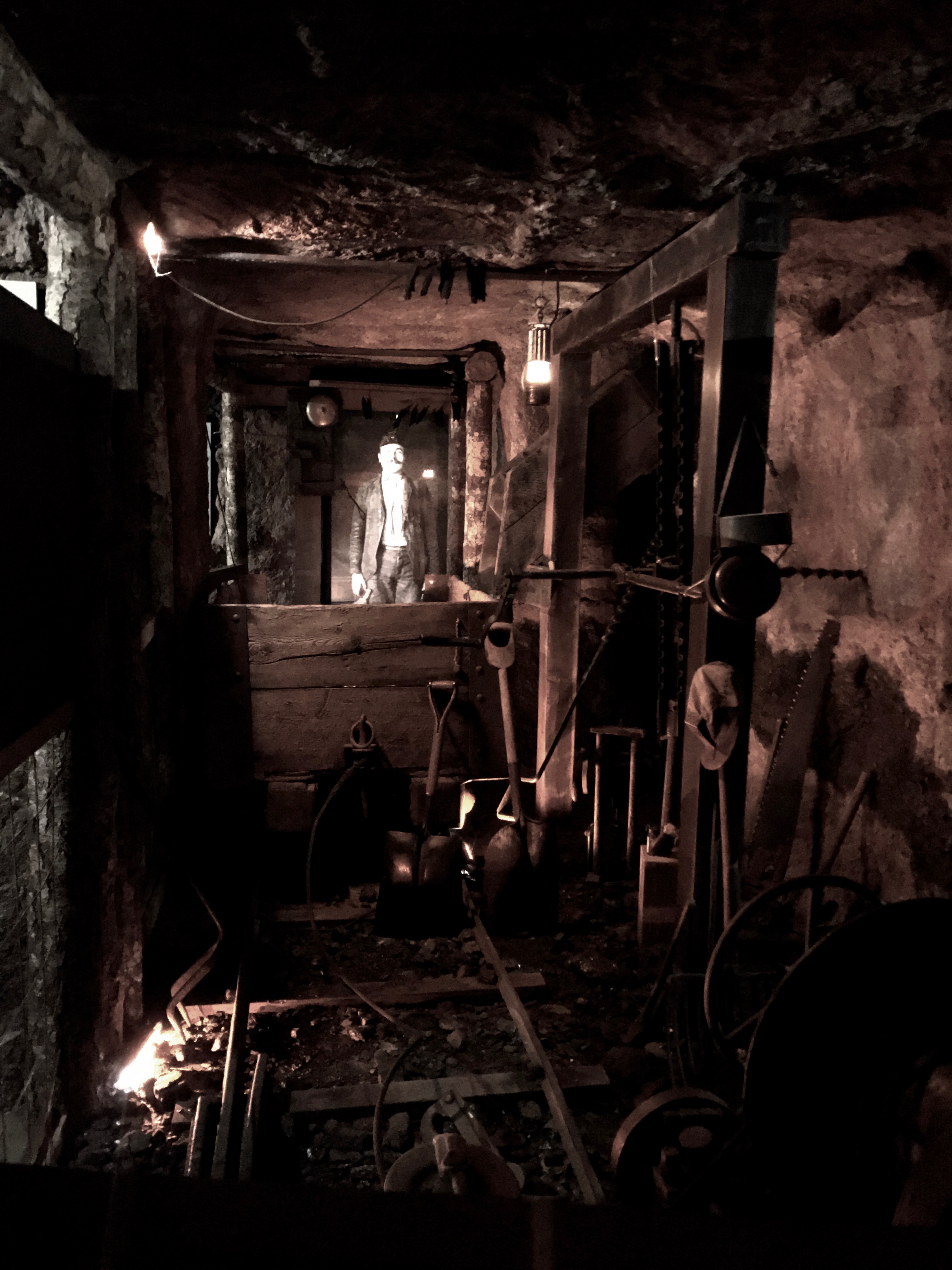
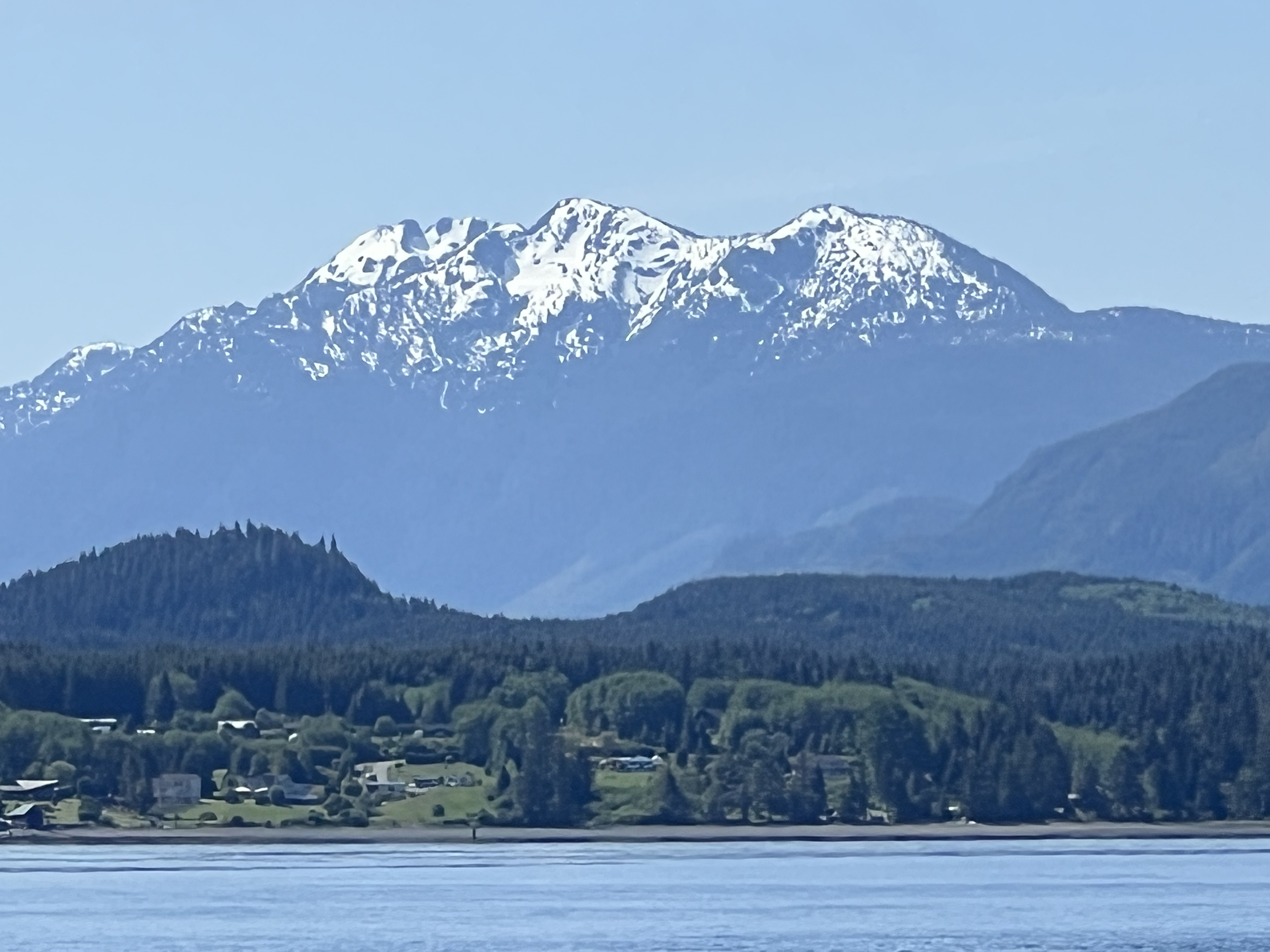
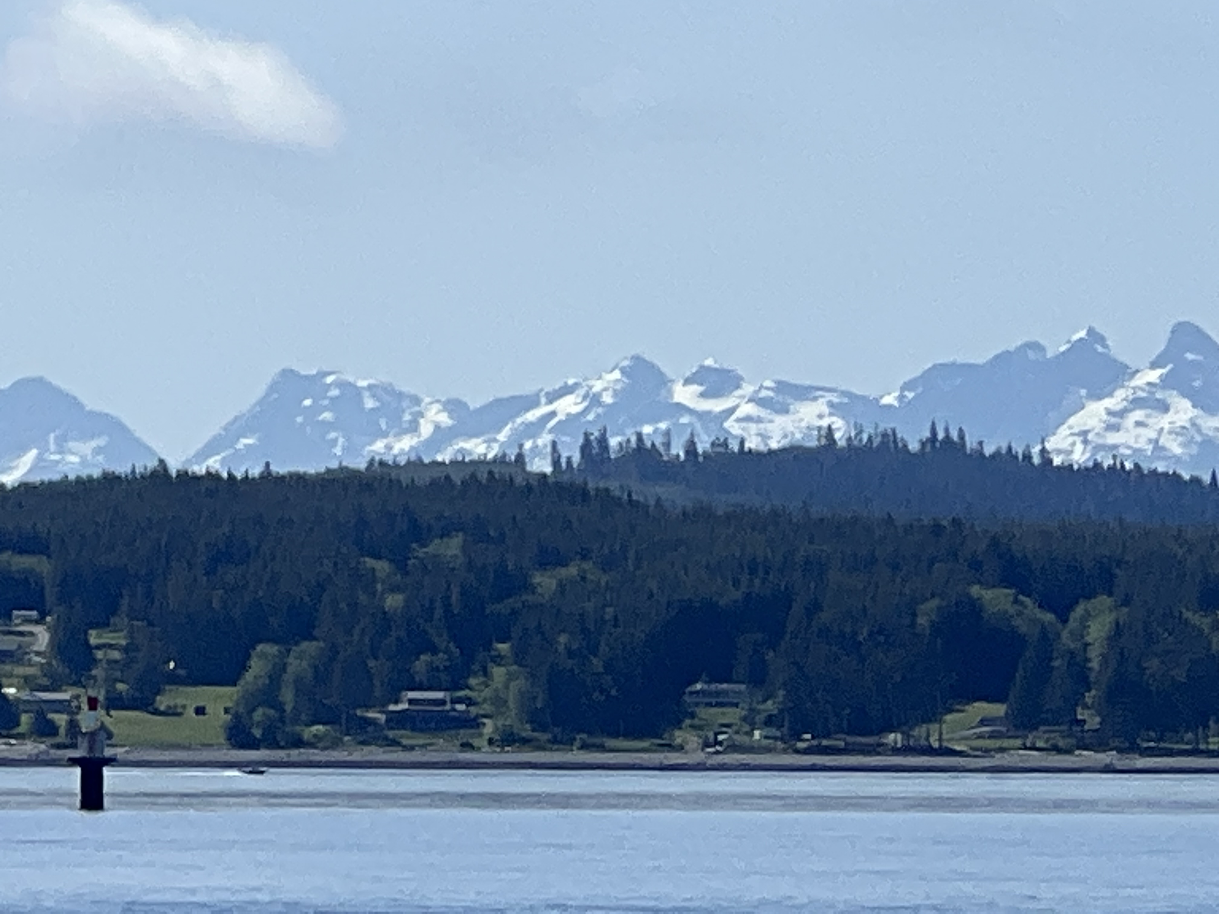
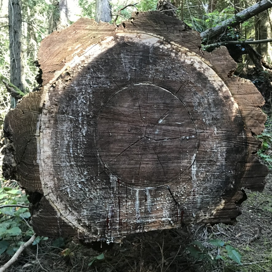
Near the head of Thomas Bay, the Baird Glacier, the water turns turquoise and carries bits of ice.  Before it lies a moraine with a large area of glacial outwash, reputed to have a variety of interesting wildlife.  It’s hard to get an anchor to hold in glacial waters but with extra crew or a guide, going ashore is feasible.

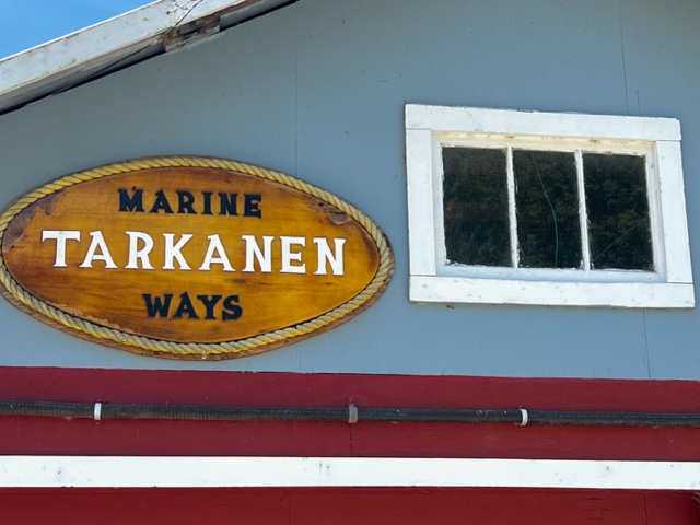
Interestingly, the southern-most tidewater glacier in the United States is the LeConte Glacier just south of here. Fed by the waters of the Stikine-LeConte Icefield, the clean, blue face of the Le Conte Glacier is actively calving both above and below water. So it’s best visited with an alert and knowlegable guide in a fast, small boat. But alas, we haven’t yet been.  Neither north- or southbound have we been able to time our arrival with an available tour out of either Petersburg or Wrangell.  In 1900, Petersburg Founder Peter Buschman did well to establish the capital of Little Norway in so close to available ice. 

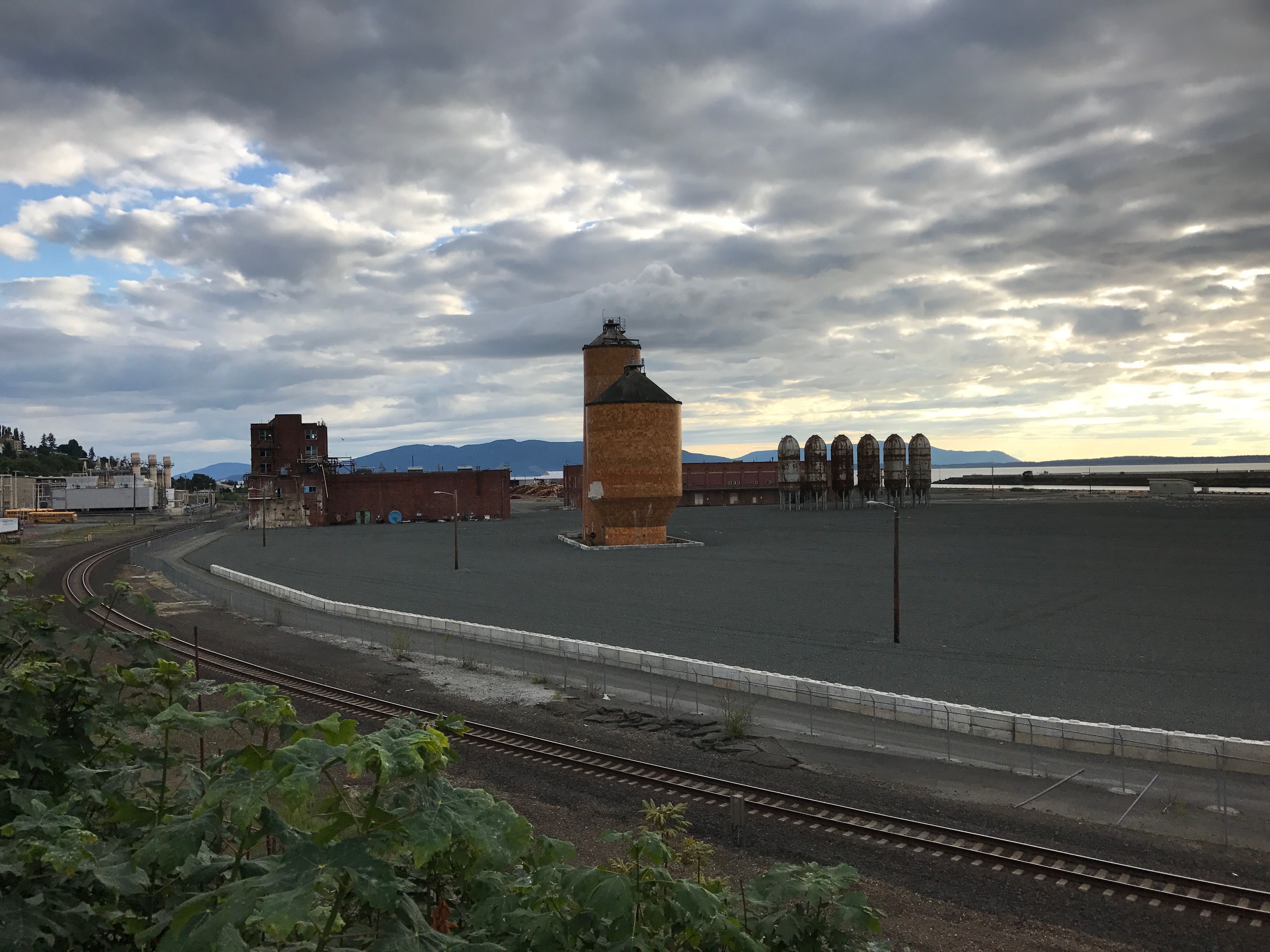
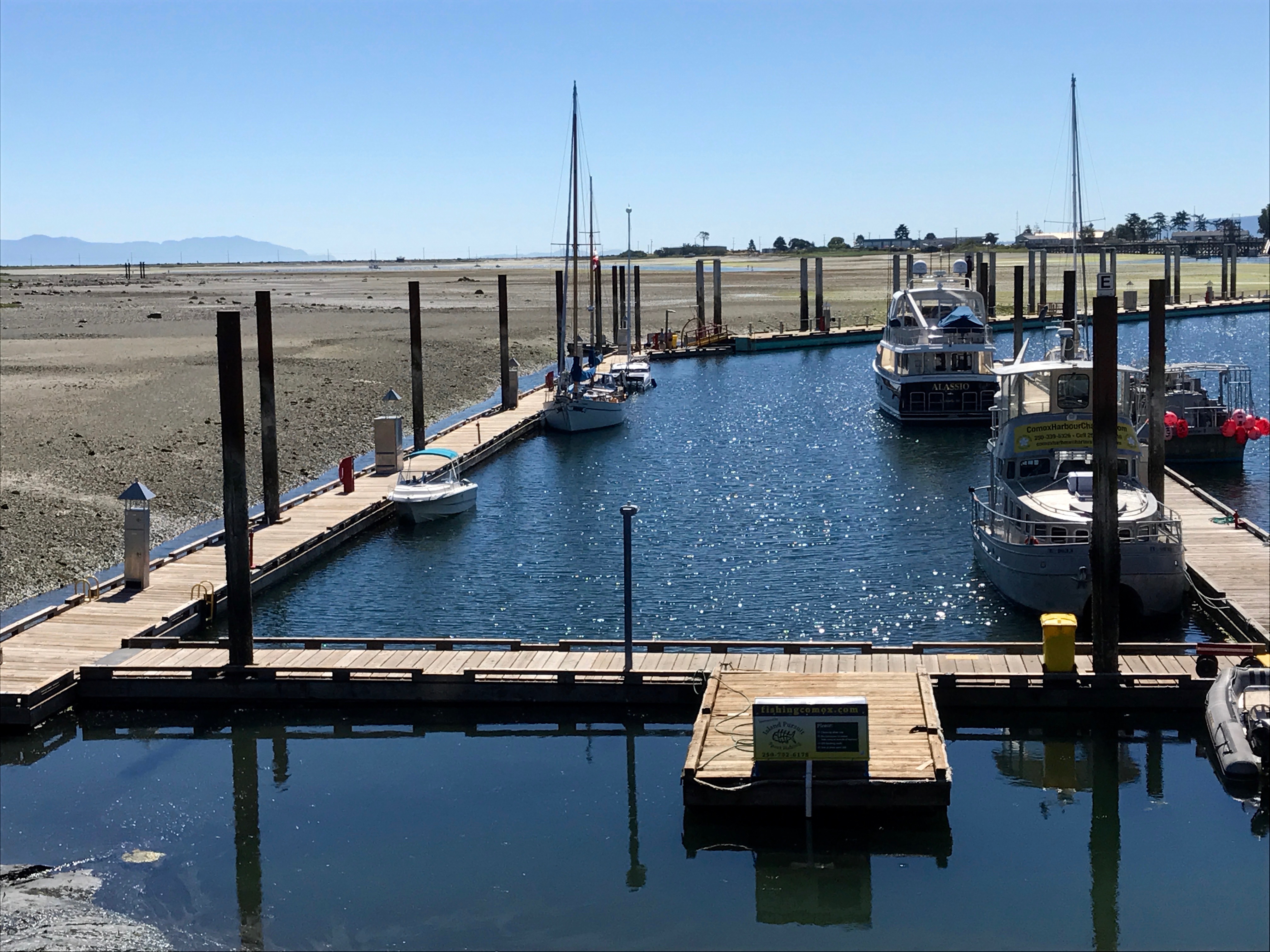
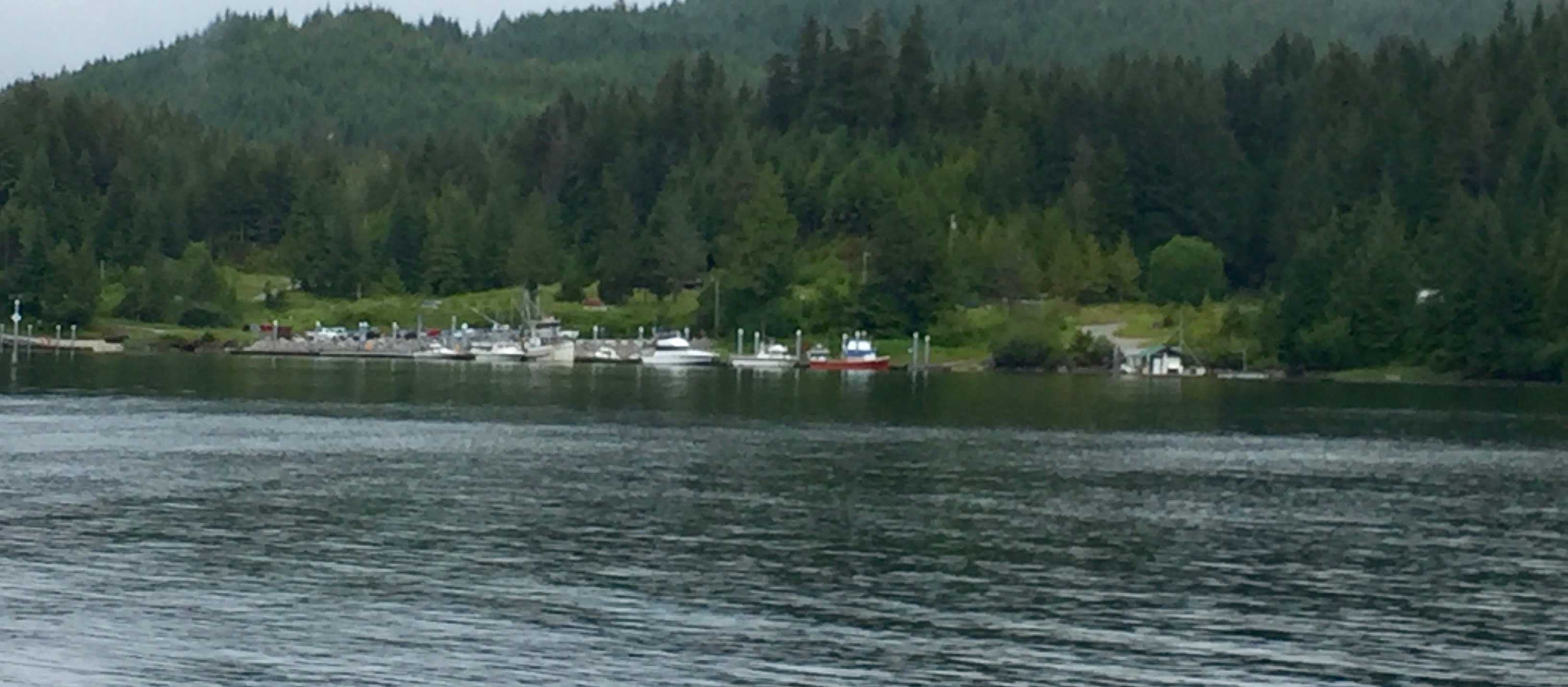
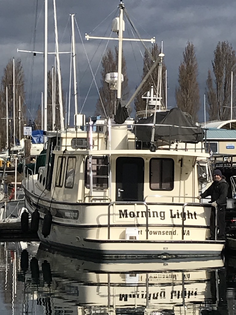
We spend the afternoon on Morning Light watching the comings and goings of fishing boats delivering their catch to Icicle Foods, whose processing operations now boast a large, open, state of the art space in the fresh air high above the docks. Ocean Beauty’s Petersburg Location is still shuttered, with company locations farther north in Kodiak, Cordova and Naknek.

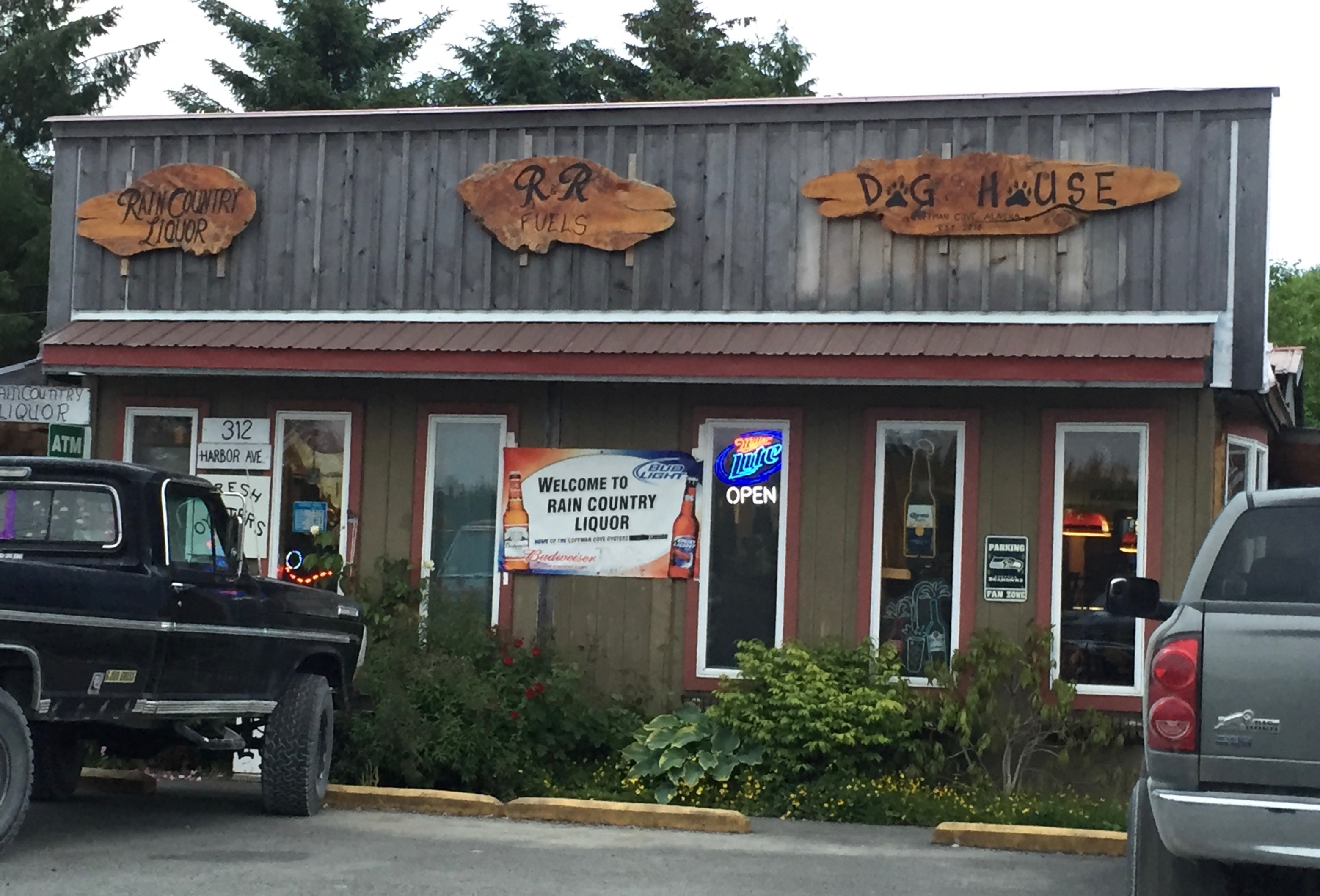
Thursday 22 June 2- 2023 Coffman Cove  Departure 0800, arrive 1430 at N 56º 00.6’ W 132º 49.9.

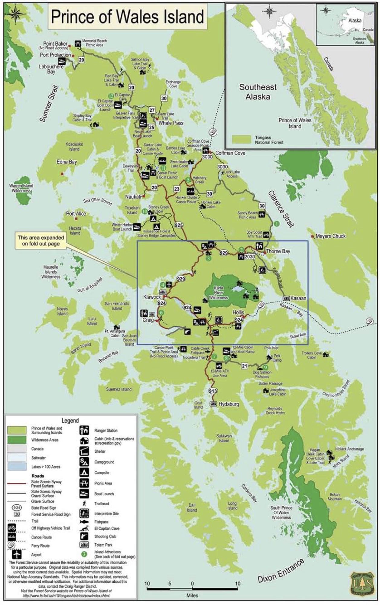
Across Chatham Strait lies Prince of Wales Island, the fourth largest island in the United States, after Puerto Rico. Prince of Wales, or POW. is seldom visited by non-Alaskans, although circumnavigating it is a cruiser’s dream. Among the island’s distinctive settlements is the village of Coffman Cove. It’s a destination for Alaska residents eager to fill their freezers with their annual personal catch. It’s especially popular with Wrangell families who may spend their weekends on the water bouncing around in small boats with a knowledgeable guide. in small boats. They stay in modest lodges or with local people.

On the way, we pass several dozen sea otters, all of whom sit up and watch us pass. And when I pay moorage, the ravens of Coffman Cove check me out at the top of the ramp.

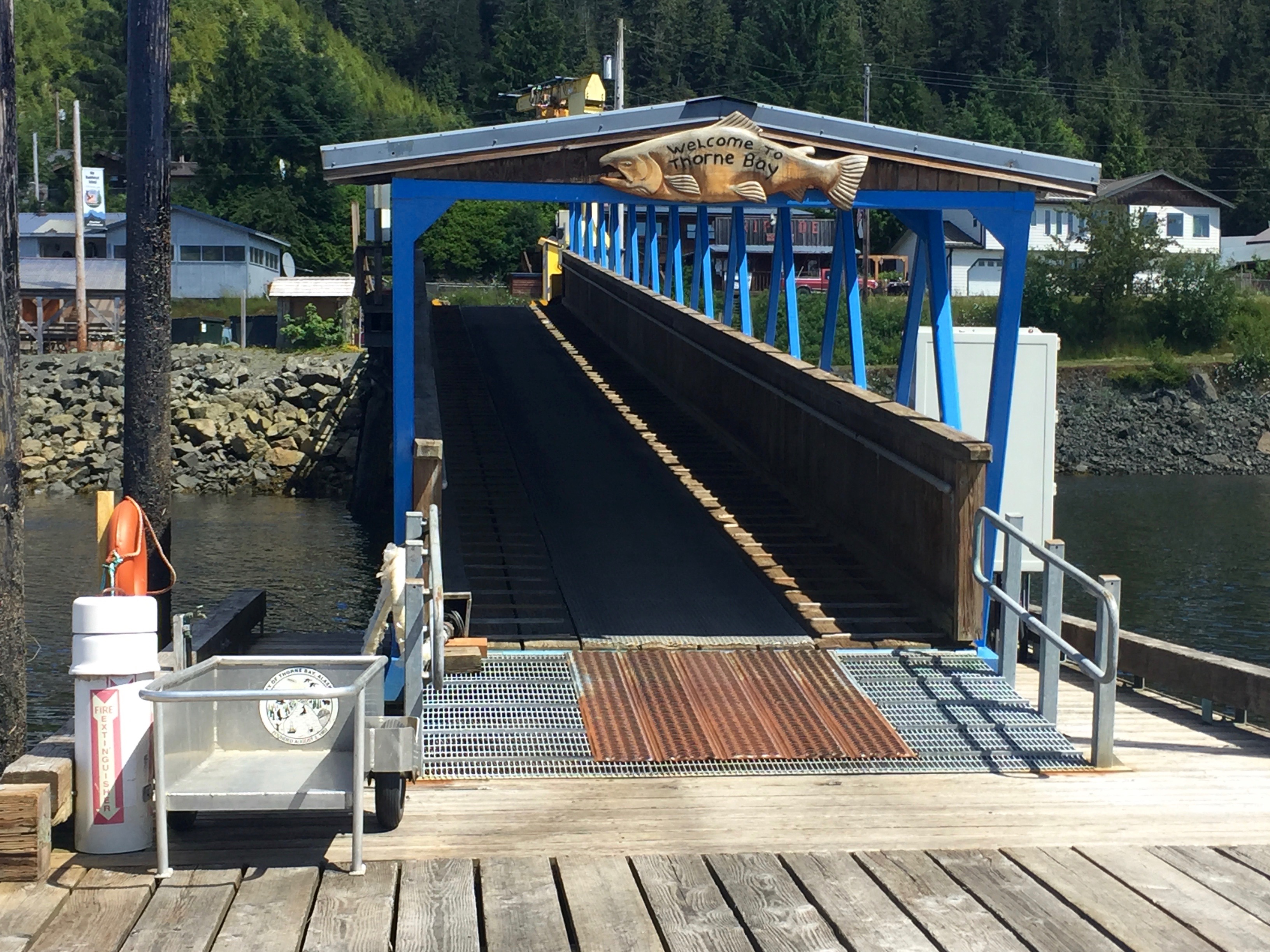
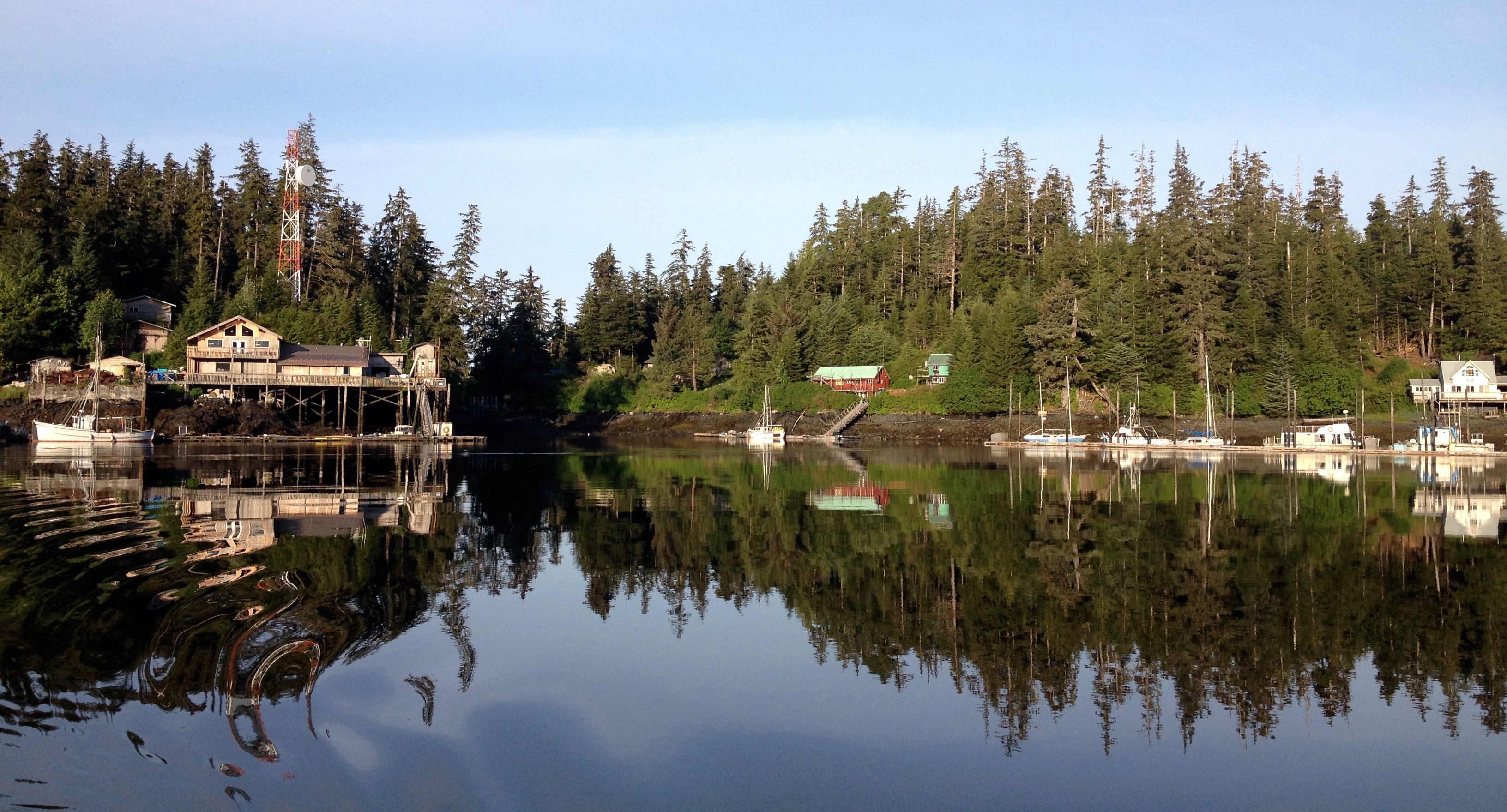
Friday 23 June 2023 – Kasaan  Departure 0800, arrival 1515 N 55º32.2’ W 132º 23.9’

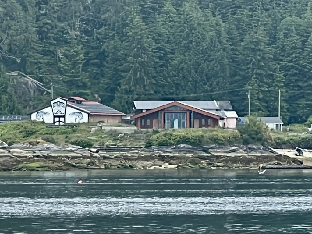
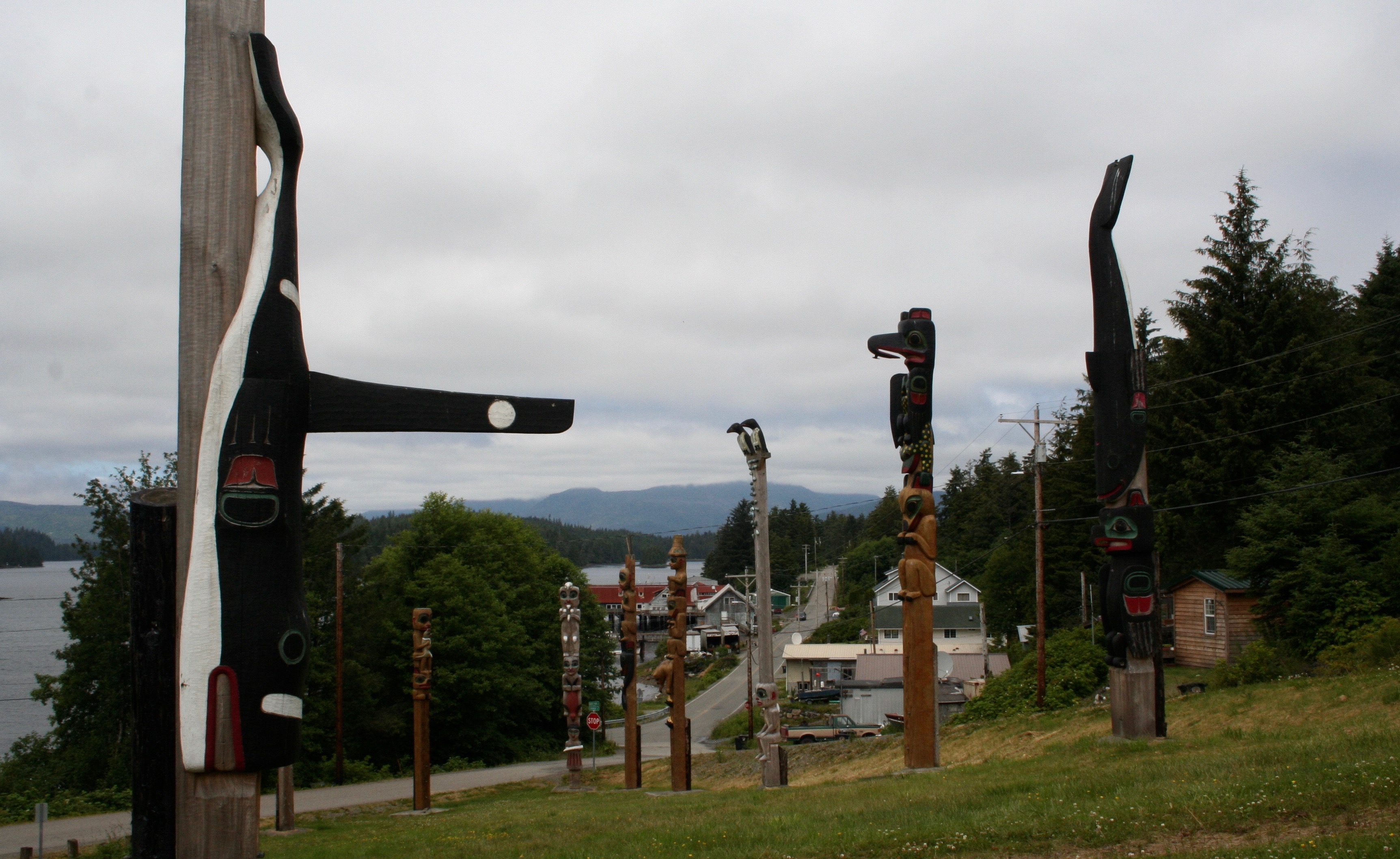
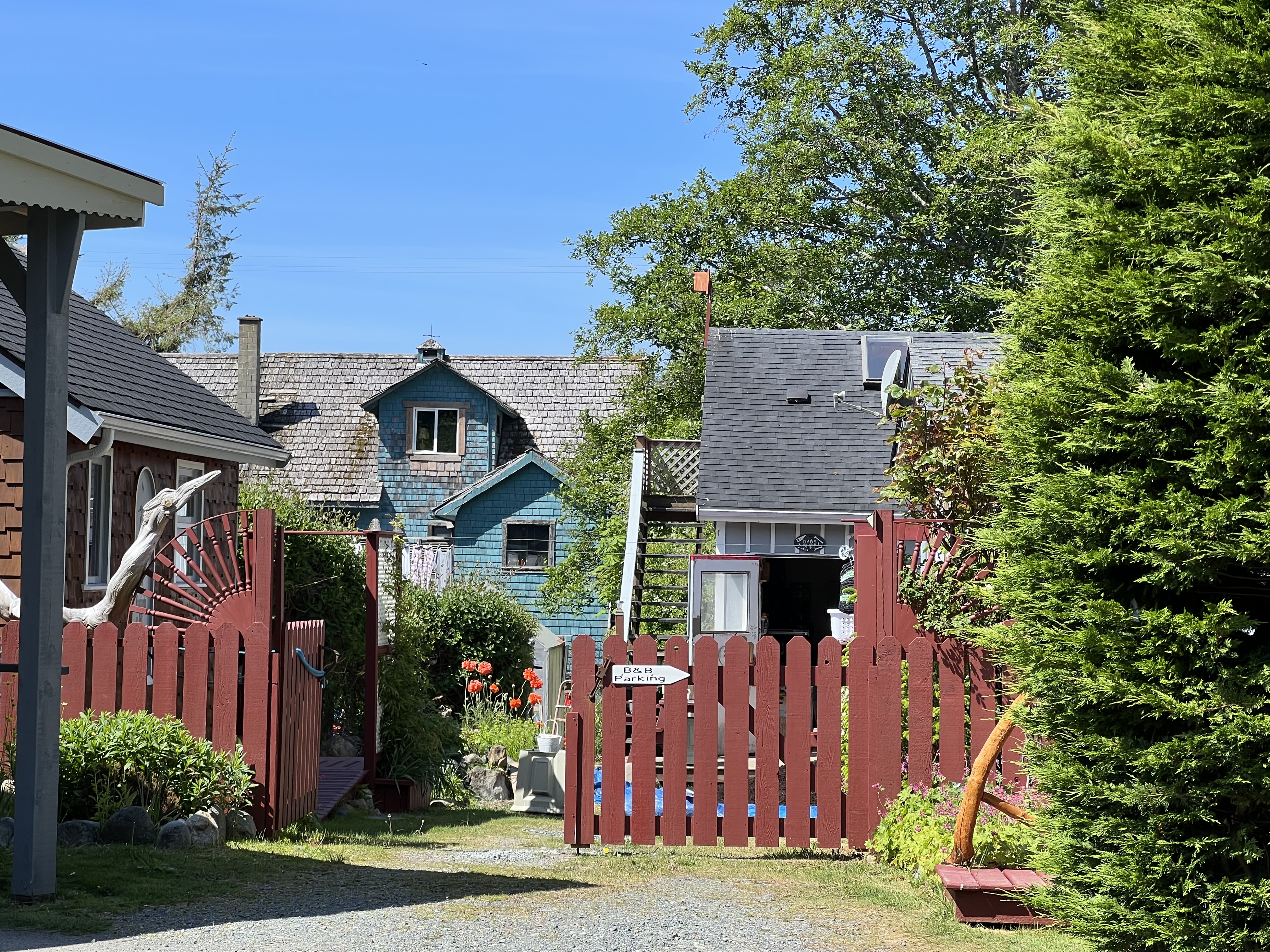
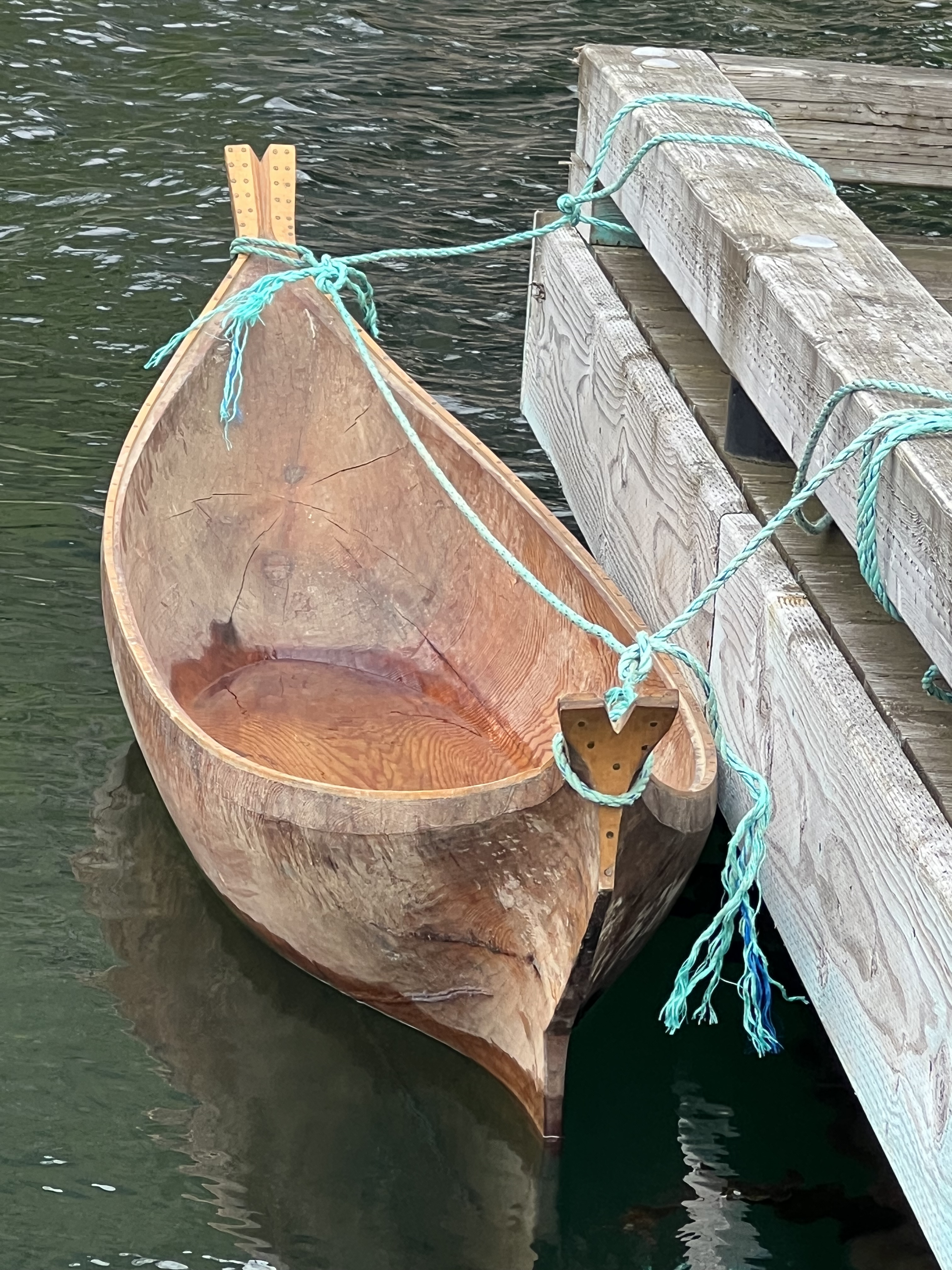
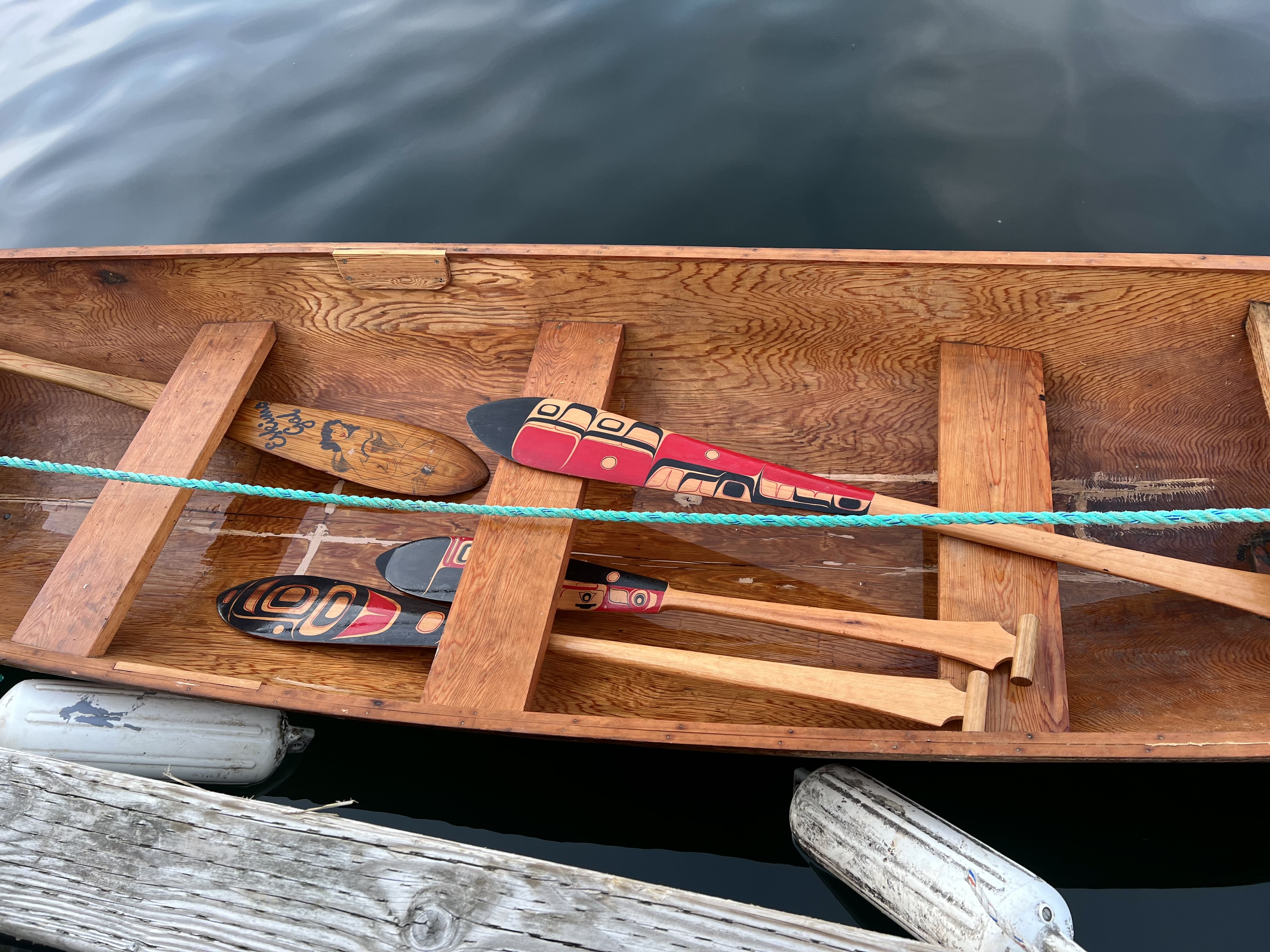
As for distinctive POW settlements and fine welcomes, Kasaan is second to none. Two dugout canoes, a small one for kids and a bigger one, with paddles of all sizes, greet us as we head up the ramp. It’s rained and the canoes could use bailing. However, you don’t touch a ceremonial Native craft without permission.

A new stretch of boardwalk takes us along the shore and into this tiny Haida village. No Canadian First Nation and none of their Alaskan tribal members are more boldly rooted on the shores of the North Pacific than the Haidas. For millennia pre-Contact they struck fear and terror into others, traveling in their great canoes to tangle with the likes of the Makah of the Olympic Peninsula and coastal communities to the South.

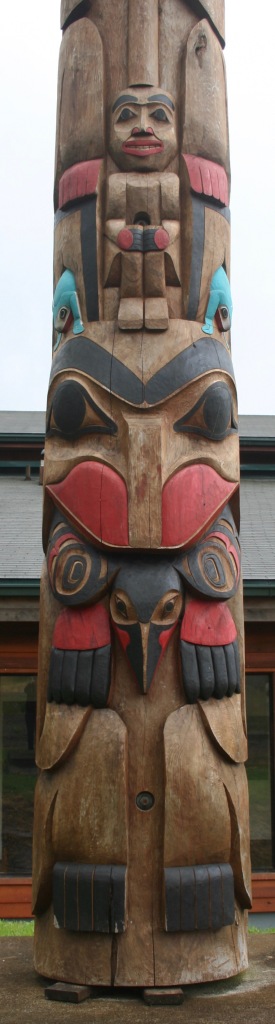
We look for the carving shed where we spent time with young Master Carver, Stormy Hamar several years ago, when he was managing the building of Whale House deep in the forest beyond Kasaans renowned collection of totem poles.

This time, it’s his son Eric who’s holding down the fort and serves as Watchman, protecting Haida cultural riches. “Of course, you can bail the canoes,” he says, “They’re there to be used. The kids love them.”

In fact, a very hip contingent of hip young Haida appears to have moved into Kasaan. Eric and his wife, who hails from Coffman Cove, have leveraged the village population from 50 to 51, with #52 on the way!

In the clearing between the carving shed and the contemporary long house that now houses the library, stands a new pole, designed by Eric’s father and completed with assistance from other carvers. With the help of the bronze plaque erected nearby, I “read” it. Unpainted, its story is told from bottom to top, the virtuosity of the carvers evident in the three-ply sisal rope which ties the past to the future. It takes my breath away. My photo does it no justice. I can wait for a coffee table book or a traveling exhibition.

The Organized Village of Kasaan is both a place to visit and a place to watch. And now one can zoom in on a village council meeting.

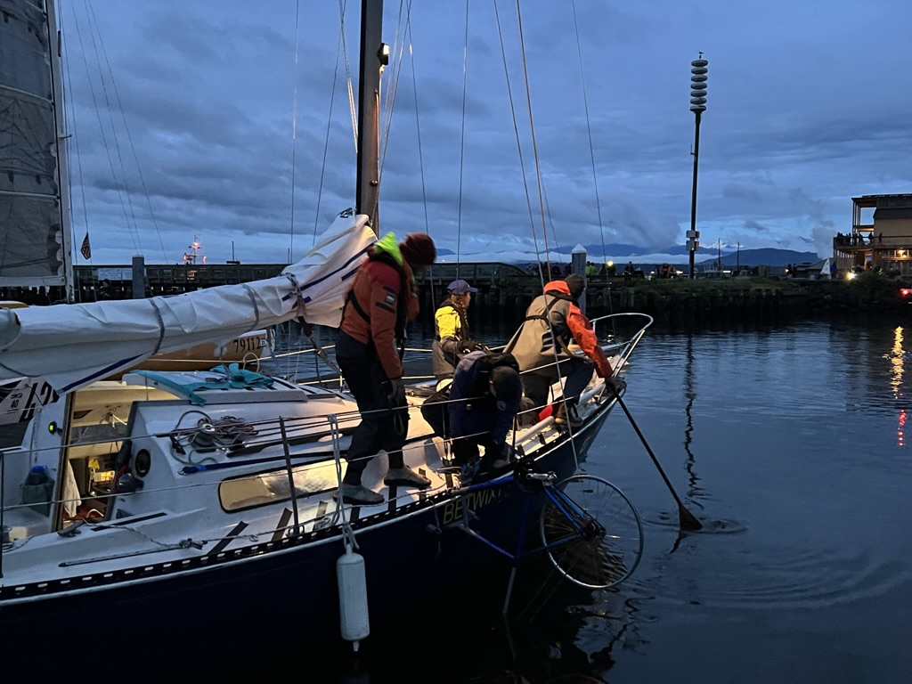
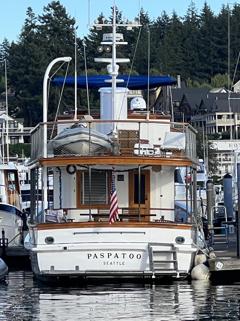
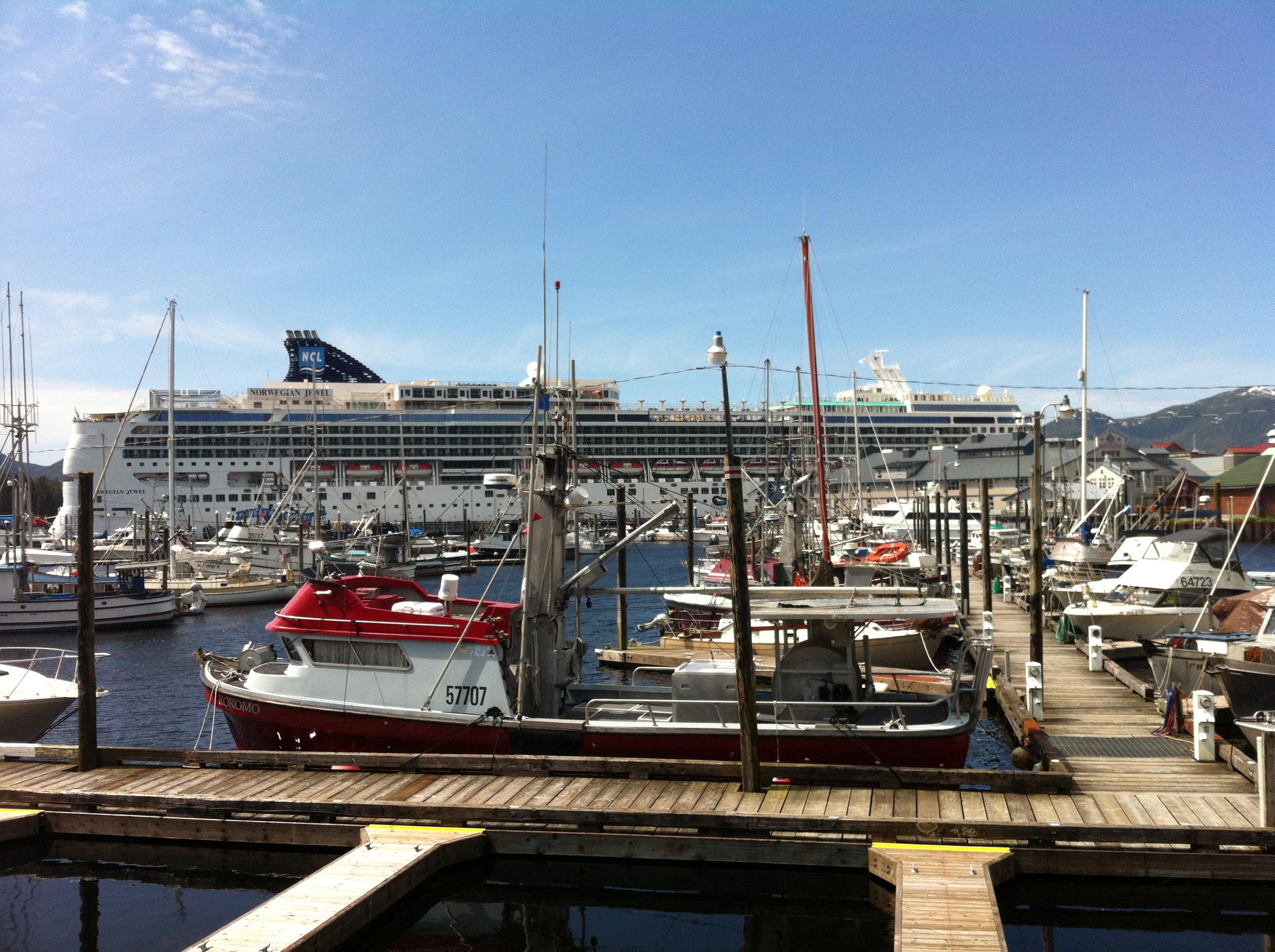
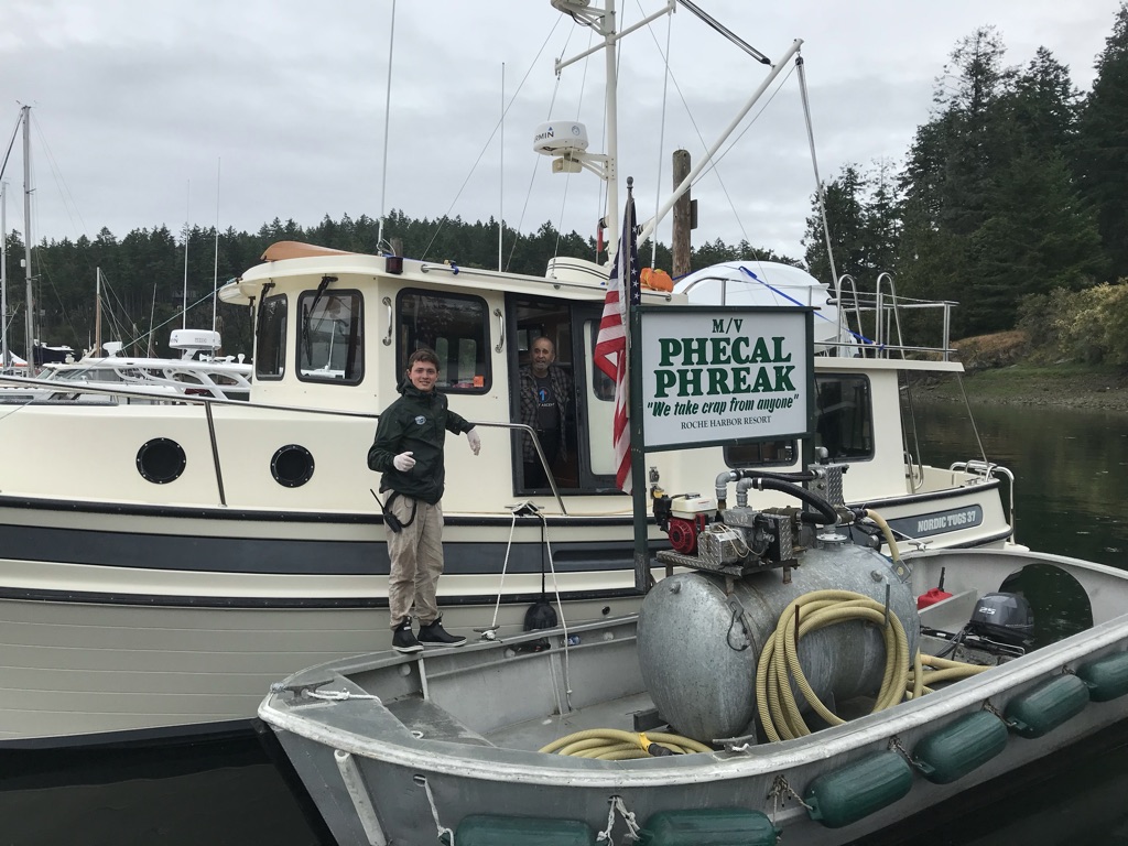
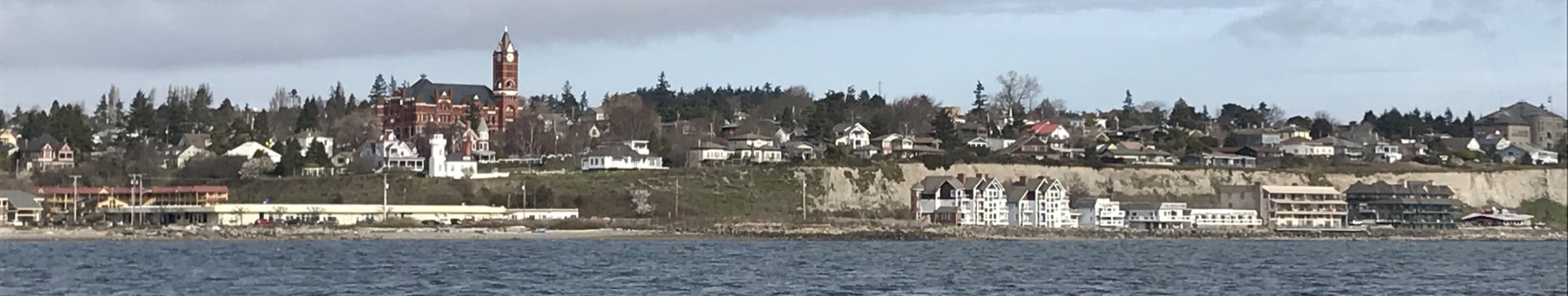
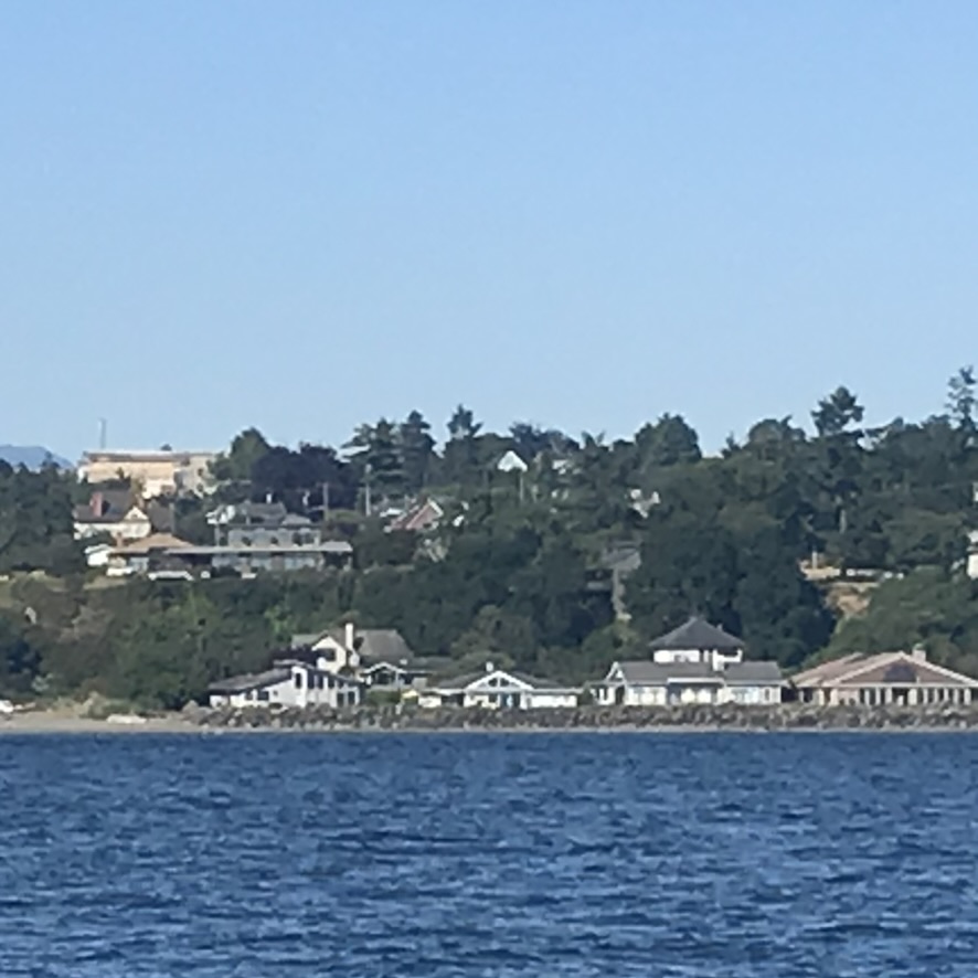
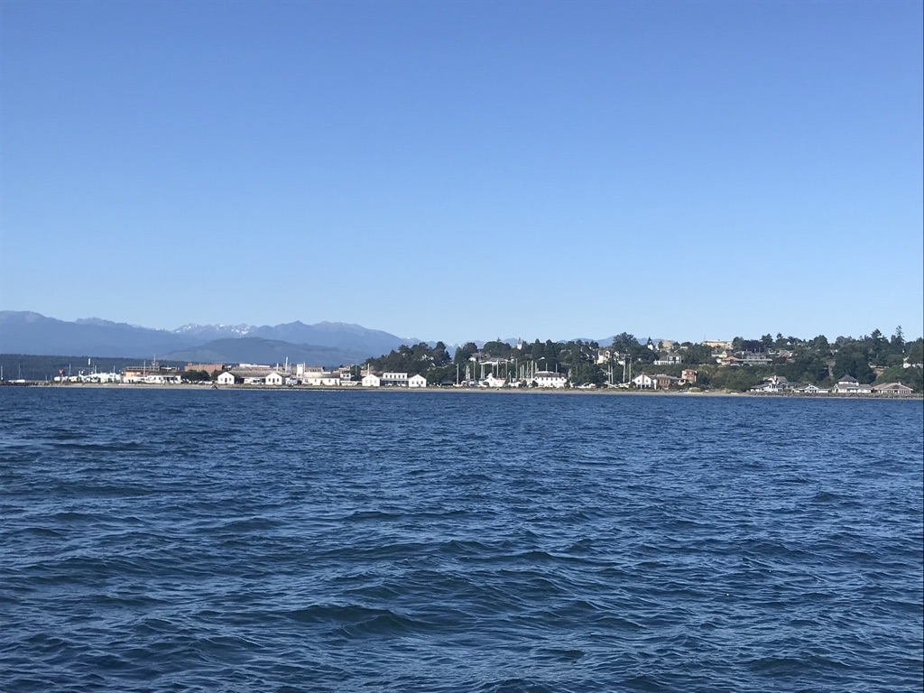
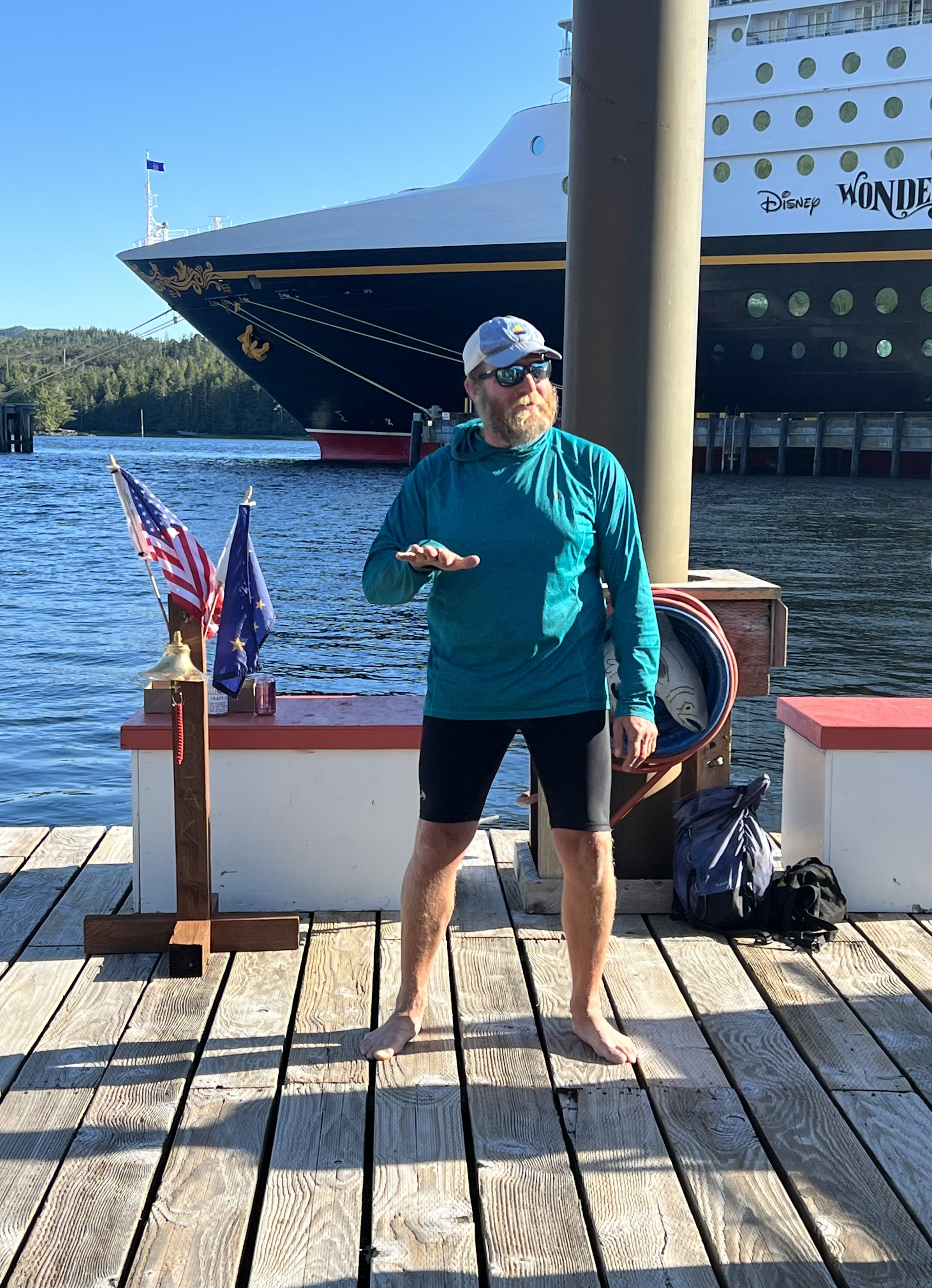
Saturday 24 June 2023 – Ketchikan  Departure 0700, arriving N 55º 20.3′ W 131º 38.4’

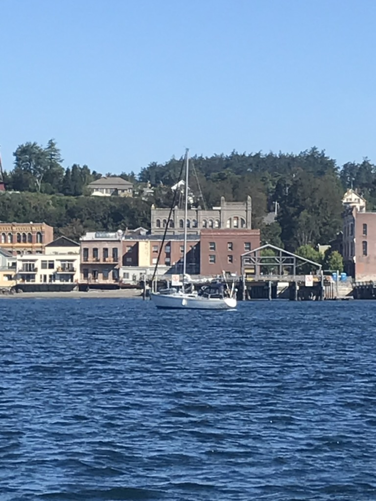
The Disney ship appears as we approach Gastineau Channel and is securing its lines at Cruise Terminal #1 when we arrive. We slip under its bow and into our stall in Thomas Basin.

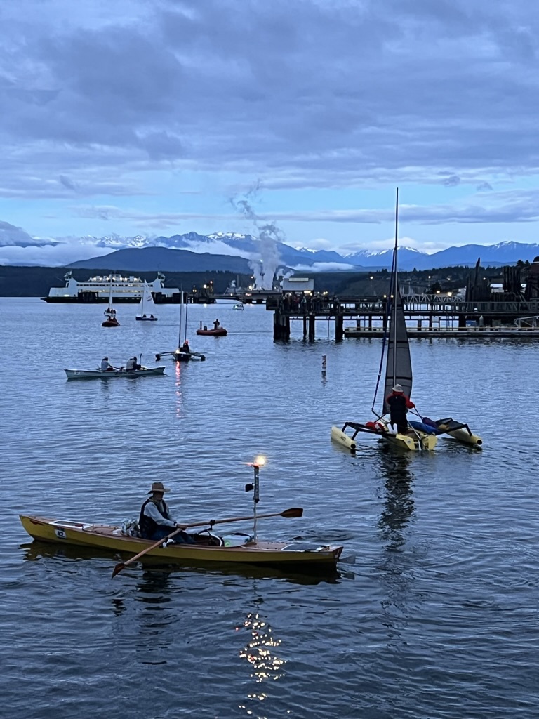
From here we can see the Race of Alaska Finish Line and hear the horn. Luckily for us, we’re there for the first of the human-powered competitors. The first rower in is Team Wave Forager‘s Ken Deem of Tacoma. He’s followed on Sunday by Team Solveig with Stina Booth and her brother George from Boise (their 2nd R2AK!)

These finishers join the tiny crowd of diehard R2AK fans who greet each team of incredible athletes Next in is Team of One aka Damon Colbry from Maine, the guy in the picture. He hops onto the float giving nary a clue in his body language that he’s just completed 16 days and 700 miles on the wild waters of the Inside Passage. To say nothing of completing the boat; Damon confesses that he was barely finished building it before the race started.

Race Boss Jesse Weigel is outstanding in his media role. Nothing like being in the presence of these incredible athletes with Jesse asking penetrating questions about strategies, surprises, low points, and high points. The four from the three teams all know one another, are middle-aged, and have done the R2AK or stuff like it before. Need inspiration? Hang out a couple of weeks at the Race to Alaska Finish Line.

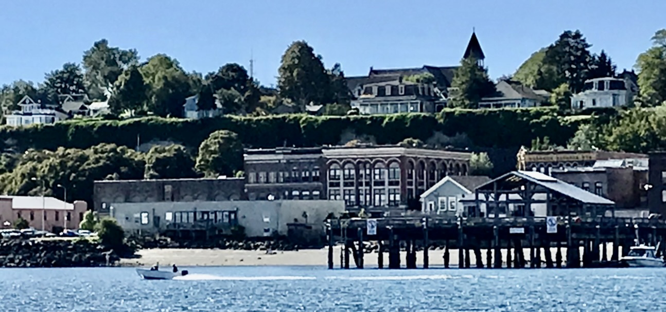
In the late afternoon as the big ships pull out, we walk around Ketchikan’s historic waterfront. The City Museum has taken the place of the old library, Ar Parnassus Books we run into Ray Troll. Then drinks at the Elks Club on Creek Street.

Monday 26 June 2023 – Foggy Bay  Departure 0700, arrival 1030 at N 54º56.9’ W 131º41’

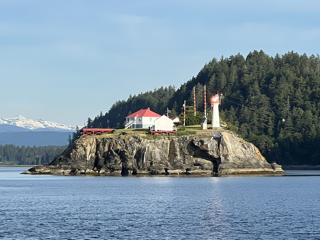
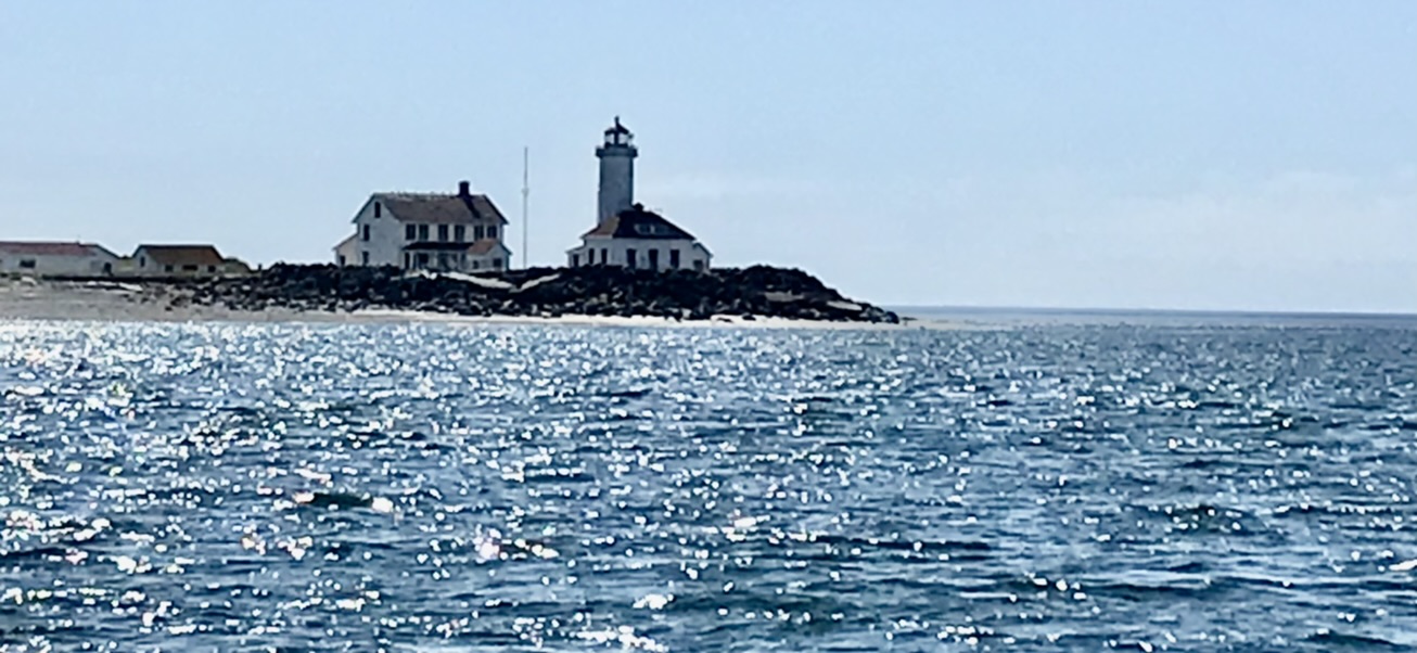
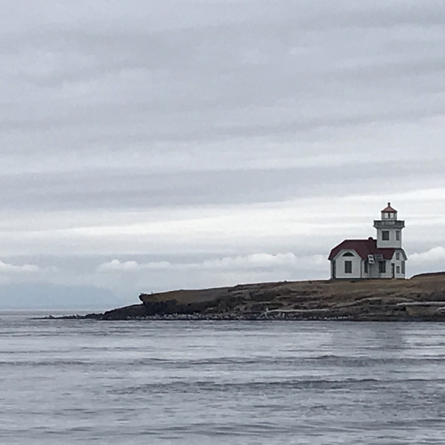
When you’re crossing Dixon Entrance, how do you know when you’ve crossed the border? Well, check the light stations along the way.

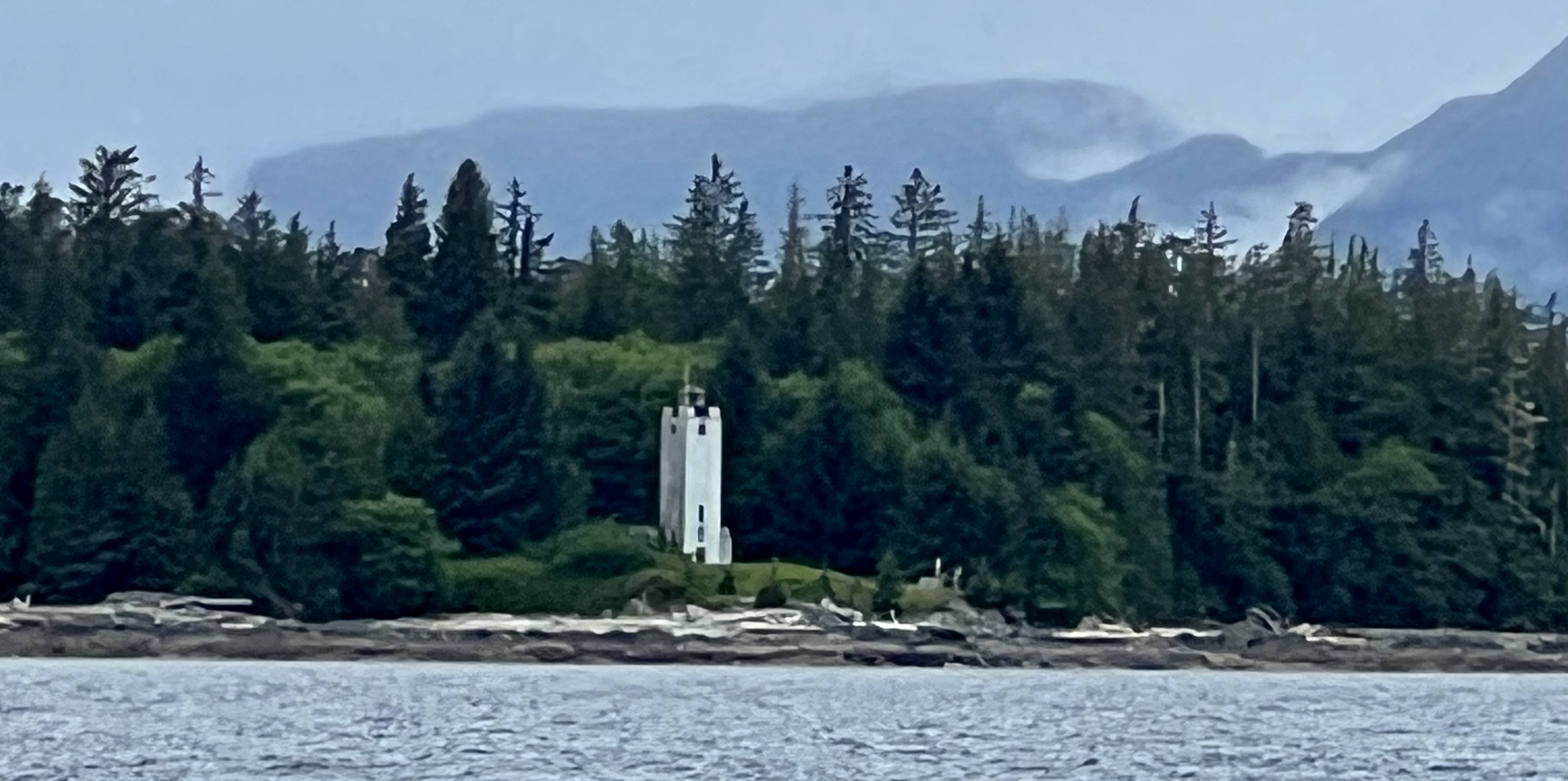
What on earth is that Moroccan mosque doing on that roadless shore? Well, that’s what a lighthouse in the southernmost parts of Southeast Alaska looks like. These were built during the New Deal, when public buildings suddenly were infused with all sorts of creative design. Art Deco continued to draw on Moorish Architecture and the solid North African minaret fit the bill for Alaska’s stormy shores. Five Finger Light near Petersburg is one you can visit. You can even volunteer as the lighthouse keeper.

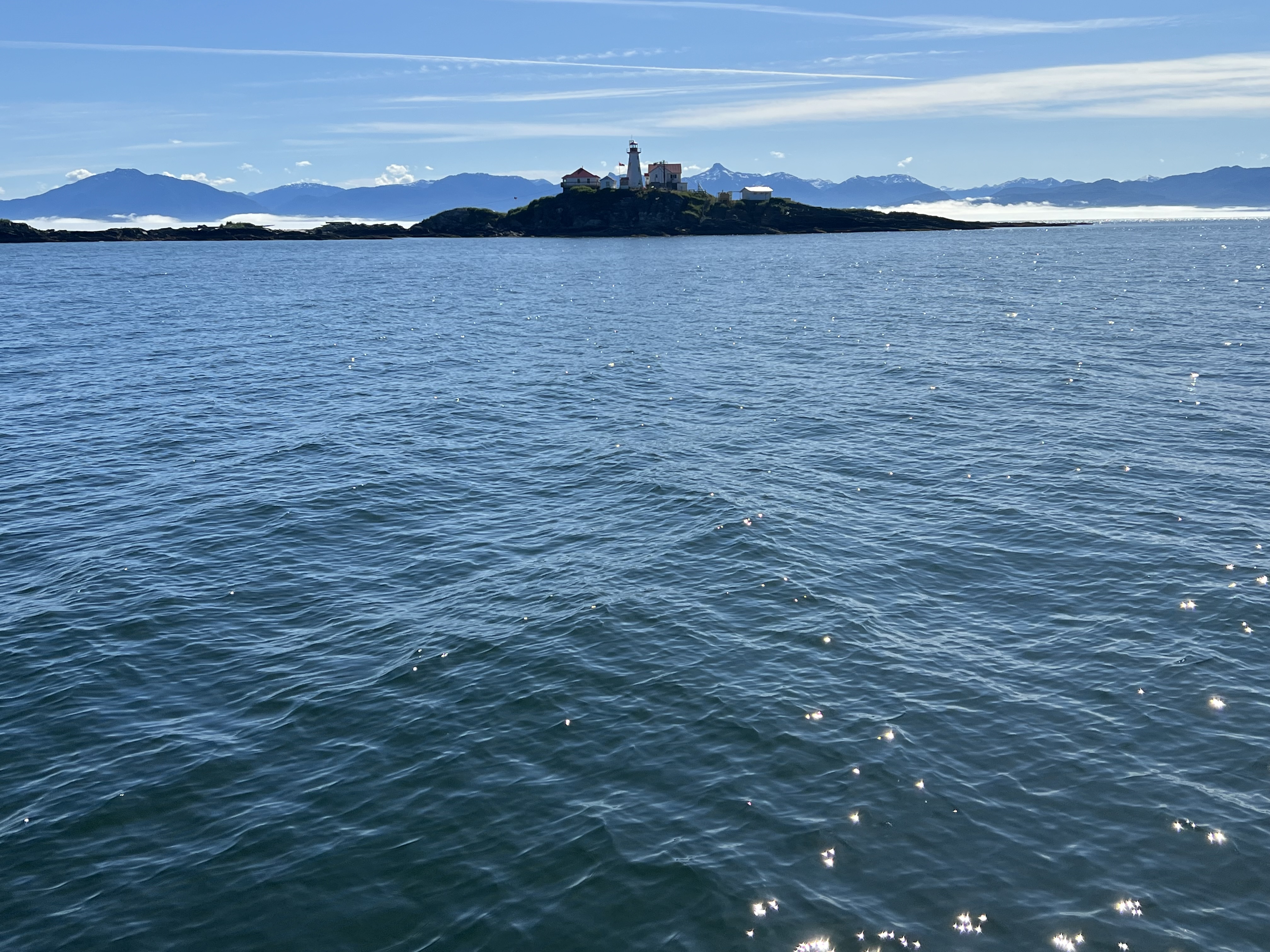
When see a cluster of white buildings with red roofs and the Maple Leave flag unfurled among them, you’re in Canada. Green Island (below) is the first one we pass southbound.

Many of Canada’s light stations are manned, with some boasting helicopters with rescue teams. An illustrated list of BC coastal facilities is here and photos of the light towers on the Pacific Coast and on inland lakes is here. Not all BC lights are pretty. Holland Rock near Prince Rupert is an ugly tower on an ugly rock and the Sand Heads Light is built on pylons far offshore to mark the channel of the Fraser River. As unsightly as these two are, I am grateful for the people who maintain them and show us the way.

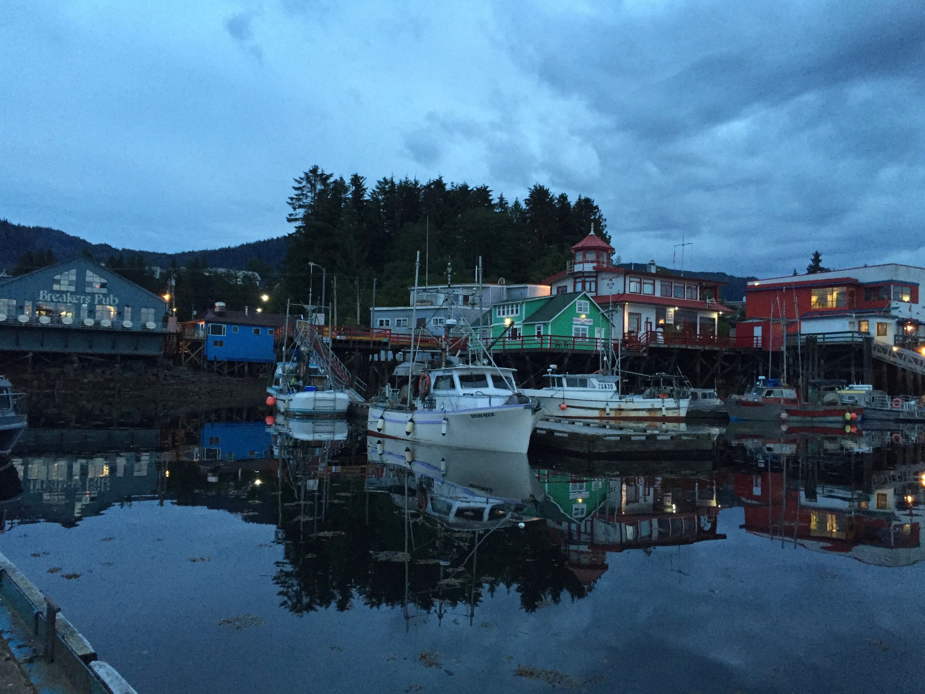
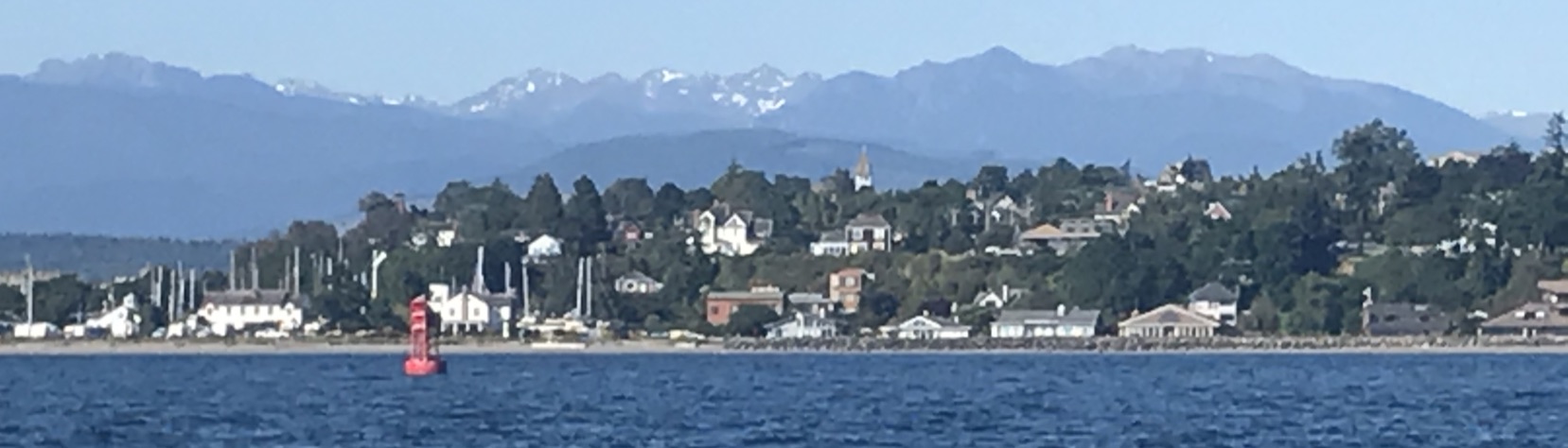
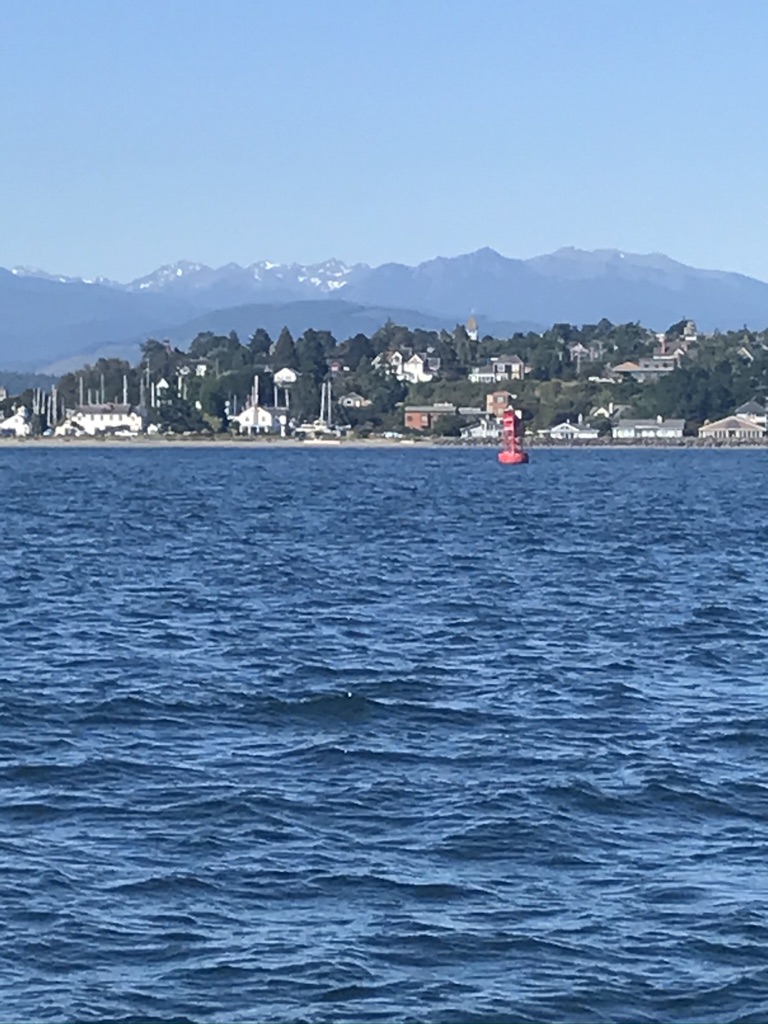
Tuesday 27 June – Prince Rupert  Departure 0530 AK time, arrival 1300 PDT.  N 54º 19.2’ W130º19.2

As soon as we pick up a phone signal, I call Prince Rupert to see about moorage. The first reservation of our trip gets us a place on the rocky outside of the guest dock.

On arrival we take on water and take off recycling and trash. Then we head to the Museum Store, Safeway, and BC Liquors, before sitting down to a meal at Breaker’s Pub. Safeway offers two free deliveries daily so we watch our groceries arrive at the top of the ramp.

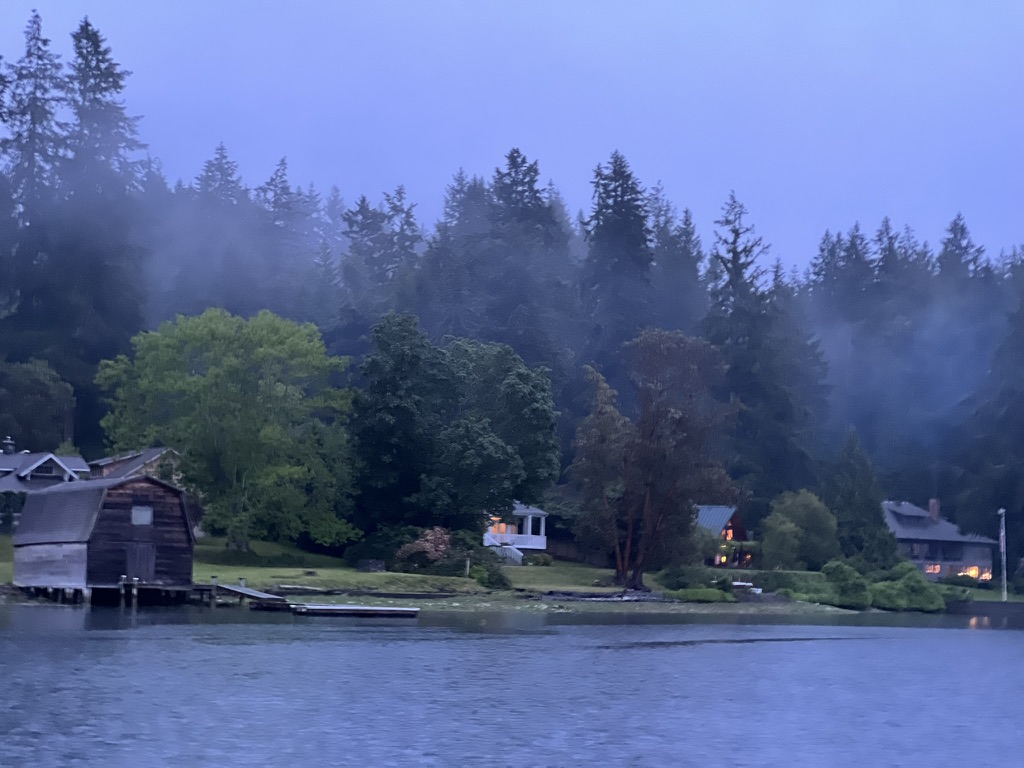
Thursday 29 June 2023 – Baker Inlet  Departure 0515, arrival 1115 N 53º48.7’ W 129º51.3’

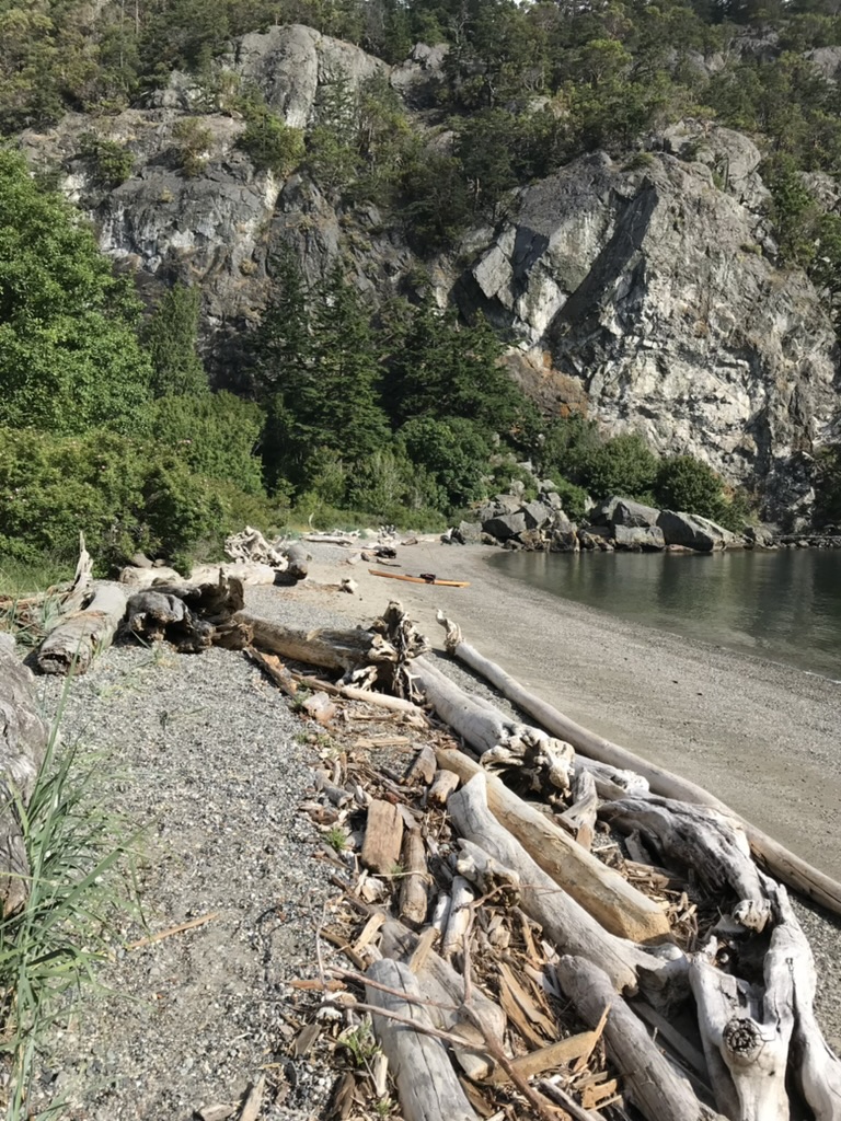
Baker Inlet is spectacular! This is our first time here. The curvy, blind, narrow entrance is tricky and is best done at slack. It’s easier the get the timing right on southbound passage from Prince Rupert.

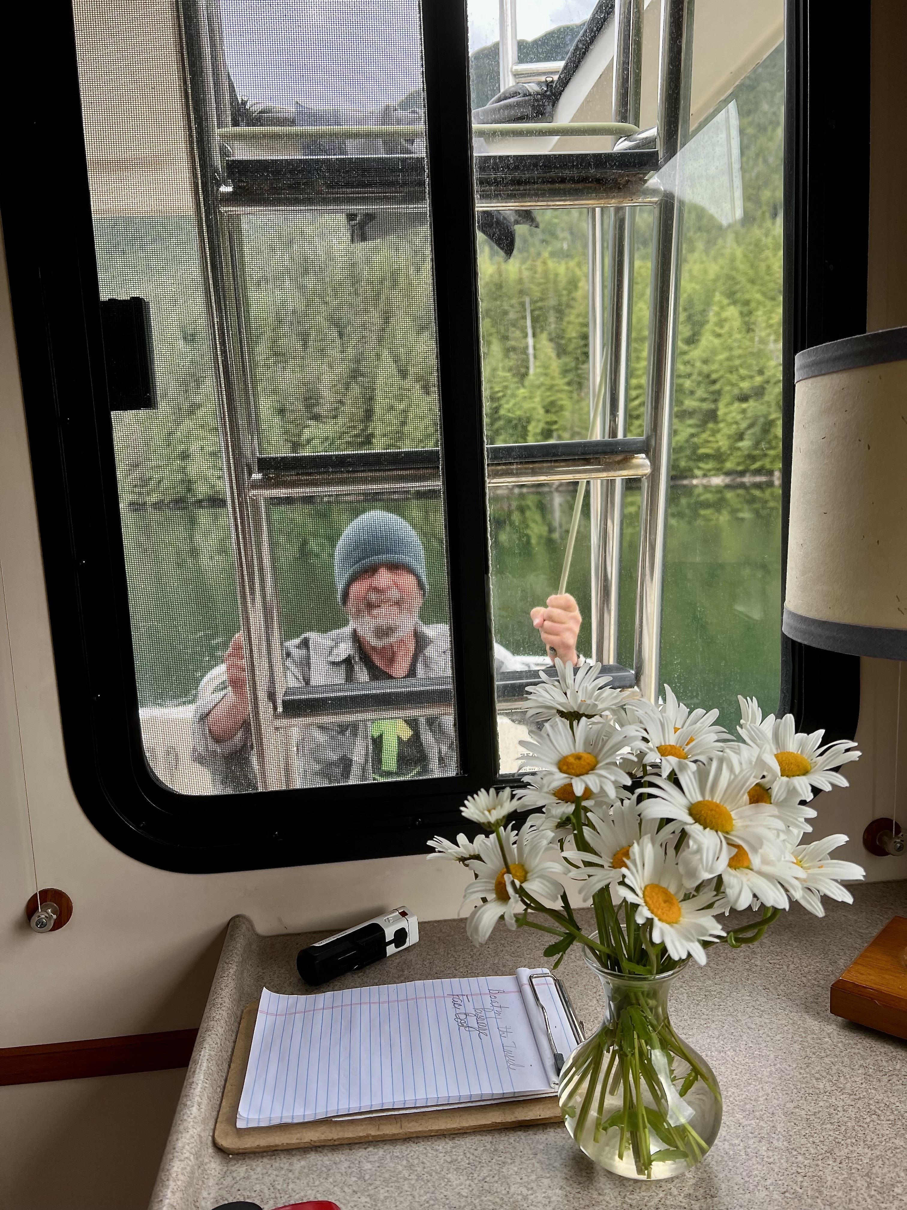
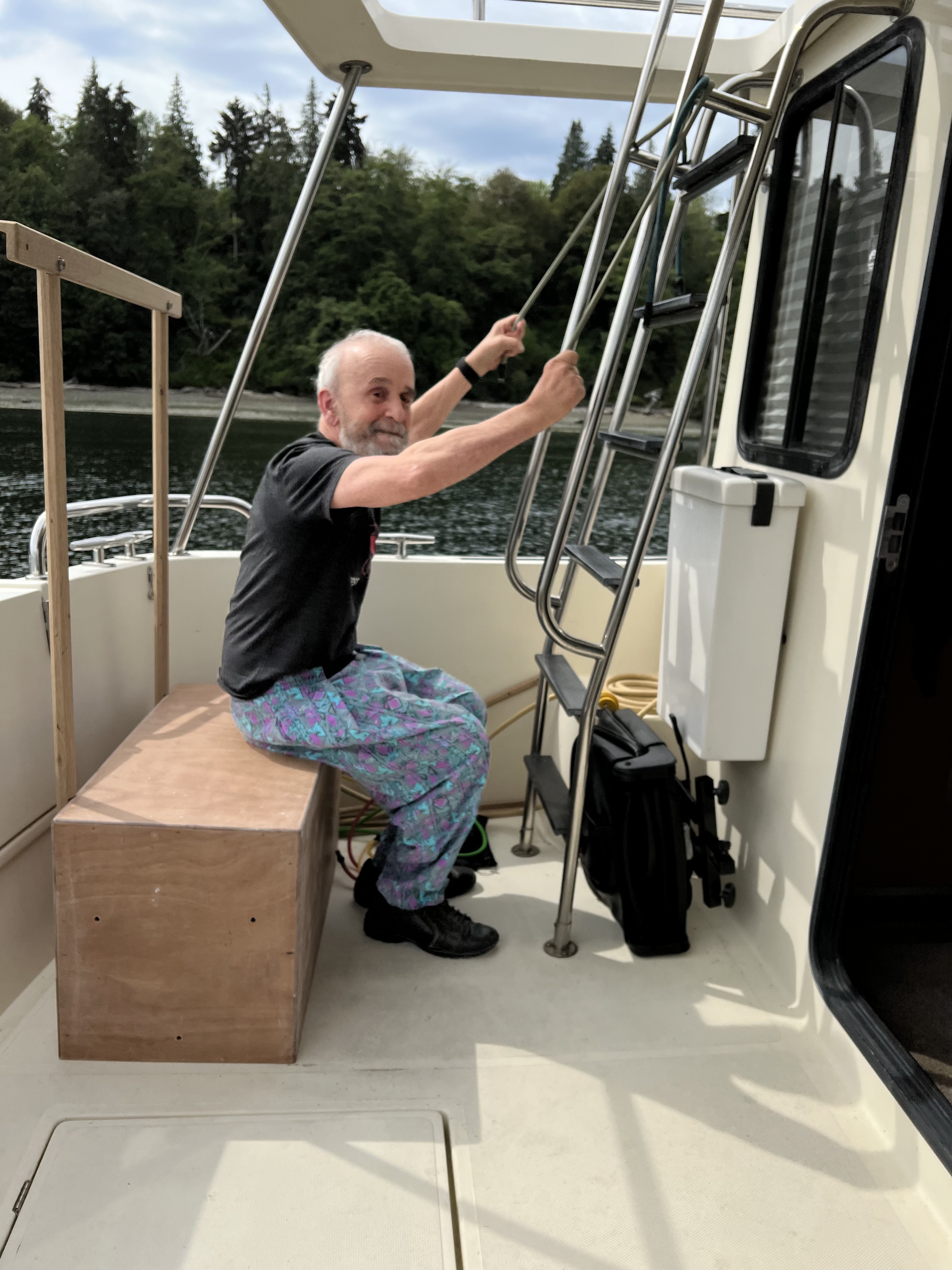
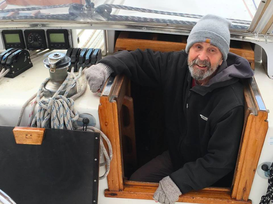
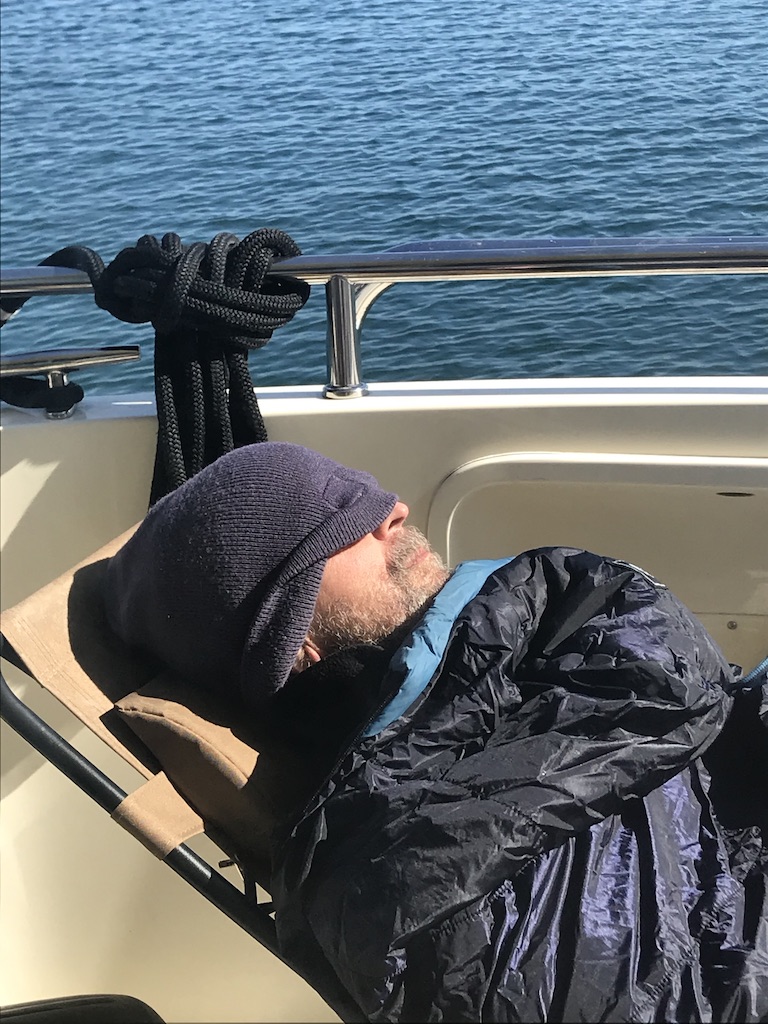
While I lounge, Jack works out in his bungie cord gym in the cockpit. Daisies are our wedding flower, thanks to whoever picked them on the way to City Hall 52 summers ago. These are from Coffman Cove where daisies proliferate.

Saturday 1 July 2023 Khutze Inlet    Departure 0615. Arrival 1615.  N 53º.05.3’ W 128º31.2’

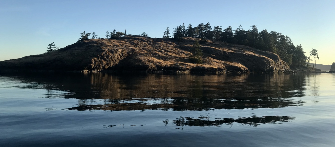
Canada Day.  We call the Kitasoo Watchman to ask permission to drop anchor on Green Spit, not far from his yurt. He welcomes us from Klemtu, the First Nation village. It’s Canada Day. 

A day off lets me finish the book I bought in Prince Rupert at the fine bookstore at the Museum. Indigenous Relations: Insights, Tips and Suggestions to Make Reconciliation a Reality is by Chief Bob Joseph and his spouse. These management consultants cover misunderstandings that can derail negotiations between First Nations leaders and Canadian executives as the former purchase or arrange for the transfer of assets from the latter. It’s for everybody, however, and will remain in our onboard library.

We’re at anchor for days. There’s no choice, no chance to plug in. Alternator problems begin. When we turn on the ignition to depart, nothing happens so we turn on the genset and take off.

Sunday 2 July 2023 Rescue Bay Departure 0600. Arrival 1200. N 52º30.9, W 128º.17.3’

Right now our house batteries are not charging. Today we are in big waters. To save power, we’ve turned off the communications, apart from our VHF handhelds. The three-day holiday weekend feels like a repeat of the Victoria Day long weekend when left Port Neville after a rocky night at anchor out of snotty weather. (Port Neville’s is no longer a pioneer settlement but has reverted to a simple geography, a broad windy inlet named by George Vancouver.) 

We are thankful for perfect weather and the fact that we’re finally below the 53rd parallel. Jack says the 53rd is the reality that no one talks about. It’s where weather patterns change and after sailing north into winter, we’re headed south into summer. 

Then the generator that has provided the necessary amps goes silent.  Oscar Channel seems a safer bet that narrow, rocky Jackson Pass. 

Heading north to Rescue Cove, we pass a couple in a canoe weighed down with provisions and gear under a red cover.  After lunch, the canoe appears, the man using a single paddle, the woman a kayak paddle.  Everything is taken out to dry on the beach.  Later I look and they’re gone!   Then in the morning, canoe and gear emerge from their camp and they paddle off, leaving us behind.

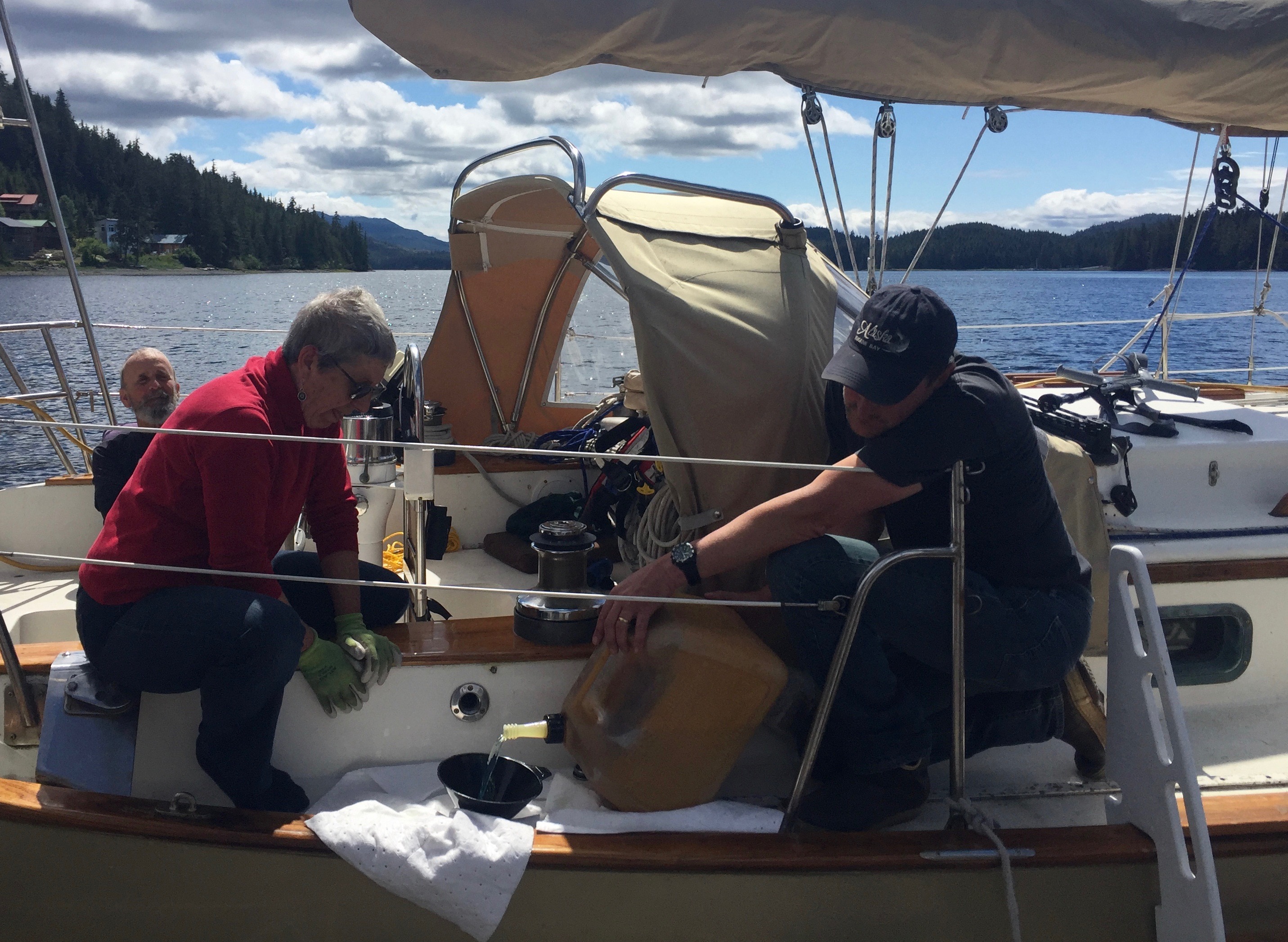
Alas, the engine will not turn over.  My efforts to jump the starter battery from the house and gensite batteries fail. Cables are not long enough to reach the bow battery that powers the windlass. We’re stuck. Good weather. Safe place. Fresh food. No hurry. 

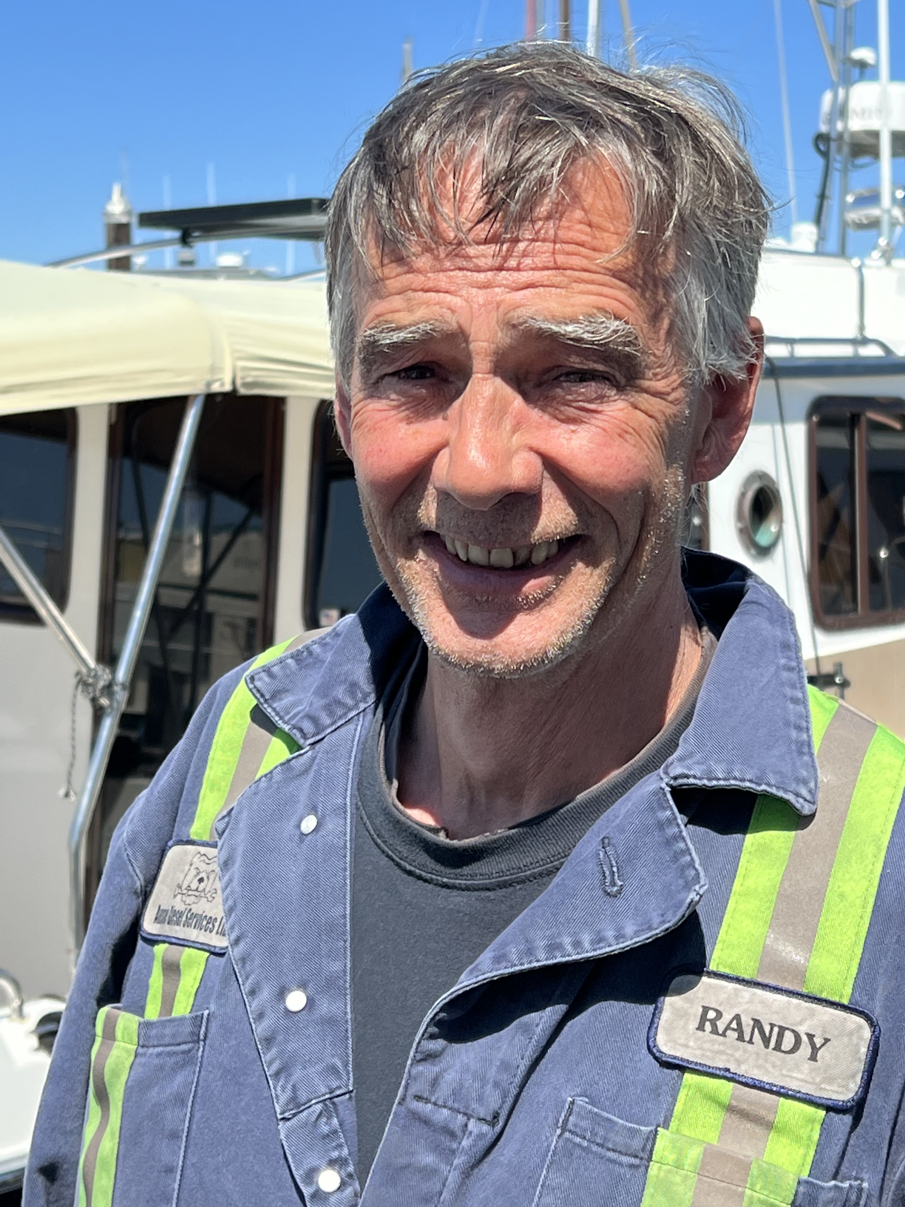
Jack calls on the radio for assistance placing a ship-to-shore call. Somebody in Bella Bella or Shearwater can provide a tow. Or maybe there’s a boat around. The Coast Guard puts out a standard a call for assistance.  Forever Friday out of Bellingham, within 30 minutes of leaving the anchorage, returns. We hadn’t thought to ask them for help.  Randy wrestles the battery from their dinghy onto Morning Light, but that doesn’t do the trick either.  The dispatcher checks in for an update.  Ten minutes the Coast Guard calls back saying their ship will arrive in two hours.  What?  Okay.  I put out the fenders and read my book. 

We’ve got fenders out on both sides. Cape Farewell appears suddenly on port and ties us up. The large crew of eight is all business. Captain Brian directs everyone to their stations.  The ship’s engineer and a young trainee step on board.  “Just relax, nothing for you to do, and you don’t pay a cent,” says Karen, as sets about showing her trainee – and us – how to secure the propeller shaft with a large pipe wrench.  We remember one that size on Aurora. Not understanding its use, we left it on board, so that wrench is now cruising the Caribbean.  To protect the shaft to keep it from turning and to secure the wrench, I supply a bit of bike inner tube and the needed length of line and it’s done.

Karen is a star. She runs us through the trouble-shooting basics and most everything checks out. Then we take a look at the spares. Oops. It looks like my assumption that we’ve got an impeller for the generator is wrong. A glitch so elemental! I’m ashamed.

I fix sandwiches and the three of us chat about her retirement plans. I ask about large Coast Guard crew on the Cape Farewater and learn they have neither a galley nor a head. Oh, those poor women!

Monday 3 July 2023  Shearwater  Departure 1000 under tow from Coast Guard. Arrival Shearwater 1700.  52º08.8 N 128º 05.3 W  

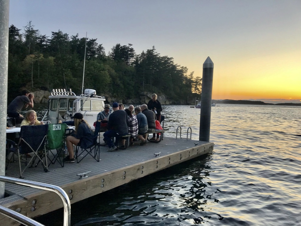
“Good to see you again!” says Masha greeting us on arrival. There’s a pot luck right here tonight.  She’s the owner of the 42’ double-ender Harmony, which joined us on the guest float in Sitka.  I learn she is half Croatian and purchased the boat – which obviously needs work – within the past year. She grew up sailing, lives aboard, and can certainly do it.  In Shearwater, the young man with her flies off somewhere, and Sam, who was her crew in Sitka, comes back aboard.  Masha is into seaweed. I break out a bottle of Foraged and Found smoked seaweed salsa. We agree that the plans and products of this new woman-owned Alaskan company are promising.

After supper on Morning Light, I join the potluck. Our leftover guac joins the papaya cubes I’d left on the table earlier. Self-ripening fruits save time and trouble. The fine mix of locals and cruisers include two old guys and a young German who hove two for two nights off Yukatat after being abandoned by their captain, but I never get the whole story on that. Jean Marc dinghies in from across the bay with a salad of baby kale, fresh zucchini and and chopped herbed veggies from his garden.  The leftovers will be our next meal. Local resident and tugboat crew member Patricia, tells us that Christophe – the harbormaster from way back – is back.  No longer trying to salvage Butedale, still pilots a coastal tug and tow, and has become a ship surveyor. I’m too busy to track him down and it’s sad to see him pull out in his black-hulled sailboat with trolling poles.

It’s a bit discouraging to have neighboring boats depart every morning. The couple crewing S/V Windrose M are flying an orange shirt!  I ask them how the see the progress of Truth & Reconciliation.  Truth is going well, they say. Reconciliation will be much harder.  And yes there’s quite a bit of redneck intolerance in North BC as First Nations take charge of Conservancies in their territories and buy up white businesses as they come up for sale.

Opposite us on our last day is the crew of S/V Tatoosh out of Nanaimo,  They agree that the modern look of the Nanaimo waterfront is cool and will stand the test of time. They explain how the island with the tower was incorporated into the plan, linking the large ship docks with the floats serving the fishing fleet and recreational boats.  

M/V Lemon Drop, one of the small, out-boarded Ranger Tugs we first encounter in Fury Bay, is buddy boating with Channel Surfing.  So named, the Jack and Jill crew tell me, after realizing that it was time to abandon sedentary channel surfing habits. Lemon Drop is skippered by an attractive woman who tells me she 76 and asks me how old I am.  Instant respect as these are the tiniest US cruising boats we encounter all trip.

In contrast, is the 90-foot aspiring super yacht rescued from foreclosure by retired Alaskan hoteliers Mark and Mary, who operate it double-handed!  They add crew when it’s chartered, which is easy with weekly rates for such a vessel running above $50K.

I’m getting to know the local people, a good mix of young and old, of indigenous and not. The Hieltsuk seem grateful when I express sympathy regarding the loss of their elder. Everyday, I chat with Maureen who works in the shipyard front office, assisted by Acacia. Maureen’s husband, Jay, works on the sports fishing side of the business. Tony, John, and Zack are at the Marine Store.  The young clerk at the Grocery Store is Stun, a Hindu Indian, who immigrated recently all by himself.

One day after lunch in the restaurant, Karen appears with Jean in tow. They ask how things are going. I tell them all we’ve learned from various people pending the arrival of a new impeller as well as frustration with service gaps, since Shearwater Marine’s lead mechanic is on vacation. Jean wonders if Nate Axel might help, if he’s not out on the water in charge of the engine room of a big fishing vessel. She calls him then and there. He comes, climbs into the engine room, and declares the alternator dead. So what about just using the generator to stay charged up during the long string of anchorages ahead? That should work, he says. As does everyone else. And if that fails, Jack has just bought longer and better quality jumping cables so we can pull juice from batteries in the bow and stern.

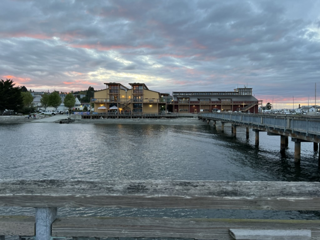
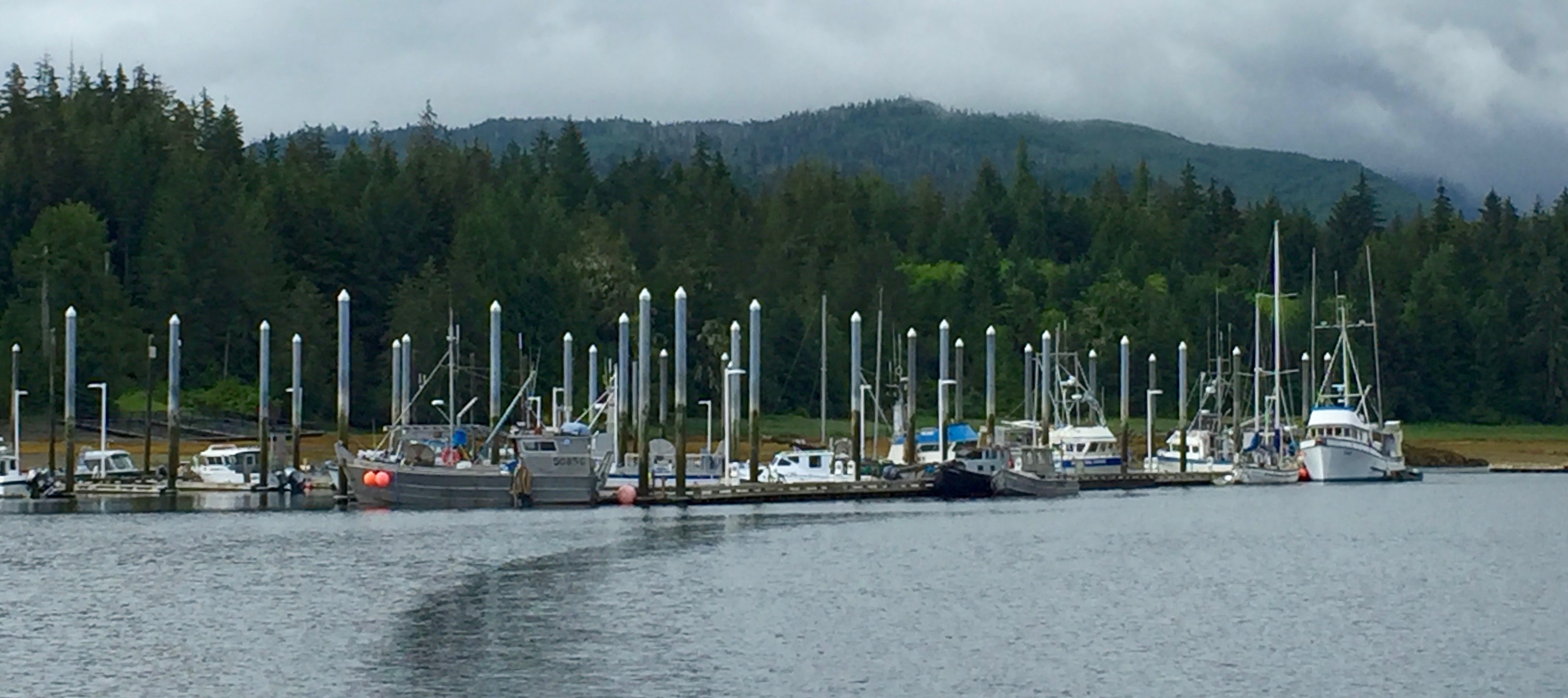
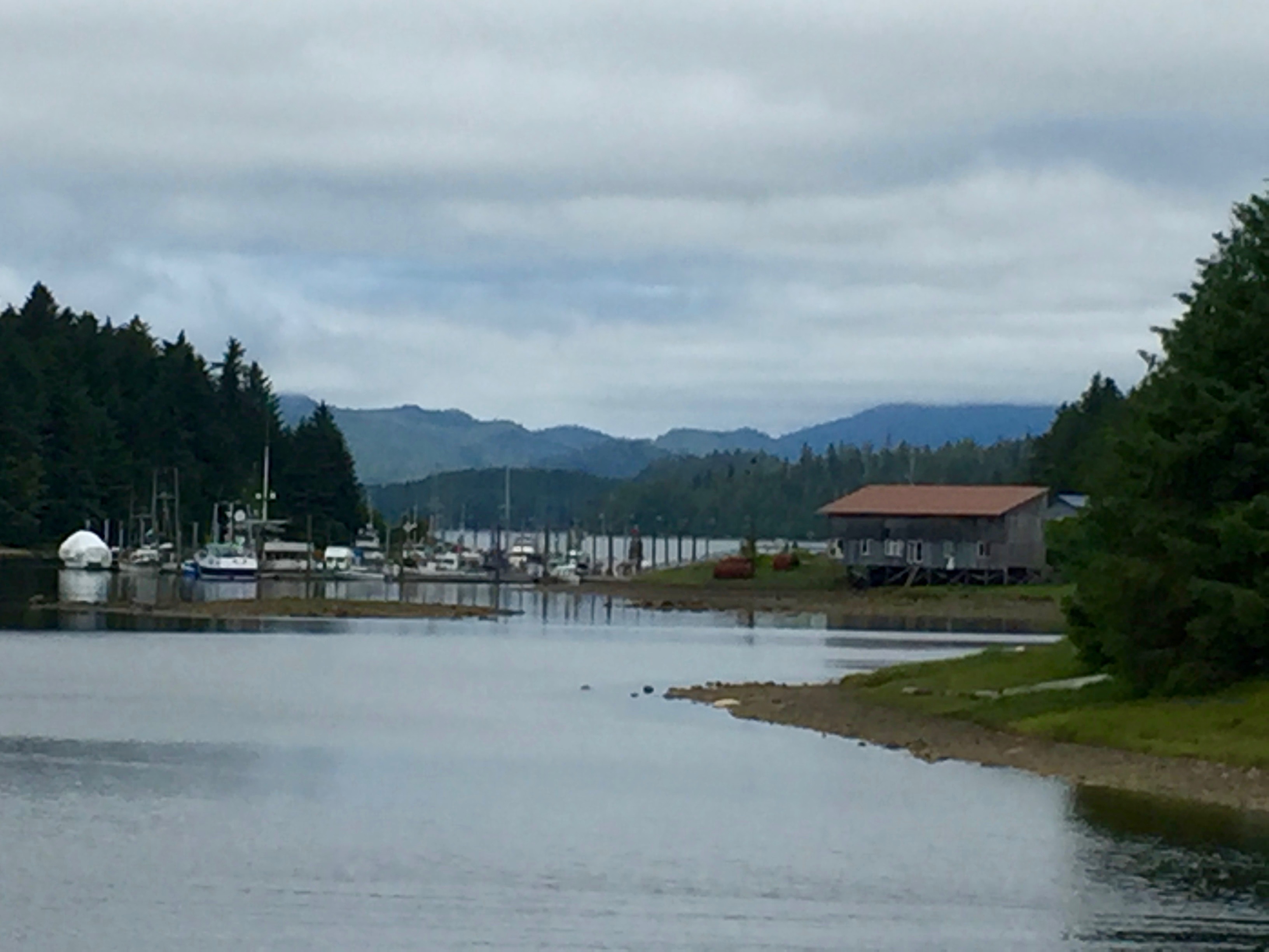
About 100 people live in Shearwater on Denny Island across the water from the Heiltsuk First Nation town of Bella Bella on Campbell Island. Water taxis link the two with regular service from early morning to late at night.

Zack – that’s him in the photos – says the impellers are expected Thursday or Friday on the regularly scheduled flight that arrives in Bella Bella about 3 pm. Nothing on Thursday. Then nothing on Friday when the SeaBus delivers. Zack calls.  Taxi guy will fetch tomorrow.  Expect by noon. Tomorrow comes. Funeral day.  Still nothing.

I track down Zack – his day off – and ask permission to take over the assignment. He insists it’s his job and is back on it. Hops on the SeaBus. The first rain in a month falls.  Turns out taxis are not running.  Zack sprints to the airport and delivers the impellers to Morning Light at 3:30 pm.  First miracle.  Zack is a star! The second is I install the impeller, replace the hoses, and the genset is working again by 5 pm. I’m a wreck. 

Sunday 9 July 2023 – Millbrook Cove, Blackney Channel  Departure 0510. Arrival 1300.  51º19.6’ N, 127º 44.2’ W. 

The genset purrs like a cat. It’s the smoothest passage ever.  We’d gotten so used to stopping Fury Cove that Millbrook Cove off Smith Sound was not on our radar. A bit confusing to enter – we found the single red buoy only upon leaving. Do Garmin, Navionics, or our old charts locate it correctly?  If one does, the others don’t. The Navionics apps on our two iPads almost always agree and are getting more accurate every year.

Monday 10 July 2023 – Port McNeill  Departure 0515, Arrival 0100  50º 35.7’ N, 127º05.3’W

Ah, Port McNeill. It’s a place where people know how to do stuff, where skilled hands willingly pass on skills, and where locals seem committed to sustaining the economy of the past into the future. They have a lot to keep going: fishing, logging, and mining industries plus the minutiae of contemporary life. Complement a mechanic – are they still all men here? – and you’ll likely get a modest reply: “Well, I’ve been doing this since I was eight.”

At 10 am Randy of Aussie Marine appears at our boat, cheering us with his presence and demeanor, asking questions, peppering technical talk with good stories, as he removes the alternator. “Let me take this to my neighbor,” he says, explaining that he’s an old guy who works out of his home.

By 2 pm Randy has had the alternator diagnosed, equipped with a new brush to replace the broken one, and reinstalled on Morning Light. Who knew such a thing was possible?

Featured

Log: On to Alaska!

Prelude

It was Alaska that called us to learn to sail in the first place. We avoided buying a boat until it was time to push ourselves farther up the coast. Once we’d made it past Ketichan to Juneau and Sitka, we kept cruising back north, right out of the promise of spring and into late winter. It’s become a habit hard to break, though we may take a break next year.

A decision we planned to make enroute was the choice between Juneau or Sitka this year. We’d ruled out doing both. Juneau would mean exciting side trips up long narrow fiords to face calving glaciers. We decided that might be more fun if family or friends joined in, making dinghy excursions and shore trails easier and more inviting. Sitka would mean revisiting beloved haunts in a small town that seems to bookend Port Townsend. Plus we’d anchor along the wild west waterfall coast of Baranof Island, attend the Summer Music Festival and see friends. Sitka won.

Sunday 28 May 2023 – Fury Cove, Fury Island   0515 departure via Gordon Channel arriving  1415 at N 51º 29’ W 127º 45’

To get past Cape Caution, appropriately named by Captain George Vancouver in 1792, we take a new route to the West. From Gordon Channel, we leave both Pine Island and Egg Island on starboard avoiding the outflow of Slingsby and the constrained traffic on the route closest to the mainland. 

With its white shell beaches and views out on Fitz Hugh Sound, Three small U.S. flagged Ranger Tugs are anchored, their crews visiting one another in tiny inflatables.  

Fury Cove, in the Penrose Island Marine Park, is one of the most beautiful anchorages on the coast and the scene of a memorable evening during the Tribal Canoe Journey several years ago. (See the story For Midouri LINK)  Now the narrow entry finally bears a “No Discharge Zone” sign (and when I raise the anchor, I’m shocked at the color and consistency of the mud). 

Only later do we learn that BC Parks asks no one to go ashore at Fury Cove. Our Navionics confirms that the old middens and the recovering shellfish beds are now off-limits. First Nations are stepping up to put the lovely, sacred places in their territories into Conservancy, as the recommendations of the Truth and Reconciliation Commission are put into practice

Monday 29 May 2023 – Shearwater   0615 departure, arriving 1319 at N 52º 08’ W 128º 06’

Shearwater floats are quite empty for this time of year. On arrival we ask Jeff, who now manages the docks, about Christophe, who left some years ago for Butedale. It seems he’s gone moved back to his old gig of driving tugs pulling  big barges.  The abandoned town of Butedale still seems promising to many, but there’s so much to be done. 

Shearwater is now owned by the Hieltsuk Nation, many of whose members live in the pleasant and lively town of Bella Bella across the bay.  On a blackboard in the restaurant, is a handy lesson in the local language. I have fish and chips, Jack his hamburger. The fries come with gravy and go back to the boat for tomorrow’s poutine with feta.  

Tuesday 30 May 2023 – Khutze Inlet  0515 departure, arriving 1415 N 52º 05’ W 128º 31’Captain Jack calls for an early morning departure so we can the swells from across the Pacific.   Once around the Ivory Island light station, we head out on Milbanke Sound’s gentle swells, eschewing the option of a more sheltered, inside route. 

It’s a long relaxing day of spectacular channels, high peaks, and waters falling from mountain lakes.  As we anchor off Green Spit in Khutze Inlet, a grizzly bear appears on the beach. A brand new yurt on shore will house a Watchman from the Kitasoo-XieXie First Nation, under whose conservancy the area now falls, a result of Truth and Reconciliation.  On return we’ll seek permission from the Watchman to spend the night.  

While the boxcar-sized chunk of tidewater ice that persisted all summer during our first trips has disappeared, this place where mountain meets sea and home to numerous brown bears is exquisite.  A boat of Indigenous fishermen enters the inlet to as a full rainbow arches shore to shore.  Soon S/V Soulstice appears near us. It’s crewed by a couple of medical professionals who cruise the Pacific Rim, working intensively and then taking time off. We met them at Port McNeill and they’re headed to Glacier Bay with a Juneau friend.  How rare to be three boats spending the night in one anchorage!

Wednesday 31 May 2023 – Kumealon Inlet   0515 departure, arriving 1415 at the north end of Grenville Channel.

Kumealon Inlet is a favorite. Colorful steep-sided islands glow at low tide.  Snow capped peaks line up one after the other to the west. Fresh water rushes into a fine lagoon to the north.  Light, color, and show contours change as the afternoon yields slowly to evening and the tide drops nearly 25 feet. (CHECK) I take a ridiculous number of photos and think of Monet and his beloved Rouen Cathedral.

Thursday 1 June 2023 – Prince Rupert  Departure 0615, arrival 0914 N 54º 19’ W 130º 19’  

Prince Rupert has two thousand more folks than Port Townsend but inspires to be an international trade powerhouse.  Coming in, a Mersk ship is being unloaded and reloaded, gantries picking up or dropping 40 ft containers off or on trucks or rail cars.  Very colorful. The grain terminal was boatless. The coal had a train unloading.  

In the Price Rupert Rowing and Yacht Club office, I chat with Kevin sho tells me says they are upgrading export terminals for fuel –  LNG, propane, diesel, and gas – at Port Edward. I’m happy to hear the Moore family are still all engaged in running their marine services business there, including one of the few travel lifts for haul-outs in the vicinity.

Saturday 3 June 2023 – Foggy Bay  Departure 0530, arrival 1045 Alaska time at N 54º 56.9’ W 130º 56.4’  

Jack has memorized Venn Passage and it seems we were done in short time.  I’ll never forget how long and stressful that shortcut from the deepwater harbor to open waters at Dixon Entrance used to feel.

While it takes navigational care to enter Foggy Bay, it’s lovely.  We drop the hook inside the reef over which we look out on Dixon Entrance.  We wake from post prandial naps to the company of Seven Grand Banks trawlers. Five of them – all different lengths – snug up across the inner bay, rafting with impressive skill to the boat in the middle. I notice boats from San Francisco, Santa Barbara and some place in North Carolina. 

Waggoner says only 500-600 recreational boats do the Inside Passage to Alaska each year.  Now with protocols relaxed since in the onset of Covid-19 plus the increase in boat purchase, I expect more.  

Sunday 4 June 2023 – Ketchikan  Departure 0530. Arrival1230. N 55º27’ W 131º41’

As it happens, on exit we trust our charts and the Grand Banks crews who go before us.  We do it as the water level drains out to a negative low tide.  

We leave at 0730.  Rock and roll. Takes time to calm down.  We could have floated here in calm sunny seas yesterday but we weren’t ready for consecutive nights in cities. Time at anchorage is much more relaxing.

Not far from the first houses of the Ketchikan, we stop for humpback whales, one slapping both long fins on the surface, throwing up turbulent splashes. It looks more like a freakout than collective “bubble” feeding.  As soon as we turn into Tongass Narrows, the heavens open with a downpour that remains steady into the night. Since the laundromat is near Bar Harbor, we eschew Thomas Basin and head north a mile past downtown.  We just fit in stall 42 on float 8 but the fairways are large. It’s 84 cents a foot and a block from the laundry.

I walk toward town to run an errand for Jack. Tongass Avenue, Katchikan’s front street is hideous in the heavy rainstorm. The end-of-day traffic is noisy and throws waves onto crummy sidewalks.

I try an alternate route up the mountainside, which turns into a web of hanging wooden streets joined by wooden stairs. Some houses have off-street parking, and single spots on log pylons on with wood surfaces and railings  I wonder where the city officials who sign off on building and occupancy permits get their code.  

While waiting for me to return, Jack checks Navionics and finds that most of waterfront between Bar Harbor and the cruise terminal #4 is greyed out on the screen. Is there something there? Is there something in the old wooden warehouses that line the street?  Very strange for a town most of whose homes and businesses are on the water or stacked on the steep slopes above. 

Monday 5 June 2023 – McHenry Cove, Etolin Island, Clarence Strait.  Departure 0745, arriving 1400  N 55º47.8’ W 132º 25.9’  

The mouth of our little bay in a bay in a bay offers 350º protection on a negative tide. The view is superb at low water as we look out on the strait protected by rocks and shoal all around.  Early departure will get us out of here before tomorrow’s -3 low.  I take a long indolent nap. Putter in the galley while listening to new podcasts – there must be a cell tower somewhere on one of those peaks above Clarence Strait. I combine broth from stem and leaves from last night’s cauliflower, old frozen spinach, and new feta for soup. Bake muffins from a Krustease box adding minced dried apricots and chopped almonds from Afghanistan. Mix last night’s leftover halibut with chipotle sauce and mango-lime chutney from Safeway. Supper is soup, tacos, and fruit salad with a warm muffin.   

Tuesday, June 6 2023 – Wrangell 0515 departure, arrival 1030 at Heritage Harbor N 56º27.4’ W 132º23.1’

The approach to tiny Wrangell is always magnificent, though there are fewer bits of floating ice every year.  Despite our early arrival the floats in the little downtown harbor are full so we go on to the newer Heritage Harbor.  The wharves and ramps are wide and strong, the toe rails on the wooden floats are nine-inches on a side. All of the electrical cables, power boxes with plugs, and switches are up to AYBC standards.

It’s early in the season and with no staff to serve the mix of fishing and rec boats in Heritage  Harbor, so we need to pay the Harbormaster downtown and get access to the locked power boxes.  I put Jack’s scooter together and find it won’t start.  Oh yes, it was out in the rain for 24 hours in Ketchikan. We take it apart, lay everything on a garbage bag, dry it off, wipe off the rust with WD-40, talk to each of the parts, and leave it in the benevolent sun.  I take off on my bike – it’s less than a mile – and pay the Harbormaster $0.37 a foot for moorage. What!?  For the best facilities yet?

The next day, the scooter is recovered so we go to town to see the colorful tents and booths selling food to fundraise for the Fourth of July.  Alas, there is only one!  And it’s for a prospective King. I’m not sure what happened to nice the ladies – of Anglo, Russian, and Native heritage – who used to compete for Fourth of July Queen but people seem a bit sad about it.   Maybe I’ll get the story from Liz and Charley Kaninski

Thursday 8 June 2023 – Petersburg   0615 departure, 1143 arrival at Petersburg N 56º48.7’ W 132º57.7’

North on the Wrangell Narrows we go, Like all Alaskan ports, it’s first come first served. We’re assigned stall 92 in North Harbor, that’s on the north side of the south floats for a bow in starboard tie.  I miss seeing the tiny #92 as we turn in the fairway There’s a lot going on. Next thing you know we’re at the ramp to the Harbor Master.  We hear Glo’s welcoming voice asking folks on the dock to get Morning Light turned in the right direction. It’s turns out to be no problem. Petersburg’s fairways are spacious and people on the floats help us find our slip and take our lines.  

I go to the office, have a good laugh with Glo, one of Alaska’s legendary Harbormasters, and pay moorage – $0.38 cents a foot. “Can’t you charge visiting recreational boats a bit more?” I ask.  “Nope,” she replies.  Seems all boats rise and fall together on the tide along this particular coast.  It’s not the same elsewhere – not at the other public small boat harbors in Alaska and not at the municipal or recreational marinas along the BC coast.  

I’m not complaining that fees are burdensome anywhere.  It’s so difficult to maintain port facilities throughout the winter storms, to say nothing of their systems to distribute water, electricity and fuel. What is sad has been the disappearance of private facilities that serve rec boats in the summer on the islands and along the channels of the BC mainland.  The fly-in fishing resorts continue to thrive but I don’t know of one that offers moorage to independent travelers.  

How different it was in the 1920’s when UW coed Betty Lowry paddled her dugout canoe BiJaBoJi to Alaska or when The Curve of Time author Muriel Wylie Blanchet vacationed along the BC coast in a 24-foot boat with her five children. At that time, the coast was full of settlements serving loggers and fishermen as well as active canneries, ethnic enclaves, and Indigenous villages.

When the tide comes up and the ramp is not so steep, we take a walk along Hammar Slough and wander the streets of town. There’s even more to see on Peterburg’s docks. 

After admiring F/V Grace on the hard in Port Townsend all winter, I’m delighted to see this fine old double-ended troller pull into North Harbor. Like other trolling fishermen, Kat Murphy is worried that the July 1 Chinook opening will be canceled. A fringey environmental group trying to save our Puget Sound Southern Resident Orcas, whose difficulties are caused by numerous issues – toxics, ship noise, collisions – in addition to a shortage of a food favored by many other marine mammals. 

Saturday 10 June 2023 – Ell Cove  0515 departure, 1430 arrival first at Baranof Warm Springs and then at N 57º 11.9’  W 134º50.9’.

The tiny (12 houses?) settlement of Baranof has been discovered.  This traditional rest stop with a roaring waterfall and hot-spring-filled baths at the top of the ramp has always served the purse seine fleet. One summer seven seiners rafted to one another and to the dock for a merry evening of crew and kids traipsing through the boats on their way to the bathhouse.   Moorage was free until the Sitka Harbor Authority took charge and extracted a fee.

With no space to tie up, we chose a side bay that was wrong into the wind and had dubious holding.  When a large boat dropped anchor nearby we pulled ours and headed out into Chatham Strait to Ell Cove. So named for its shape, invisible from the shore, it doesn’t appear on our charts but is on Navionics.  A perfect cove with waterfalls falling outside the entrance heard tumbling down from the mountaintops above  and mineral colors adorn the otherwise untroubled white rock shores. It’s about the size of a football field.

Monday 12 June 2023  – Schultz Bay 0530 departure, 1315 arrival at mooring buoy, aka “Mike’s Place.”  N 57º23.5’ W135º 35.8’

Our destination is Sitka on the west edge of Baranof Island near the open Pacific and two long days from the east or “waterfall coast” of the Island.  The passage is the aptly named Peril Strait, in the midst of which are situated Sergius Narrows, which needs to be transited at low or high slack.  Early departures are no problem for us, even though we arrive 40 minutes early. While Jack takes a nap, I motor slowly around Deep Bay until slack. We pass the Narrows with ease and tie up in Schultz Bay at the west end.  

Schultz Bay has a cabin that fishing and hunting families can rent. Out in front is a mooring buoy, similar to two others along Peril Strait. All are free, first come first served, and not included in cabin rental.

Tuesday 13 June 2023 – Sitka  0530 departure for 0900 arrival at N 57º03.5’ W 135º21’

Sitka is the jewel of Southeast. For the last 52 years the locals have hosted a Summer Music Festival in the former capital of Russian America.  The Festival founder and original Artistic Director remains active in year round Festival offerings to various communities from his home in Juneau.  He nominated the second Artistic Director, cellist Zuill Bailey, who is now 52.  The community assures the ongoing success of the festival with their confidence in Bailey’s vision, their dedication as volunteers and their work securing a historic house where artists live and rehearse.  Each week in June there are five events – Tuesday through Saturday.  Tuesdays are at The Mean Queen, a waterfront bar. 

We arrive in in time to get a table, order our pizza, and admire leftover decorations from a recent Pride Week drag show. Tuesday’s repetoire always features a review and preview of excerpts from the main stage performances of the previous and next weekend. The “listen again” piece performed by Alex Gonzalez on violin and Zuill Baily on cello moves with such dazzling energy and virtuosity, that in the brief silence at the end before the room explode into applause, some guy at the bar shouts “I’ve done a lot of shrooms and that was the coolest music I’ve ever heard!” Everybody cracks up. What a sweet moment!

Wednesday is Bach’s Lunch, which takes place in lovely Odessa Hl on the Sheldon Jackson campus. (One year the performance was deep in old growth of the Totem Park.)  No Bach this year but we dine on tuna sandwiches in the hall.  Thursday is a specially curated session that digs into the history of the old and contemporary pieces to be performed on the weekend. It’s held at in Miner Hall, an elegant craftman stylke home that the Festval has purchases to house musicians and rehearsal space.   Friday and Saturday feature different programs in Harrigan Centenial Hall, whose backstage consists of floor-to-ceiling windows. As you you listen, you look out on islands, which may be enveloped in mist or rainbows, and the wooden trollers returning after a day of fishing.

After Saturday’s concert, we’re invited to the home of Kurt Hansen, along with son Brian and our first Sitka friend Sarah, who provides occupational therapy and wound care for SEARHC, riding her bike to reach many of them at home.  Kurt tells the history of the Festival that owes its success to strong artistic directors and a welcoming community that applauds their choices of music and musicians.

Featured

Log: Go simple, go (sorta) small, but go now!

Prelude

Jack said we just needed to set a date. So he did. May 15th. If you don’t, you risk never casting off those lines. We were up before dawn and soon off.

Upon arrival at every new anchorage or dock, Jack faithfully took his little notebook from the nav station drawer and logged the essentials. Initial paragraphs are his. I was sloppy about taking notes. I jotted thoughts on nautical charts, stickies, and tiny legal pads, trusting photos to remind me where we’d been and what happened.

Precious little writing. Blame the carefully curated stack of books that kept calling me. Plus, an initial post was cautionary and de-motivating: I’d captioned some photos but was uninspired about producing text. With departure from a rare location with Internet scheduled within the hour, I signed up, signed in, and assigned the task to ChatGPT. It was done in less than a minute!

Finally back home, I wrestled with a single post covering 76 days, before breaking it into stages. So here we go. Comments and corrections are welcome!

Monday 15 May 2023 – Maple Bay Marina  0550 Departure from Port Townsend 1543 engine hours, Point Wilson smooth on strong ebb,  Slow customs at Sidney BC Van Isle Marina,  Arrival 1530 at 48º 47.7’ N 123º36’ W.

Blissful sleep in home port. Up at 4:20 AM to fill water tank and secure scooter on board.  Lines off and by 5:50 as we head out into a blinding sunrise. I hold my hand close to my face to protect my eyes but no boats are moving, the ferry has just docked, and the sea is smooth.   

Perfect crossing. We pass several harbor seals heads turned, big doe eyes looking at us and a loaded “bird boat,” –  a log with seven double-crested cormorants, and a lone California gull.  

Bird boats are reminders to stay alert for big logs we don’t want to hit; but there are none.  Perfect crossing. Passed a loaded bird boat –  a log with seven double-crested cormorants, and a lone California gull – and several harbor seals heads turned, big doe eyes toward us.

Rather than pass Canadian Customs at Bedwell Harbor with its customs kiosk up a steep ramp, we continue on to Sidney. We scoot around the spit, tie up to the extension of the fuel float right next to the customs phone!  Alas, the phone doesn’t work.  Jack tries his cell phone and is put on hold. The noon sun is unrelenting so the heat shuts down the cell phone.  I pass Jack a bowl of ice and a sandwich bag to revive the phone plus a folding chair and a hat so he can wait for someone in Ottawa to pick up.  He’s told to wait for the local rep, who checks us and our border passing history out on the phone rather than traipse down to the boat in the lunchtime heat.

We head up Satellite Channel and through the lovely Sansum Narrows, the peaks of Saltspring Island to starboard. We pass up Cowichan to check out Maple Bay.  

Maple Bay would be “bulletproof” in a storm, to use a common term meaning “360º protection from wind and waves.” However, the docks are rickety, the AC power distribution questionable, and the place has the vibe of a used boat lot. Marina staff is obviously new and getting the hang of it, the docks guy doubling as an employee of Harbour Air, whose float planes provide regular service to Vancouver, Victoria, and neighboring islands. Restrooms. showers, and laundry are fine, with maintenance outsourced to a Vancouver Island firm.

Northward passage to Nanaimo means arriving Dodd Narrows at slack so there’s time to read  The Guardian and the New York Times and, when the Weekly Local 20/20 Announcements rolls in to see the meetings and events that won’t clutter my calendar for months. We turn in early as usual. Only later do I read that the boat shop-turned-pub at the top of the docks doubles of as a museum and was a favorite of John Wayne. 

Tuesday 16 May 2023 – Nanaimo 1100 departure for slack at Dodd Narrows. 1500 Arrival at N 49.1º W 123º56’  

Seasonal return to a favorite place. Spring has come late and suddenly. Nanaimo is  a cauldron warmth and joy. The harbor master assigns us to the mostly empty float adjacent to the fishing boats. 

Nanaimo has great waterfront design. Has any other smallish town embraced such a distinctive and durable contemporary style? Granville Island and other parts of the Vancouver waterfront do a fine job of bringing together working, residential, and visiting communities in lovely, safe, walkable, and rollable spaces, too. But Nanaimo is its own place.

Trollers” fish and chips is freshly painted and under the new management of a sixtyish South Asian. I enjoy watching him train and encourage his new hires as I sit in the shade across from Morning Light waiting for our takeout order.

A new protocol at Nanaimo is locked gates during the night. I’m stymied in my early morning attempt to access the recycling center on shore. I encounter a young man who’s inadvertently found himself locked off land all night. At 6am someone opens the gate to free us.

Just before we cast off, an email from Jan Steinbock slides in! I haven’t heard from her in ages!  Jan is one of a handful of readers of Baggywrinkles’ Blog. She has just arrived at Shoal Bay, where she’s spending a week!   

Wednesday 17 May 2023 – Boho Bay, Lesquiti Island  0610 departure with 0930 arrival at 49º29.8 N 124º13’ W

Georgie Strait is flat, whiskey Golf inactive, and our passage is passage to Lesquiti Island is joyous. Although located admist the dense populations of Vancouver on one side and Vancouver Island on the other, Lesquiti has been an abode for thoroughly off-grid living for decades. Probably all it took was residents rejecting ferry service.  

Over the past couple of years, I’ve been looking at documentation of off-grid living by Canadian scholars and filmmakers, especially on water, sanitation and electrical generation systems by households, both individual and clustered. Lesquiti Island is always mentioned.  Some year we’ll poke around a bit more. There’s much less information on these technologies in the US apart from the work of the global permaculture community plus the dubious YouTube how-to videos posted by everyday enthusiasts.

It’s in the middle of a birdless stretch of the huge horizontality of Georgia Strait that lies between us and our evening anchorage that we are blessed with the appearance of a raven. It hops onto our forward port rail and then steps up on my paddlebroad to look directly into our eyes! As anyone in these parts can tell you, Raven is omen-ous.

We drop the hook half a boat length from shore, where it will stay put. The historic motor vessel Hecate Ranger  is anchored nearby.  Boho is full of logs and small debris but quiet aside from pair of Canada Geese. The male flies around bay pursuing the female, both squawking noisily. Then they sit unruffled atop the the granite walls of the bay before another round. It’s hot and sultry. I start in on my carefully curated selection of books for summer reading.  

Thursday 18 May 2023 – Hjorth Bay in Hoskyn Channel – 0615 departure for smooth passage on Georgia Strait arriving 1415 at N 50º1’ W125º.  

Smooth passage north toward Seymour Narrows. We realize we’re fully provisioned and have no need to stop in Campbell River and wait for the slack there now after discovering Okisollo Channel last year. The lovely passage wends between Quadra Island to the south and Sonora and Maurelle Islands to the north and west.  At the southeast end lies Surge Narrows with  Beazley Passage, where – our Waggoner tells us – “spring floods set eastward to 12 knots and ebbs set westward at 10 knots” 

So we need to figure out anchorage and time to run Okisollo at slack.  We try the little bay that was once a center of community for folks living in the Discovery Islands. But Post Office is closed, the floats are filled with local boats, the float homes have trees growing on them, and anchoring lacks shelter.  So we backtrack a mile to Hjorth Bay, again dropping anchor a half a boat length from shore. We wallow in the afternoon sun, sleep like logs, and enjoy the dawn. 

Friday 19 May 2023 – Shoal Bay  0945 departure for Beazley Passage in Okisollo Channel with a wait for slack at Surge Narrows. 1400 arrival at Shoal Bay at 50º27’ N 125º 21’ W

The rapids in Breazley Passage are a mere mile from our anchorage.  As usual we allow more time than necessary and end up waiting for the window of slack, said to be a short 5 to 11 minutes.  We circle outside the entrance and while checking the chart, peep in among the small islands and rocks that create the rapids.  Lo and behold there in the middle of the froth are a young man and woman sitting in a small open boat, presumably at anchor!  

As soon as we enter, an orca suddenly appears in front of us!  Jack turns to starboard as the whale slips to port.  As we exit the turbulence, we share broad smiles with the couple in the boat.  They are the embodiment of “local knowledge.”  They know the ropes – the direction and strenght currents, when wildlife appears to feed in riled waters, where the bottom will catch an anchor, and how to successfully manage maneuvers others would dare not attempt. “Local knowledge” is the official term used in the U.S. Coast Pilot and the Canadian Sailing Directions to indicate what you may observe but shouldn’t do.  It’s a warning not to follow local boats if official charts, instructions, and aids to navigation say otherwise. 

It’s always a thrill to arrive in Nodales Channel, then turn left into Cordero Channel, marvel as vista out across Philips Arm opens up, and emerge expectantly from around the island blocking the view into lovely Shoal Bay.  Will there be a place at the wharf?  We see a single blue sailboat. Not even Bessie, the boat of resident owners Mark and Cynthia is there. We tie up.  

I’ve been out of touch with Jan, a fellow member of the Oregon Women’s Sailing Association, but have had time to ponder why she is traveling alone. Suddenly she is there on the dock.  I jump out and while hugging her, ask, “Is Donnie is still with us?”  She shakes her head and we both start to cry.  

Donnie was so full of life and nourished by a huge sense of adventure.  I’d heard from him relatively recently, the annual invitation to gather with his team at Portland’s annual ALS march.  He and Jan loved to sail and travel. A legendary cruise brought them to the Broughtons, where a visit to the deserted and now protected village of Mamalilicula First Nation – where we’ve never been – was among their most vivid memories. When they drove up from Portland to see us to see us several years, they stayed at The Swan. We had dinner at Doc’s in Point Hudson, with Donnie telling stories between bites of food and gulps of air from his respirator.  

He passed after deciding ‘to stop’, as Jan put it.  The future would no longer allow them to travel together. Mindfully alert, his body was failing. They had a rich life together, surrounded by family and grandkids. I get it about caregiving but was surprised that even for in the ALS community, it’s so hard to find caregivers outside of the family.  Jan’s going to be okay.    She flows deep and calm. It was wonderful to be with her and I look forward to many more reunions. 

Saturday 20 May 2023 – Port Neville  0915 departure for Green Point Rapids, Wellbore Channel, and via Whirlpool Rapids. 1350 Arrival N 50º31’ W 126º 01′

Though I’m reluctant to leave Shoal Bay, engine mysteries have appeared and we are now beyond most marine services. The alternator appears not to be charging. And yes, I feel responsible. Back during my preparatory labors in Port Townsend, it had taken me forever to figure out the wrench-socket-plus-extender needed to remove the cover protecting the fan belt on the engine. (I’m still mad that girls were not allowed to take shop back in the day when boys were learning basic stills.) Not finding the make, model, and serial number of the alternator, I was unable to add it to my lengthy list of parts. Worse, I figured it must be a Balmar, which Nordic Tugs normally paired with our Cummins engine and for which I’d found and printed the manual.   

I favor heading back south to Campbell River but Jack figures we might be able to run the necessary electronics and communications equipment by turning on the generator. Dock neighbor Cecil of the blue sailboat confirms that this should work so the next morning we take off.  It’s a long long way to Port McNeill.

We manage the set of three rapids and get out into Johnstone Strait.  The weather is snotty, green water’s coming over the bow and the windshield wipers are struggling to keep up.  But we persevere and go all the way to Port Neville.  We know anchoring here is a pain in the neck. The Waggoner suggests dropping the hook in Baresides Bay, directly south of the MSh symbol on Charts 3545 and 3564 where you will be in 15 feet of water at zero tide and 200 feet from shore. Excellent holding. Not the most protected but out of the words of westerly winds. So it is. We breathe, have a nice supper, and rock and roll to noisy sleep as the waves hit the bow of the V-berth.

I finish Robin Wall Kimmerer’s Braiding Sweetgrass.  It’s the beautiful Young Adult version chosen for this winter’s Port Townsend Community Read.I feel a profound sense of gratitude, inspired by the Community Read, by the librarian who thrust the free copy into my hands, by shelter from the storm replete with time to read, and perhaps by my new awareness of the non-human people who have inhabited our continent for millennia.

Sunday 21 May 2021 – Port McNeill  0615 departure, arriving 1130 at N 50º35’ W 127º 05’

We just go for it. Johnstone is slightly calmer and Morning Light does her thing. 

Just out of Port McNeil we are waked by three, big fast power boats. Don’t they know that this area serving Telegraph Cove, Alert Bay, and Malcolm Island is filled with local small boat traffic?  We arrive at North Island Marina to get fuel and discover there is no moorage thanks to the arrival of two flotillas. So we move to the Municipal Marina next door.  The weather is terrible. After rocking around for 24-hours, a kindly dock attendant helps us move to a more sheltered slip. It’s Victoria Day and so we have some forced respite before a four day work week.  

On my way to pay moorage on Tuesday morning, I pass a signboard announcing local businesses. What a relief to see this among them: Aussie Marine Diesel – Authorized Cummins Specialists. 

We manage our patience through the long weekend and Jack place his call at 9 am sharp on Tuesday morning. The same day, a guy in coveralls appeared dockside, his right hand on his heart. “Whew. Everybody needs repairs today! I had to cover this up,” he said, revealing the Aussi logo of a bulldog with a wrench in its mouth.

Tyrell confesses that he works mostly on the logging side of the business, which is fine with us. Big diesel engines have huge commonalities across uses and the years. On the first day of the Wooden Boat Festival, I look for the biggest, oldest work boats, knowing I’m likely to get a great story from a seasoned mechanic.

Tyrell is from Port Alice, a tiny town deep in the heart of North Vancouver Island. By boat, it’s only accessible via the Quatsino Sound on the West Coast. By road, however, one can get there by BC Transit! He’s soon checking out all the battery banks, talking all the time so Jack and I follow, his multimeter moving with impressive speed. We loosen the alternator just enough to see it’s a Delco-Remy and decipher letters and numbers needed which model.

Although I have a page and a half of model and serial numbers for other things on the boat, I’d never identified the alternator. I figured it must be the original Balmar installed in 2003 and duly download that manual. So there’s nobody but me to blame – though with the disclaimer that I was raised a girl in the 1950s, swore off car ownership, and spent most of my adult life in places around the developing world where it’s unethical to pick up a wrench if there is someone nearby who knows what to do and needs the business. I’d struggled with how to get the cover off the fan belt for ten days back in PT before learning that hardware stores have extensions for socket wrenches.

Let’s remember that Morning Light came into our lives with the understanding that no one would work in the engine room without my being there. We’d be going to Alaska without a sail! Why not pay good mechanics to take a little extra time and show me the way?

On Friday morning, Scotty-the-boss himself calls and comes. Over the past week, others have confirmed his creds. He’s a big, modestly confident, amiable Aussi, a redhead with a Mohawk, nose ring, tongue stud, and a tattoo of the bulldog logo on the inside of his massive right forearm.

Using Tyrell’s notes he’s figured out our dilemma. It’s got to the weird wire that goes to an external Balmar regulator. Most Balmars have internal regulators but our after-market Delco-Remy doesn’t. And with Tyrell, we’d missed a single sloppy connection. “Automotive, says Scotty scornfully.”

He asks for a kitchen knife to trim the wires and matches to shrink the sheath. He’s old school, young but started early. He doesn’t haul a cart of tools but carries a lot in his head and muscle memory, constantly building on it.

Featured

Summer Books – 2023

Paved Paradise: How Parking Explains the World. Henry Grabar. Penguin, 2023.  

Thanks to my British colleague Peter Yates, I fell under the spell of Human Geography while teaching high school in Yemen in the 1980s. With our students, we climbed medieval mountain fortresses, crawled through ancient irrigation tunnels, and documented the life of villages on the Red Sea coast.  It worked.  

Paving Paradise emerges from the black-and-white page as the best example of this genre of exploration I’ve encountered in a long while. While much has been written about Americans’ devotion to the automobile, there’s been scant attention to the amount of space accorded to the storage of vehicles at either end of every trip.  Grabar has done the sleuthing and spadework necessary to map out this complex and sad geography.  

In a blurb on the back cover, the number-crunching author of The High Cost of Free Parking – Donald Shoup – says this of his disciple’s work:  Like no one else before, Henry Grabar explains why mismanged parking is the greatest single cause of many urban ills. Everyone who wants to reduce traffic congestion, clean the air, support public transportation, encourage biking and walking, promote business, increase employment, improve public services, and slow global warming should read Paved Paradise and heed Grabar’s advice for solving the parking problem.

As we return to Port Townsend, City Council is considering the shape, funding, and management of a potential Transportation Benefit District.  It seems a good time to talk about the basics of space and land use, especially since parking remains the elephant in the room. Paved Paradise for next winter’s Community Read, anyone?

I confess to having taken a two-decade-plus break from following Iraq. A series of essays I started about life and work in Baghdad are replete with joy and gratitude but when things fell apart, the writing became too painful. The US invasions of Kuwait, Iraq, and Syria destroyed the stasis of oppressive dictatorships which had allowed people to manage, be productive at work and school, enjoy relative safety and health, make plans, and have hope.

Born in 1975, Gaith Abdel-Ahad has been observing Iraq and the implications of the actions of American-led coalitions all his life.  After many years as an interpreter and journalist on the ground, he joined the staff of The Guardian and has continued to offer some of the best insider reporting on the Middle East.  In this clip from an interview with Christiane Amanpour, Abdel-Ahad cites Iraqis’ rejection of their current, corrupt government, their distaste for democracy, and their nostalgia for a strongman regime.  A Stranger in Your Own City explains why this is so.

In my wilder dreams, I see millions of my fellow citizens embarking on personal journeys of truth and reconciliation and then raising their voices in a final NEVER AGAIN!  Sitting down to read this book would be a way to start.

You’re Not Listening: What You’re Missing and Why it Matters. Kate Murphy, Celadon Books, 2019.  

In an early May interview with Shankar Vendantum of Hidden Brain, I got a wake-up call from Kate Murphy on how and why to listen, and the dire consequences of failing to do so. As for You’re not listening, Jack tells me that at least once a week. Thrift Books had a used copy on our front porch days before our departure. 

Murphy is a stunning speaker and enticing writer whose grasp of contemporary communication theory reaches into many fields, including social media, AI, and the speed of change in the ways information moves. Everything fits together. Listening is almost a lost art.  I’m hopeful You’re Not Listening will put me on a more productive path to knowledge and communication. 

How Far the Light Reaches: A Life in Ten Sea Creatures. Sabrina Imbler. Hachette Book Group, 2022.    

After hearing Sabrina Imbler recount “If You Flush a Goldfish” on (I think) This American Life, I downloaded How Far the Light Reaches from Audible.com and followed up with a hard copy for my summer reading. 

Here is a voice from a new generation of science journalists. The author pairs each account of marine critters with their personal stories and drawings. Imbler is an amazing writer. Start this book – or listen to the author reading it.  I suspect we will be learning from Imbler for years to come.

The Fisherman’s Frontier: People and Salmon in Southeast Alaska.  David F. Arnold.  University of Washington Press, 2007.  

“Do you have anything on the politics of fishing?” I ask the woman at Sing Lee Alley Books in Petersburg.  She walks me to a familiar shelf and thrusts this volume into my hands.  How did I miss this one over the years?

The Fisherman’s Frontier is a comprehensive history of Southeast fishing from the earliest millennia to the 21st century. It combines scholarship on the arrival of humans on the Pacific Coast, the evolution of salmonids, the development of fishing technologies, the structure of work at hundreds of 19th century canneries, the establishment of Indigenous rights, and tensions between corporations and independent fishermen, all in the context of the historiography of the American West.   

With 70 pages of notes, bibliography, and index, The Fishermen’s Frontier has the essential background for understanding recent decades of fish politics. It’s a keeper for the shipboard library.

Not on My Watch:  How a Renegade Whale Biologist Took on Government and Industry to Save Wild Salmon. Alexandra Morton. Random House Canada, 2021.  

If you’re an activist who wonders what it takes to bring about change, Alexandra Morton is for you.  She’d taken up residence on remote Gilford Island in the Broughton Archipeligo intending to study the natural behavior of killer whales, having worked with them in captivity. At one of Pierre Landry’s famous Echo Bay pig roasts we happened to take in, she likely was on the serving line.  A small non-idegnous community of off-gridders, fishermen, writers and researchers often helped out at these events for marina guests.

At the request of her neighbor, early settler, fisherman, and salmon activist Bill Proctor (who I have met), Morton started to look at the impact of the Atlantic salmon farms along the British Columbia coast. These are operated by global firms based in Norway or Chile to produce a source of protein to feed the world.  In reality, what is produced is an inferior fish that is vulnerable to sea lice and a variety of infections and can compromise the health of native Pacific salmon runs. 

Morton, a curious, perseverant scientist devoted years of her life to hands-on research into the science and politics of fish farming. In her small boat and often at night he surreptitiously sampled farm fish, examined them in her makeshift laboratory, counted sea lice, tested for other pathogens, reported the data to anyone who would listen, and raised the money to support her work. To determine the various runs of different families of salmon, she collaborated with scientists up and down the west coast. She examined Atlantic salmon sold in supermarkets – with color added – and found dangerous viruses.  She did this work for three decades. The feature documentary Salmon Confidential helped publicize her work. The United States’ federal action to outlaw fish farms in Washington State helped Canada’s environmental and First Nations activists to push for the decision to ban Atlantic salmon farms in British Columbia by 2025. 

Will it work? I don’t know. Aquaculture of various types holds promise for food security, expressed even by salmon historian Arnold (see above). While farms have disappeared from the Broughtons and Clayoquot Sound, interest in aquaculture among some First Nations combined with the federal funding now available through the Truth and Reconciliation process.  As for me, I’ll heed the bumper sticker:  Friends Don’t Let Friends Eat Farmed Salmon. 

St Michael’s Residential School: Lament & Legacy. Nancy Dyson & Dan Rubenstein.   Ronsdale Press, 2021.

In 2015, Jack and I visited Alert Bay, an experience that left a deep impression on us. on  It happened to be Indigenous People’s Day and no sooner had we stepped off the ferry from Port McNeill than we were invited to a celebratory salmon bake.  First, we went to the U’mista Cultural Centre to view the collection of ceremonial items that had been restored to the First Nations of Kwakwaka’wakw territory. The seizure of these potlatch treasures by British colonial authorities, we would learn that day, was only a small piece of the cultural genocide inflicted on the Indigenous people of this area of the Central British Columbia Coast.  More tragic and compelling was another exhibit at the Centre on British Columbia’s residential schools. These were operated by religious groups of various denominations, the majority Roman Catholic. The colonizers’ goal – enshrined in public policy – was to destroy everything Indian in their charges.  

St Michael’s of Alert Bay looms large in the history of residential schools. Dyson and Rubenstein were Vietnam refuseniks who escaped over the boarder and found work at St Michael’s in 1972. The young couple remained on the job only 4 months. Finding the children so traumatized and the lack of food and care so appalling, they spoke out and were fired.  With the start of the Truth and Reconciliation Commission in 2015, these Canadian activists were encouraged by Chief Robert Joseph to tell their story.  This they did to produce a raw slice of life at St.Michael’s that everyone should read.  I passed my copy on to Chris Woo, a City of Port McNeill official who kindly opened the local museum and gave me a private tour. 

Indigenous Relations: Insights, Tips and Suggestions to Make Reconciliation a Reality. Bob Joseph with Cynthia F. Joseph. Raincoast Books, 2019.

This volume was added to my onboard library when I spotted it the large collection of books sold at the Museum of Northern Columbia in Prince Rupert. Now staffed almost exclusively by members of Canada’s First Nations, it features a small but superb collection of historical and cultural objects, conducts educational programs for the area’s school children, and delights visitors. This museum is to be missed!  I hope that the offerings in its carefully curated shop will soon be available online. 

I recognize now that one of the authors of this well-researched and carefully-stated work in cross-cultural communication is the same Chief Robert Joseph who encouraged the authors of Saint Michael’s Residential School: Lament & Legacy. Both works are part and parcel of the ongoing Truth and Reconciliation process.  As noted in this summer’s cruise log, First Nations are now investing in enterprises such as marine services, fishing, and tourism, often purchasing existing businesses from white Canadian owners and sometimes in initial partnership with them.  Everyone who cruises the Inside Passage should have an onboard copy.  When we were in urgent need of engine repairs in the Heiltsuk First Nation outpost of Shearwater, which is across the water from their interesting home village of Bella Bella, it prepared us.  For example, when on day one after the long Canada Day weekend, we learned of a death of an elder in the village, we knew how to act and this stretched out patience.  Some things just can’t be hurried.  

Braiding Sweetgrass: Indigenous Wisdom, Scientific Knowledge, and the Teachings of Plants.  Robin Wall Kimmerer. Adapted for young adults by Monique Gray Smith with illustrations by Nicole Neidhardt.  Zest Books, 2022.

While Braiding Sweetgrass has little to say about the coastal areas we travel, it helped me better understand its cultures.  After hearing the bookmentioned by Holly Hughes and others, I gave it a try but the time and place hadn’t been right. Print books ask you to sit down. Since lovely anchorages invite you to do that, my onboard reading piles up before we cast off the lines. (On May 15th. Jack says having a departure date set weeks ahead prevents cruises from being compromised as things come up.)  In the last week of readying the boat, I stopped at the library to recycle copies of The New Yorker and Atlantic in the free box near the door.  

The library had selected Braiding Sweetgrass in its new young adult edition for last winter’s Port Townsend Community Read. This choice brought a large and diverse audience, with Indigenous voices and young people facing climate devastation joining the mix. I’d heard the interviews and discussions on KPTZ, our local station, and thanked a librarian, who thrust a leftover free copy of this beautiful edition into my hand. It has given me a profound appreciation of indigenous world views and of the non-human beings that make Nature whole and make Nature make sense. This book is a treasure. I will read it again on a rainy afternoon before the year runs out.

Working Boats: An Inside Look at Ten Amazing Watercraft.  Tom Crestodina. Sasquatch Books, 2022.  

The straits and channels of the Inside Passage provide a fascinating introduction to nautical transport.  The boats Jack and I see up close are the working boats Crestodina documents in this book.  

I’ve been long fascinated by Crestodina’s drawings depicting boats used in the various Alaska fisheries. They appear cross cut so you can see from the captain in the wheel to the engineer in the engine room and, on decks between, the bunks, salon, galley, and head. So having in hand the slim, colorful study, autographed by this artist, author, and fisherman brings great joy.

Written for questioning observers of all ages, the book covers tugs, barges, ferries and a large NOAA research boat as well as fishing vessels. Crestodina manages to cram lots of technical information into the smaller images accompanying each watercraft to explain operations. There are many jobs on any boat and he makes who does what where clear.  With the maritime industry proffering so many jobs as older folks retire, this book is a boon for anyone seriously wanting to go to sea or to work on land building and maintaining these marvelous vessels.

The ships that pass us will always hold our wonder at their functional beauty, even more so now. It will be a permanent feature of the Morning Light library.

Pacific Seaweeds: A Guide to Common Seaweeds of the West Coast. Updated and Expanded Edition. Bridgette Clarkston & Louis Druehl, 2020.

You immediately appreciate the small, backpackable heft of this book, its brilliant photography, the color coding that makes use easy, essays on seaweed distribution, communities, conservation, and cultivation, a good glossary, and an index with species appearing under Latin and popular names. But what really got me was the section “Nutrition and Cooking” with beautiful recipes. Alas, I have yet to read it, so watch this space.

While at Shoal Bay in July, I had a spirited conversation with artist-potter Cynthia McDonald about books, entrepreneurship, and local foods. She lives a rich, centered, carless, boatless, off-grid existence on the sublime, underpopulated shores of British Columbia, where seaweed grows clean and profuse. She knows a lot about seaweed and is intrigued by the interest of her First Nation neighbors to invest in commercial foraging or cultivation and processing. As economic opportunity through the Truth and Reconciliation process coincides with the mandated closure of Atlantic salmon farming, local tribal leaders are considering the repurposing of the facility in Phillips Arm.

Cynthia hadn’t seen this volume so I gave her my copy, suggesting she pass it on to her neighbors when she’s done.

Black Ivory: A Revolt in Style. Jason Jules and Graham Marsh.  Reel Art Press, no date.  

This joint Mother’s and Father’s Day gift appeared on our doorstep days before departure. Daughter Selena Kyle has a knack for beautifully designed books about design and style.  On recent cruises, I’ve enjoyed books she’s sent on contemporary approaches in weaving and on knotting as a creative design.  

Black Ivy’s revolt refers to the sartorial choices of African American leaders from mid-century on. As the classic photos of the period when we came of age show, the button-down shirts, soft shoulder three-button jackets, and military repp ties were always there.  Now the authors infuse these conventional clothes with revolutionary new meaning in ways “you’ll never be able to see them in the same way again.”  True.

Documented by renowned photojournalists, the men are studying at Morehouse College, playing jazz in Manhattan clubs, speaking at the March on Washington, crossing the Edmund Pettus Bridge, and taking the knee on sidewalks to swimming pools and eateries Jim Crow has closed to them.  Brief bios and commentaries on context make this volume a compelling overview of history and culture.

Of Bears and Ballots: An Alaskan Adventure in Small-Town Politics. Heather Lende. Algonquin Books of Chapel Hill, 2020. 

Nobody knows Haines, Alaska, population 1,905, more intimately than Lende, whose obituaries for the Chilkat Daily News give her profound insight into people and place.  In If You Lived Here, I’d Know Your Name, Lende divulges her process of writing obituaries and provides examples.  Her visits to each family to share their grief and time spent with friends of the deceased enable her to bring discreet gossip to a time-honored art form, which has disappeared save for the thorough, caring small-town newspapers that are still found in Alaska.  (An example from the Petersburg Pilot is “Whiskey Ted, 64” )

Of Bears and Ballots is another of Lende’s books whose real, nicely-drawn characters tell the story of small-town life and values, shared and not, changing or stuck. Of her run for the Haines Assembly in 2016, Lende writes: I was proud of myself for running, for channeling my frustration with the circus of national politics that has been distracting, really ever since Sarah Palin’s rise.  And now Trump seemed to be her successor in the “speak first, think later” category, prompting headlines with outrageous pronouncements and turning politics into a new kind of theater of the absurd. 

Once elected, she writes of the issues and the players with wit bordering on hilarity.  No policy wonk, she muses on the complexity of decisions, pulling variously on threads of economic development, land use, recreational opportunity, and the shadow of climate collapse that looms large in the higher latitudes.  In the end, it is Lende’s affection for democracy and for those with whom she disagrees weave the fabric of the book and its relevance to local governments everywhere.

Beyond Forgetting: Poetry and Prose about Alzheimer’s Disease.  Edited by Holly J. Hughes, Foreword by Tess Gallagher, Kent State University Press, 2009.

Reading Tess Gallagher’s essay – the foreword to Beyond Forgetting – stopped me in my tracks. Knowing this was an important book, I put it aside for a time when I could give it the proper attention. But not before sending copies to two families to which our own is close. A family member’s dementia changes everyone in any family.

Beyond Forgetting landed in the onboard library for this summer’s cruise to Alaska. When we were finally becalmed in a string of wilderness anchorages, I found it an absolute page-turner! No, I didn’t rush it: each piece is a masterpiece. I read each twice, a convention of Urdu language poetry readings. Especially helpful is the context – ten to fifty words from the author – that follows each piece.

My gnawing quotidian takeaway: The years – five to eight? – between visible onset and death. Writers and cases seem to concur. An awful long transit of forgetting.

Beyond Forgetting owes its force to the gifts of editor Holly J. Hughes. She puts the awe back into awful. Her hundred-plus poets offer works from all over the world. This prescient volume is not so much read by you as shared with you. It can be imbibed poem by poem, chapter by chapter, over eight years or in a sitting. Its movement is heartbreaking, chronological, sweeping, timely. It deserves its honors, both awarded and yet to come.

As the Age Wave breaks over the mid-2020s, Alzheimer’s Disease affects hundreds of thousands more people (sticken, caregiving) than when this book appeared in 2009. Let’s hope that Hughes’ unending creativity as a writer and editor will not deter her from revisiting this matter.

Complicated Simplicity: Island Life in the Pacific Northwest. Joy Davis. Heritage House, 2019. 

Americana, Canadian style. I stumbled onto this title somewhere in my searches for off-grid living. We live in a rural country with a long tradition of off-grid living and precious little written about it. Same for the rest of the United States, The best documentation is of communities to the North. Notable is the work of Phillip Vannini and Jonathan Taggart; Off the Grid: Re-Assembling Domestic Life is their volume from Routledge that informs the 2023 documentary Life Off Grid.  

In the early 60s, when Joy Davis was 10, her parents bought an island off Gabriola Island. To attend school, Davis and her younger sister would cross Georgia Strait by skiff leaving before dawn and returning after dark, while her parents fully embraced off-grid living.  Such navigational chutzpah rivals that of the 19th century Women to Reckon With who sailed the treacherous waters around the Olympic Peninsula from Port Townsend and Sequim to settle in West Jefferson County.  

For this volume an adult Davis interviewed members of twenty full-time off grid households.  Their contemporary realities and recollections are a bit flat in comparison with Davis’ lived experiences from earlier years, The book is choppy and redundant since neither informants nor their stories are fully introduced. Instead their musings are introduced by themes, such as the construction of homes and docks, daily, weekly and seasonal calibrations of time, and the isolation on which some people thrive while others do not – a bit like taking a long cruise on your own boat.

One paragraph stands out, thanks to “Cherry Street,” a failed endeavor City Council approved on the recommendation of Port Townsend’s former City Manager.: 

According to Jim Connelly, (a Davis informant) who works with the house moving firm Nickel Brothers in Victoria, staff are always delighted to see houses make their way from urban settings to islands.  Barging an existing house to an island property has many benefits. Often older houses available for moving from urban neighborhoods are well-built, with charming features.  But it’s important to have the right site…The foundation must be pre-poured.

Integrating a free 8-unit apartment building into a cross-border community is more easily dreamed than executed. It can compromise confidence in local government decision-making, as the (now more attentive) citizens of Port Townsend found out. 

How to Shit in the Woods (4th Edition) Kathleen Meyer.  Ten Speed Press, 2020. 

The 4th edition of this classic that first appeared in 1989, has sold over 3 million copies and counting. Longtime outdoor guide Meyer writes with wit, humor, and every scatological pun in the book. The next time there’s an open mic, I’ll be tempted to read the hilarious accounts on pages 97 and 98 of suddenly finding oneself without toilet paper, if only to break our cultural silence on everyday urination and defecation.  

I bought the book looking for information on how the regs have change since my backpacking days and environmentally sound gadgets and technologies on the market. “Packing it out” was well established in sensitive ecosystems before the biggest change with the 1993 EPA rule banning landfilling of fecal matter.  While not directed at the outdoor industry, this required guiding businesses to adopt disposal in a sewer or septic system. Individual hikers, climbers, and paddlers, however, remain free to “shit in the woods” according whatever guidelines apply to the area they’re in. Meyer is clear on these guidelines and backs them up with sound data from public and environmental health.  

As for commercial products marketed to both individuals and commercial outfitters, features, prices, and suppliers are listed for a limited number options in a market that has exploded post-pandemic with the popularity of both outdoor recreation and the van life. My fear is that dubious products lead buyers to think they are doing the right thing when they are not.

Interestingly, Meyer attempts to avoid using the word “wilderness” in her writing owing to an observation shared by Chief Standing Bear of the Oglala Sioux:  We did not think of the great open plains, the beautiful rolling hills, and the winding streams with tangled growth as “wild.” Only to the white man was nature a “wilderness”and only to him was the land “infested” with “wild” animals and “savage” people. To us it was tame. Earth was beautiful and we were surrounded with the blessings of the Great Mystery. Not until the hairy man from the east came and with brutal frenzy heaped injustices upon us and the families we loved was it “wild” for us. When the very animals of the first began fleeing from his approach, then it was for us the “Wild West” began.

Rolling Nowhere: Riding the Rails with American Hoboes. With new preface by authorTed Conover.  Vintage Books, 2081, 2001.  

Last winter Jack and I both found ourselves in the same new book. Cheap Land Colorado: Off-Griders at America’s Edge.  Reading on his Kindle, Jack was taken by author Ted Conover’s brand of journalism incorporating participation observation.  Listening on audible.com, my interest was low-cost housing.  In Colorado’s San Luis Valley, it is still possible to purchase a five-acre parcel of land for $5000 or less, as Conover himself did. 

All of Conover’s works look into the lives and motivations of Americans we may not meet: hoboes, prison guards, undocumented workers, and the celebrities and dreamers who live in Aspen.)  Published when he was twenty-four, Conover’s first book was originally given the subtitle “A Young Man’s Adventure Riding the Rails with American’s Hoboes,”   to which he took great exception. In the preface of the 2001 re-release, he writes I must admit, as I reread this first book of mine, that the description was accurate.  These are a young man’s adventures…this younger man, despite his pretensions of experience, seems a bit callow.  And so candid!  

Rolling Nowhere is a period piece.  Jumping freight trains – and the romance, danger, lore, and vocabulary that went with it have faded.  I did, however, appreciate Connover’s cold ride over the high desert and mountains of Oregon because in 2021 Jack and I took an Amtrak from San Francisco over those rails, which we hadn’t known existed!

Women to Reckon With: Untamed Women of the Olympic Wilderness.  Gary Peterson and Glynda Peterson Schaad, Posidon Peak Publishing, 2007.  

When in the course of our long cruise, things wouldn’t work or broke down completely, I relaxed with this lovely book.  Conceived by a brother-sister team whose debt to the archives of the Clallam County Historical Society is clear, the work introduces a dozen women using photos, news accounts, letters, diaries, inventories, and itineraries from the Victorian period and early 20th century interviews and documentation.  Maps, timelines, The women run the gamut from Russian Anna Petrovna, the first white woman on the Peninsula, who arrived in 1808, to Klallam leader Martha Elizabeth Irwin-Merchant-Maybury, who was abducted as a young girl from the Nanaimo tribe on Vancouver Island.  

While I found my used copy of Women to Reckon With in a PT thrift shop, I was delighted to later see new copies in the Jefferson County Historical Society shop in the lobby of the old City Hall.  

Featured

Summer 2022 Cruise Photos

Silent for three years, Baggywrinkles’ Blog is being teased back to life. The new WordPress editing system scared me off and with the endless appearance of new apps essential to my everyday existence, screen time had become scream time. Now after five weeks out on the water, I’ve committed to a second try. Here are some photos of this summer’s cruise to the Broughtons, notes on the books I read (all but one in old-fashioned print), a log with notes on anchorages and disappearing wilderness marinas, and photos of year-round cruising in 2020 and 2021. As this is still a construction site, please complain, advise, leave comments, and keep coming back.

Featured

Summer Books – 2022

In anticipation of long quiet days at anchor, I start moving books on board in the winter. This compartmentalizes what I don’t have time for in the dark days of January when I read to get a leg up on the new year. Both protected reading times bring together genres and topics that normally don’t mix and offer a delicious loosening of the mind. Summer cruise reading offers few distractions: you can’t unabashedly follow a tangent when you don’t have Internet.

Horse. By Geraldine Brooks.

Horse was reliably recommended by Jack the Skipper, who reads hundreds of books a year. Since it appeared only on June 15th, Jack read it on Kindle while I listened on Audible. This sweeping work of historical fiction is built around the legendary Lexington, who lived before during and after the civil war in the heyday of horseracing. Black slave Jarrett attends the foal’s birth and remains with him through his old age passing after siring hundreds of winners. Other characters include Jarrett’s three owners, an equine painter, a mid-20th century Manhattan art dealer, and a contemporary expert in horse bone articulation at the Smithsonian. The Washington DC setting stretches the historical stage through the murder of George Floyd and Juneteenth as a national holiday. When it comes to race in America, this work offers lots to chew on.

Brooks dedicates Horse to her late husband, Tony Horwitz, whose works (mostly of nonfiction history) also span the gamut – from the exploits of Captain Cook and Civil War re-enactors to those of Frederick Law Olmsted. Geraldine and Tony’s sojourn in Saddam Hussein’s Baghdad happened to coincide with our own. At the time, diplomats and foreign correspondents were protected by the regime but it was deviously difficult to figure out what was going on, as Tony recounted in his Baghdad Without a Map.

Sincerely, Mildred By Ashley Lane.

I finished this book by the time we made it across the border and loved it. It’s a coming-of-age story set in a fictional town located between Kalama and Longview on the Columbia River. It’s the 1930s during the hard times after the Crash when twenty-somethings faced prospects as limiting as kids do today. This is also the decade when my parents met.

Protagonist Mildred is a plain girl who endures her work in a salmon cannery by daydreaming, which inadvertently leads to an exchange of letters with a young pilot rebelling against his timber baron father. By securely rooting the story in the manners, customs, and rigid class structures of the day, Lane manages flights of fancy plus a final chilling escape from mobsters which has me waiting for the movie.

Sincerely, Mildred was an impulse purchase. After coffee at dawn in Port Townsend and on our way to an 11 am meeting in Portland, Viki Sonntag and I found the anticipated rest stop on I-5 closed. Oh, dear. Once over the summit, we turned toward Castle Rock, Washington, where we found The Bank, a book store with a coffee bar in a century-old bank building, replete with period vaults. Oh, yes. When I asked about book readings, our barista competently took me into the shelf to introduce noted Pacific Northwest authors, many known to me. Of Sincerely, Mildred, she simply said,“people keep talking about this one.” The author is a Columbia Valley native who loves “exploring the Pacific Northwest with the love of her life and a pack of wild kids.” It’s no surprise that she cites Geraldine Brooks as a key influence.

Those Vulgar Tubes: External Sanitation Accommodations aboard European Ships of the Fifteenth through Seventeenth Centuries. by Joe J. Simmons III.

Part of a series on nautical archeology the slim volume is impeccably researched and illustrated with drawings of ship toilets for both officers and ordinary seamen that are based on the paintings of early marine artists, including Dutch Masters such as Brueghel. Archeological clues were greatly enhanced by the 1686 ship Vasa, which sank upon its launch in Stockholm Harbor, from which it was raised in 200? and ready for me to visit in 2018.

External sanitation accommodations were a Fifteenth Century improvement whose iterations persisted through the Nineteenth Century. Rich in the vocabulary of maritime technologies, the book does not contain the word toilet, favoring a diversity of obscure maritime terms. The contemporary term “head” seems a holdover from the seats of ease in the bow or head of the ship that served the bulk of the crew, a placement that proved unwise and was abandoned.

Those Vulgar Tubes was given to me by Scott Walker, my Transportation Lab colleague whom I have yet to persuade that public infrastructure to accommodate private bowel movement is essential to successful public transit systems.

Rainshadow: Archibald Menzies and the Botanical Exploration of the Olympic Peninsula. Edited by Jerry Gorsline.

Archibald Menzies was the young Scottish surgeon and botanist who was appointed Naturalist to accompany Captain George Vancouver to the Pacific Northwest in 1792. Like others on the crew, his journals are alive to reactions to places and people never before observed by Europeans. This 64-page pamphlet excerpts Menzie’s coverage of landfall at places around Jefferson County. Of our Point Hudson neighborhood and the bluffs above, Menzies says this:

The shores here are sandy & pebbly-the point we came to was low & flat with some Marshy ground behind it & a pond of water surrounded with willows & tall bullrushes, behind this a green bank stretched to the Southward a little distance from the shore which was markd with the beaten paths of Deer & other Animals. While dinner was getting ready on the point I ascended this Bank with one of the Gentlemen & strolled over an extensive lawn, where solitude rich pasture & rural prospects prevaild-It presented an uneven surface with slight hollows and gentle risings interspersed with a few straddling pine trees & edged behind with a thick forest of them that coverd over a flat country of very modest height & rendered the Western side of this arm a pleasant & desirable tract of both pasture & arable land where the Plough might enter at once without the least obstruction & where the Soil though light & gravelly appeared capable of yielding in this temperate climate luxuriant Crops of the European Grains or of rearing herds of Cattle who might here wander at their ease overt extensive field of fine pasture, though the only possessors of it we saw at this time were a few gigantic Cranes of between three & four feet high who strided over the Lawn with a lordly step.

In the Jefferson County Historical Society Museum shop, I found this 1992 JCHS publication commemorating the International Maritime Bicentennial of Vancouver’s legacy. His mapping of the Pacific Northwest was done with such accuracy that we can recognize our tiniest anchorages along the Inside Passage. Writing in the Port Townsend Leader, marine historian Gregory Foster calls the expedition of the Discovery and the Chatham “perhaps the greatest small craft saga in the annals of seafaring.” He notes that the eight yawls, lunches, cutters, and jolly boats covered five times the distance of the mother ships. Today local school students relive the experience by rowing and sailing replicas of these boats. in the programs of the Northwest Maritime Center.

Sailing with Vancouver: A Modern Sea Dog, Antique Charts, and A Voyage Through Time. By Sam McKinney.

Many have sailed in the “footsteps” of George Vancouver, including us. But adventurer Sam McKinney was captivated by small boats and would use them to sail across the continent from the headwaters of the Mississippi south to New Orleans and east to New York. To replicate the Voyage of Discovery, he chose a 25-foot boat, anchored where Vancouver did, and nosed about the shores in similar weather and conditions.

Sailing with Vancouver will live aboard Morning Light. I found it while sitting in the comfortable chair next to the used book shelf in the Northwest Maritime Center Chandlery.

Dancing in Gumboots: Women of the Comox Valley. Edited by Lou Allison with Jane Wilde.

This delightfully engaging social history of the late 1960s and 1970s should be read by anyone whose mother came of age in this period. Thirty-two current and former residents of the Comox Valley tell their stories of homesteading on Hornby and Denman Islands, building Valley communities along the rivers as farmers, fishermen, teachers, and artists, many after long years surviving as tree planters in the forestry industry. Photos of contributors older and younger accompany the text. I applaud this format and regret we don’t see it more often, particularly as this generation passes on. Any small community that invites elder citizens to contribute life stories should be blessed with a rich multi-faceted overview of those important decades.

Writes Roberta DeDoming, who arrived on Denman Island in 1970: “I get defensive when people disparage the sixties “hippies” as merely frivolous and flaky, failing to acknowledge the tremendous contributions to society made by alternative culture individuals and groups: environmentalism and ecology, connection to the natural world, self-sufficiency, sustainable development, the anti-nuclear and peace movements, peaceful protest and civil rights activism, shifts in attitudes and practices around birth and death, animal rights, food awareness, feminism, gender expression and gay rights issues, race equality issues, openness to elemental and Eastern religions, mindfulness, meditation, the idea of being spiritual but not conventionally religious, learning about and honoring Indigenous history and cultures, and many back-to-basics ideas of simplicity and healthy living.”

Upon arriving in Comox, I headed straight for Blue Heron Books, where I found this 2018 follow-up to Jane Wilde’s 2012 initiative Gumboot Girls: Adventure, Love, and Survival on British Columbia’s North Coast. What distinguishes Dancing in Gumboots is the larger number of Canadians who migrated from across the U.S. in protest of the Vietnam War. This cohort of new Canadians continues to be civically engaged in their local communities. Our loss was British Columbia’s gain. If a team of Canadian and U.S. historians is at work on relevant documents from hundreds of BC communities on this important era, I’m not aware of it.

Update: Back online, I’m surprised to learn from an earlier post that it was editor Jane Wilde herself who put the original Gumboot Girls in my hands. Ah, the sweet benefits of forgetting!

The Comox Valley: Courtenay, Comox, Cumberland and Area. By Paula Wild with Rick James.. Photography by Boomer Jerritt.

Photographic essays provide an overview of the entire Comox Valley, from foundational to contemporary. There are good historical notes on logging, mining, fishing, and farming in the valley that lies parallel to the coast under the still-majestic Comox Glacier. Included is the saga of the 1988 elasmosaur find and the preservation of the bones of this footed fish in the Courtenay Museum.

On our way into Comox Harbor via Baynes Sound, I caught a glimpse of the “Wrecks” at Royston, the log dump that operated into the 1970s. Just as the World War I hulls protected the townsite and industry of Powell River, 15 historic wooden ships were scuttled here. Among the warships, whalers, tugs, a barquentine, a schooner and windjammers lies Melanope, “a three-masted vessel that was launched in Liverpool in 1876 and may still hold the record for the fastest passage under sail from Port Townsend to Cape Town, South Africa.”

Since I don’t enjoy video and rarely go to the movies, I love photography all the more. “Coffee table books” are the first thing I seek out at a used book sale. This likely came from one brilliantly organized by the Friends of the Port Townsend Library. An annual membership permits access to the sale an hour before doors open to the public. Sure, I have too many books, but thanks to the Friends, “new” ones cycle in and old ones out.

How Dare We? Courageous Practices to Reclaim Our Power as Citizens. By Paul Cienfuegos.

Aging out of time stretching ahead, I’m trying to be bolder, as Washington Nonprofits and Bolder Advocacy keep urging. Cruise reading helps me reflect, fill knowledge gaps, and set a path. I remember feeling empowered when I realized – in the past year – that the Constitution says nothing about local governments. This book now bridges an embarrassing gap in my understanding and motivation. The Declaration of Independence was radical. Then James Madison and American oligarchy got nervous about the authority of the thirteen colonies and wrote a Constitution to increase federal authority. While the unwashed protested, insisting on adding a Bill of Rights, the damage was done. Now the Community Rights Movement is calling us to action. Since moving to Port Townsend, I’ve been grumbling about the limits of local – certainly an impediment for a researcher. With How Dare We? I recognize where some of our most effective local advocates are coming from.

I’m not going to paraphrase Cienfuegos’ argument; the context, examples, and repetition in How Dare We? make things clear. My favorite essay is the critique of Naomi Klein’s This Changes Everything. Folks I know fought successfully to have this book chosen for the annual Port Townsend Community Read and to bring the author to a well-attended Zoom Q & A sponsored by the Library. While educational, This Changes Everything did not launch a movement. Klein, a productive, articulate Canadian with American roots and a global vision, fails to chart the pathway to change. In Cienfuego’s words, “Naomi’s vision begs for a community rights solution.”

I owe my purchase of How Dare We? to Jocelyn Moore and my careful reading of it to the author himself. Jocelyn is an environmental educator in Jefferson County with an interest in water and sanitation who suggested viewing housing justice issues through a community rights lens. She is among the helpful friends Paul Cienfuegos acknowledges in his book. As for Paul, he surprised me with an out-of-the-blue call to thank me for ordering the book. (It turns out I’d dropped a digit in my address.) I was delighted at Paul’s warmth and encouragement and look forward to finding his more recent essays, interviews, and podcasts online.

Weaving: Contemporary Makers on the Loom. By Katie Treggiden.

The twenty-one weavers introduced here come from all over the world and embrace a gamut of experimental techniques as artists, industrial designers, or innovators. One commonality is use of reclaimed materials. Many experts now agree that existing supplies of industrial remnants, used clothing, and discarded textiles of all kinds are enough to supply the raw materials for the production of future textiles. Moreover, the production of cotton, linen, and wool, are no longer sustainable given the amount of land, water, and labor required. By showing how fossil-fuel based synthetics can be kept out our soils and waters, this artful volume offers a deep environmental subtext.

A weaver of note is 33-year-old materials scientist Jen Keane, who points out that recycling cannot be indefinite as polymers eventually break down. Her “microbial weaving” is a hybrid of multidirectional warp and a dense web of microorganisms such as bacteria and yeast. The resulting new fabrics show promise for the sportswear industry, where shaping for performance is key.

Brief weaver autobiographies and luscious photos of their works are interspersed with five insightful essays, of which my favorite is “Weaving Futures.” Just as the Nineteenth Century Jacquard loom would point the way to punch cards used in computing, weaving in three dimensions and textiles made of metals recovered from electronics are likely to apply to new solutions. Here’s only of the eye-opening examples:

Ancient Bolivian weaving techniques are being used to create three-dimensional cardiac implants for children with congenital heart issues – those born with a ‘hole’ in their hearts. Inspired by this grandmother’s weaving skills, cardiologist Franz Freudenthal invented the top-hat shaped ‘stopper”, which is woven from a single strand of nitinol – a highly elastic nickel-titanium alloy with shape memory – and travels through blood vessels to the heart via a catheter inserted in the groin, opening out only when it arrives in the right place, filling the hole and staying put for life. The implant cannot be mass-produced – only Bolivian Aymara women with their unique weaving techniques have the skill and dexterity required, and even they undergo four months’ training in the lab to perfect Freudenthal’s device. The implant is particularly important to Bolivian children who not only live at an altitude that exacerbates such heart conditions, but also with a culture where some indigenous communities believe that open-heart surgery damages the soul – so a uniquely Bolivian technique has been able to solve a uniquely Bolivian problem. Today 40 women weave 250 to 300 devices a month, saving thousands of children each year.

Weaving: Contemporary Makers on the Loom was a Mothers’ Day surprise from Selena. Rather than tear off the protective wrap, After a quick look at the contents online, I moved the full-format white volume onto Morning Light. This is the ideal follow-up to a birthday book Selena recommended to Jack: the extraordinary new volume on the lives of Josef and Annie Albers, which I nursed until our date of departure. As a former weaver, I’ve always been fascinated by the design process, though I was hopeless at it. Instead, I hijacked images from pottery and wove them into knotted rugs and produced reproductions of Eighteenth Century coverlets. My real love was building looms, from multi-harness affairs to simple upright, ground, backstrap, card, and inkle looms. A similar pleasure returned in early 2021 when I built a standup paddle board and a small rowboat cum sailing dinghy – both from kits using lightweight Okoume marine plywood. Learning to paddle, row and single-hand year round is ongoing and a lovely way to stay mentally healthy and physically active in a pandemic.

The Blossoms are Ghosts at the Wedding. Selected poems and essays by Tom Jay.

Our towering Jefferson County citizen, Tom Jay, passed this past year. in his early seventies. His mind puts him way ahead of our times. I was in his presence only once: at a reading by poet Holly Hughes, one of my teachers. One of Tom Jay’s contemporaries summarizes his legacy-confirming life roles: “Essayist, poet, sculptor, and ecological & wild salmon visionary.” There’s a lot in this beautifully-designed 2004 volume from Port Townsend’s Empty Bowl Press. The six sections: Home, Hag, Wife, Clue, Focus, and Surprise feature both essays and poetry. I find essays more poetic than poems. While neither genre can be read hurriedly, essays invite attention in ways that limit distraction and tangents.

Tom Jay’s essays baffled me in the early days of our cruise. Now they transport me. “Larva” and “Red Boat/Pink Buoy” brought joy to my fatigue following a cruise in our inflatable and its return to the salon deck. managed single-handedly using traditional mast, boom, blocks, and winches, in a bit of wind at that.

My unused, new of The Blossoms are Ghosts at the Wedding cost a buck at a Friends of the Library sale. I look forward to spending time with the poems. Let’s support our poets. We need them.

How to Shit in the Woods: An Environmentally Sound Approach to a Lost Art. By Kathleen Meyer.

With over three million copies sold since 1989 and now in its fourth edition, this book speaks for itself. Brilliantly updated over the decades, rooted in science, penned with sophisticated humor, and published with boldness and passion, How to Shit in the Woods is perhaps the most engaging book to fall into the hands of Nature-loving North Americans who otherwise pay scant attention to sanitation issues, public infrastructure, and ensuing issues of environmental justice. The epigraphs that precede each chapter are scintillating and sweeping. Bill McKibben contributed the foreword. Just read it.

The Whaling People of the West Coast of Vancouver Island and Cape Flattery. By Eugene Arima and Alan Hoover.

Having run out of cruise and reading time, I perused the wonderful historic photos in this book and hope to devote a short cruise later this summer to it. The Whaling people range from the Nuu-chal-nuth First Nations people, who we visited at Friendly Cove at the head of Nootka Sound on the West Coast of North Vancouver Island, all the way south to the neighboring Makah Tribe here on the Olympic Peninsula.

In 1999 the Makah harvested their first grey whale in 70 years under the accords of the 1855 Point No Point Treaty. This year they re-opened their village at Neah Bay to outsiders for the first time during the pandemic.

Featured

Stern ties and cultural (in)competence

Through the heart of the Salish Sea is a cultural fault line that divides most Canadians from most Americans.

We like to swing and they don’t.

Smuggler Sunset
At the end of the day, our flawed stern tie provides this high tide view.

Through the heart of the Salish Sea is a cultural fault line that divides most Canadians from most Americans.

We like to swing and they don’t. They like to tie and we don’t.

I’m talking about the art of stern tying. Stern tying is what you do at an anchorage where people stern tie. After dropping anchor you run a line from the stern of the boat to the shore. This means your boat doesn’t swing, although in the wind the stern tugs at its tether like an annoying dog.

Occasionally stern tying makes sense. Let’s say a storm kicks up in Malaspina Strait and along with most everyone else you head for shelter in tiny Smuggler Cove. More boats can squeeze in when they park side by side around the edges, bows facing in in a neat circle. To facilitate the spacing of boats at this location, Provincial park authorities have installed iron rings at intervals along the shore. But even when there are no rings and lots of scope for swinging, the folks north of the cultural fault line will still stern tie.

And unlike those of us from the south, they are adept at it! No sooner is the anchor down than one of the crew gets in the dinghy, takes the end of a yellow plastic line from a bobbin mounted in the stern of the mother ship to the shore, puts it around a tree or though a ring, bring it back to the boat, and ties it two the stern. Done in less than 5 minutes.

Jack’s log offers a single note on a recent anchorage: “The stern tie from hell!”

There are only three boats there when we pull in to Smuggler Cove, a couple of hours south of Pender Harbour. With our pick of where to anchor, we choose our spot and drop.

As Jack at the helm tries to keep the boat off the rocks, I fumble with the yellow plastic line, get into the dinghy and head for shore. Somehow I manage to lose the end the line and have to go back to the boat to retrieve it. This time Jack unspools a whole lot so we can cover the distance. Fortunately, the yellow plastic line floats and doesn’t foul the propeller.

Stern tie is twisted but t
Here’s our set up on an earlier, imperfect stern tie in Laura Cove.  Note the makeshift bobbin mount, the wet shoes and socks and the fenders on the rail that will complicate a future effort that is going into the books as “The Stern Tie from Hell.”

I reach shore, get wet to the knee as I step out on a large flat rock. I secure the floating dinghy, untie the bitter end of the yellow line and scale the barnacle-encrusted cliff – just as well I’m wearing my snow pants. I find a ring, pass the bitter end through it and head back down to the dinghy, now stuck on the flat rock because the tide is falling pretty fast. I climb back on board Aurora as Jack kills the engine. We assess our twisted lines and check the tide tables.

Oops. We’re a more than an hour from the low low in a full mooned spring tide cycle. We’ve got to re-anchor and do the whole thing again!

Our stomachs are empty and our brunch of poutine will have to wait. I pocket a granola bar and head to the bow to raise the anchor. Rather than taking the trouble to open the hatch and flake the chain back into its locker under the V-berth, I bring the chain up on the deck. Then I accidentally step on the windlass motor button and manage to jam the anchor in the cradle and the taught chain on the windlass. As Jack keeps the boat off the rocks, I fetch the hammer, screwdriver and WD40. Swearing like a sailor, I eventually coax the links off the iron ratchet.

Lunch of poutine.
Our poutine brunch finally comes in the middle of the afternoon.

Finally we can repeat the process.  I drop the anchor and feed out a pile of chain. Then I get back into the inflatable still wearing my wet snowpants and shoes.  I tie the bitter end to the dinghy so the line can follow me.  I paddle out (not row, mind you, thanks to the oarlock that broke in Pender Harbor). The cliff is really high now; a vertical foot of tide has run out during the jammed windlass incident.  But with the end of this saga in sight, I bound to the top of cliff and put the end of the line through it. Now all Jack has to do is feed out the line so I can double it back.

Oh oh. Either my trajectory was loopy or the stern has swung, but now the line between spool and water is badly tangled among the spare fenders hung on either side of the $20-used-barbecue-that-has-never-worked.  Now it’s Jack who is swearing. He pulls fenders back over the rail into the boat, removing all play from the yellow plastic line and making things much worse. In the end he has to untie each of the fender lines.

Finally, standing atop the cliff like a resilient mountain goat, I coil all the line needed to reach the boat.  As I climb back down to the dinghy, the barnacles catch the coils.  Once the line and I are safely down in the dinghy heading back to the boat,  the whole scene changes.  The slack line snags on a rock and then another. As I look back in defeat, my paddling takes the inflatable atop the the half of the line already in place adding a new twist.

Our stern lines are rarely parallel.  Often they look
Our stern lines are rarely parallel; sometimes they do a crazy cat’s cradle.

Canadian stern ties result in neat parallel lines from ship to shore. Ours can be more like cat’s cradle.

Stern tying gives me cultural angoisse, existential anomie. It’s one of those times when the local culture seems impenetrable. How much else about Canadians do I fail to understand?  Does any of this behavior carry over to important differences in, say, the way they park their cars?

Featured

Musings about Tides and Currents

The puzzling movement of large logs on a king tide.

We turn off Sutil Channel into Quadra Island’s Drew Harbour. The place is empty so we have our choice of anchorage. After studying the chart, observing the surface currents, surveying the contours of the land, and predicting the winds through the trees, we drop anchor on a bump off Rebecca Spit.

We find it the perfect anchorage. This is later confirmed by a couple of sailors who had watched us spin peacefully throughout the gale-force winds which battered their similarly sized-boat tied up nearby at the Heriot Bay Public Wharf.

Rebecca Spit 1
As the king tide peaks and carries the beach logs off Rebecca Spit, we can see across Sutil Channel to Cortes Island and Desolation Sound beyond.

In the late afternoon we stand on deck. Through a break in the trees on the spit we can look across the white-capped channel to Cortes Island and the mountains of Desolation Sound beyond. As the sun sets, the winds stop, the tide peaks, and the salt logs lining the lovely curve of the spit, creep into the water. Over a hundred of them, large and small, float throughout Drew Harbour, glistening a rich brown in the setting sun. Then as the tide peaks, they all return to our curve of the spit. The whole show lasts about 90 minutes.

RebeccaSpit 2
Soon the logs from Rebecca Spit float throughout Drew Harbour!

With the same tide height predicted for the next evening, albeit it an hour later, I persuade Jack to stay up and watch the curious journey of the logs. But this time, it doesn’t happen! There’s some modest log movement off a more southern part of the spit, but yesterday’s logs merely floated briefly before falling back into place.

My Otis Redding frame of mind.

When you’re in an Otis Redding frame of mind “watching the tide roll in” and then “roll away again,” you realize a lot is going on. The interplay of tide, current, depths, heights, and wind is a wondrous mystery.

Isolated logs may be encountered anywhere when you’re underway. They may bounce up on steep waves on when the wind is against current in Johnstone’s Strait. They may float calmly, transporting a dozen gulls or a long bald eagle. We have seen a harbor seal using one to haul out while moving on with the tide.

The rule is if you see one log, you keep an intense lookout for others. And when you see others, you know there are more.

I used to think that logs escaped log booms or slid off barges – which they do, of course – but most of them probably move around under their own steam, or rather, under the power of Nature. They fall in the forest, sometimes over streams. They may be the remains of an cannery that has been decaying since salmon runs nearly collapsed at mid-century. They may simply be among the salt logs which group and regroup along the shores in the spring tide zone. They may be new growth trees a foot-and-a half-or two in diameter or huge old growth trees.  In Tidal Passages, Jeannette Taylor’s history of the Discovery Islands, there’s a picture of the Beyers family in front of a fresh log from Von Donop Inlet that is 17 feet in diameter!

Three years ago, coming south from Alaska, I remember tucking into the Broughtons, among the most pristine waters of the coast. Just before Echo Bay we found our passage littered with logs of all shapes and sizes. We motored slowly, weaving in and out of them. Fortunately, the thick morning fog had burned off making the logs starkly visible in the noon sun, which must have coincided with a king tide. I need to check the data on that.

Lots of data!

Back in Port Townsend a bunch of scientists, along with my friend Dave who specializes in marine weather, are studying the way King Tides hit Port Townsend shores. As part of a broad Washington Sea Grant study to predict the impact of the month’s highest tides on sea level rise, they’re feeding data into a broad study. They use some simple sophisticated equipment and also rely on ordinary citizens who monitor the same tides with their cameras. What a wealth of new information there is in photographs stamped with time and GPS coordinates! Maybe we’ll figure this out.

Although flows of water may be riddled with riddles, there is a lot of data. It’s been accumulating since Newton. As I understand it, repeated 18 year series of observations now make it easy to pinpoint the two daily ebbs and flows that characterize our area. Our Ports and Passes manual for 2017 Tides and Currents for Washington Inside Waters, British Columbia and Southeast Alaska is 622 pages long. It’s based on research by the Canadian Hydrographic Service, which cooperates with NOAA (and registers the “negative tides” of the US as the commonsensical “zero tides” of Canada.)

Tides and currents are of course very different. Tides are measured vertically although water flows horizontally. As for currents, let’s not go there now. If you want to see the types of questions they throw up for a mariner, just keyword search the blog for “currents”.

What about non-watery currents and tides?

Thought tides and conceptual currents figure in the way we consider and talk about other realities. Is there any order there?

It seems to me that tides are broad movements. Take gold rushes. There were so many of them along the coasts of the Americas! A gold rush is something that takes root in the minds of many to draw physical tides of people from many locations into a single quest.  The past couple of years have brought to European shores tides of refugees, people embedded with compelling notions of freedom or survival.

As in Nature, non-watery tides certainly interact with currents. But currents are sharper, less superficial than tides. They cut vertically. They help explain some of the fault lines in a society. Are the evolving notions of working class and middle class currents in conflict? What about the knife-edged current of contemporary “bathroom bills” that slices through the rising tide of human rights victories for LGBLT folks?


Featured

Voices of Comox

“Here! You should read this!”

Suddenly, a light blue paperback is thrust before me by a set of hands turning open the cover and luring me in. “You’ll love it.” The woman who’s sidled up up next me goes on, “Stories by 34 women who lived in Haida Gawai and other parts of the North Coast in the 60s and 70s. I’m Jane,” she says, snapping the volume shut and pointing to her name on the title page, “And I got these women to write about their lives.”

We’re at Blue Heron Books in Comox. On arrival I’d greeted the saleslady, telling her how good it was to be back and inquiring what about new titles for our shipboard library. Hidden in the art supplies corner overhearing our exchange is Jane Wilde, who masterminded a unique look at a period and place. By the time I check out Gumboot Girls: Adventure, Love and Survival on the British Columbia’s North Coast a is signed and waiting for me at the cash register.

Jane’s right. Great book. In our three days on the hook off Rebecca Spit I devour it along with Grant Lawrence’s Adventures in Solitude, stories of life in Desolation Sound over the past 50 years. Serendipitous companion volumes.

“When are you going to get rid of your president?”

At the Salvation Army store next to Blue Heron, I find a treasure trove of used forks, teaspoons, chowder spoons, and so many knives that I choose only the smaller bistro style ones. Ten cents each. When I’m ready to pay up, I spread I spread everything out on the glass jewelry case. The clerk wonders if I’m organizing an outdoor wedding, “Nope. This is to help save the Salish Sea! We’re getting rid of plastic at the Port Townsend Wooden Boat Festival.” With so many schools and organizations going plastic free it’s hard to find good utensils I tell her. And yes I’ve left enough behind for a couple of households.

My colors revealed, my fellow shopper voices her distress. She looks a typical Port Townsend progressive. But she’s Canadian and Canadians are taking Trump really hard. They need reassurance.

Slowly and surely the wheels of justice are turning, I say. Meanwhile look at what’s happening at the state and local levels. People in the US are awake, learning the ins and outs of government and taking it back. State legislatures are stepping up to salvage social justice and climate action. And communities everywhere are launching new initiatives to strengthen democracy and local resilience.

“I’ve been here forty years and this was the worst winter yet.”

Jack and I are in line at the Comox Valley Harbour Authority to pay for another day’s moorage at the Fishermans Wharf we can enjoy the Sailfish catamaran races.
The sun is intense. The joy is palpable. Kids skip. Bounces in the steps of sandaled feet. Skin and ink everywhere. The weather out of the northwest seems to have finally vanquished the the unbroken wintry systems from the southeast.

The man ahead of us, shakes his head with a smile. He’s fished these waters – commercially – his entire career. Winter was bad. No, it wasn’t just imagination. Not just aging joints complaining. “Do you remember how it started? Before the end of September? Not a decent stretch of a few days until now.”

Comox2
The wharf on the seawall had music and a beer garden, the perfect place to watch the Seafest multi-hull races, which featured everything from professional trimarans to small cats crewed by very agile teenagers.


Featured

Log: 2017 Salish Sea Circle Cruise

A day by day account of how we got where we are. Stay turned for photos, links, and updates.

Saturday, July 22, 2017 Watsmough Bay. 48º25.9’N

“Watsmough Bay: The most scenic anchorage in the San Juans?” asks the cover of the May 2015 issue of Pacific Yachting magazine. We think so. What’s more it’s the San Juan destination closest to Port Townsend. But never is it more beautiful than when hear an anchor drop and discover it’s Martha. Captain Robert Darcy waves. This century old schooner which recently did the TransPacific race lives in Point Hudson in front of the boat shop in the Northwest Maritime Center where owner Darcy is lead shipwright.

Martha.jpg
The century old schooner and recent star in the TransPacific race normally lives right in Point Hudson near our house.

Thursday, July 20, 2017. Bellingham 48º45.4’N122º30’W

Bellingham is a much bigger place than the Fairhaven district where we boarded the Alaska Ferry years ago.  Indeed the waterfront is vast and forever changing as the city tries to meet the demand for housing.

At the Squalicum Harbour office, where we pay our 75 cents a foot there is not so much as a free map. Figuring out Whatcom County’s capital, visiting friends and exploring its cultural sites will have to wait for another trip. I spend Friday at the library, trying to tie up the week’s loose ends. A stop on the way at the Chamber of Commerce nets an excellent pile of maps and information about the town.

Georgia Pacific.jpg
The old Georgia Pacific site on Bellingham’s long waterfront has just been cleaned up and is ready for development.

Tuesday, July 18, 2017 Sucia Island 48º45.8’N 122º54.4’W

Have we not been to Sucia since a trip with Kinza years ago? Spanish explorers named northernmost of the San Juan Islands “sucia”, or “dirty” because of the the many reefs surrounding it. We tie up at a buoy and sleep through a bouncy night. To get Washington State Parks’ $15 per night fee to shore we hail a family with a dinghy.

Baker from Sucia
Our view out the wide mouth of Echo Bay on Sucia Island includes Mt Baker and a sweep of other snow-capped Cascades.

Monday July 17, 2017 Point Roberts 48º58.6’N 123º03.9’W

We raise the main among the 18 gigantic cargo ships anchored in English Bay and head out into the Strait taking the swells uncomfortably on the beam. toward the then rock and roll across the delta of the mighty Fraser River swollen with snow melt from far away BC peaks.

Of Point Roberts, Washington, a visitors’ guide writes this:  Locals call it “The Sigh.” You drive through the border, turn right onto Tyee Drive with it towering evergreens and “The Sigh”involuntarily escapes you. Point Roberts is an island of serenity next to the bustle of the Vancouver metropolitan area.

Point Roberts.jpg
Carved into a salt flat just a mile south of the Canadian border, Point Roberts is home to boats from all over the world but has lots of space when many are out cruising.


This sleepy, 5-square mile scrap of land that protrudes south of the 49th parallel, is home to 1500 people, many of them dual nationals of Canada and the US.  Point Roberts is an isolated enclave that boasts forests and farms and a sandy salt flat with a tear-drop shaped marina carved into it. The enclave borders Tsawwassen, whose busy port accommodates large ships and the BC ferries that connect Vancouver with the mainland.

Friday, July 14, 2017 Vancouver’s Coal Harbour

Howe Gambier Is.jpg
In Vancouver’s back yard, Howe Sound is especially peaceful before the business day begins.

It’s been more than three years since we docked at Coal Harbour. Our Alaska cruises rarely leave time for it and two years ago smoke from the first fires flowed down the channels to blanket the city. Coal Harbour lies between Stanley Park and Canada Place surrounded on two sides by the city’s renowned promenade, which fills with skaters, skateboarders, walkers, joggers, cyclists and buskers.


We get active. Friday night we do to the entire waterfront – under Lion’s Gate Bridge, into the hot sun setting over English Bay, around Stanley Park, past little sand beaches, the bathing beaches adjacent to the vast public pool and back into downtown on Denman Street for our traditional Mongolian Barbecue. Saturday night, we cross downtown to Granville Island on Vancouver’s new separated cycling lanes before heading up the narrow sidewalk on Granville Street Bridge with its spectacular views. Have a bite (and refresh the scooter batteries) in the place adjacent to the theatre overlooking the dock with the tiny colorful foot ferries and the rest of the Saturday evening parade. One the way back to the boat we ask some cyclists about Burrard Street Bridge. They tell us eastbound line is still under construction but we can and should use it. Wow. Burred Bridge has full-sized separated non-motorized paths in both directions, with cars relegated to a single lane. On Sunday we ride through Chinatown and turn south on Hastings beyond Skid Road as check thrift stores for flatware to replace the remaining plastic at September’s Wooden Boat Festival in Port Townsend.

Gulalai and Habib come down to the boat bearing luxurious provisions from land-locked Afghanistan: dried white mulberries, giant golden raisins, enormous walnut halves and a season’s supply of figs. We catch up on the last seven months. Everyone is well except Gulalai’s mom, aging with paraplegia suffered in a hospital mishap several years ago. All her kids and grandkids live nearby but she is a quiet woman who loves to read. Gulalai is trying to find her recorded books in Pashto but Dari will have to do

Thursday, July 13, 2017 49º24’N 123º28’W Keats Island

We rock and roll down the coast. The motion of the water on the hull is enough to clear the barnacles and other gremlins from the knot meter, which suddenly – on day 36 – springs to life! We’d tried to pull the through hull and clean it off – always dramatic when the fountain of seawater covers the sole of the salon – but find that the sea creatures have cemented it in place. As the chart plotter gives us SOG – speed over ground – the knot meter is not essential. How nice to have something just fix itself like that!

We’re headed to the spectacular Howe Sound. Jack hands me the Waggoner Guide and says, “You choose.”  I expect the nicest wilderness coves on Gambier Island now have real estate. I eschew any waters that are constantly rocked by the many ferries that bind the Sound to the City. Samammish and the high peaks around Whistler are too far, better to save it for a future trip.

PlumperCove.jpg
Plumper Cove from stem to stern.  At right are new floats for boats that arrive too late for a buoy and the expansive views of Howe Sound and the Coastal Range.

So I opt for a mooring buoy in Plumper Cove Marine Park with its great view up the Sound. In addition to the seven mooring buoys, there are new floats on the dock. The family of Canada geese still come up to boats expectantly at supper time. We watch them cross the cove strategically to visit any boat where people appear in the cockpit, exercising their preference for barbecuers and children. Ah, the weedy creatures of civilization!

Wednesday, July 12, 2017 Smuggler Cove 49º30.9’N 123º57.9’W

Lovely place but as Jack remarks in his log: “Stern tie from hell.”

Bow to stern panorama of Smuggler Cove, a gem of a safe anchorage off often angry waters.

Monday, July 10, 2017 Pender Harbor 49º37.8N 124º02’W

We fly down Malespina Street with only the jib, poled out.

We pole out the jib and fly down Malespina Strait. Dave and Jennifer’s Fisherman’s Marina is now part of John Henry’s grocery and fuel dock. The marina manager is an enthusiastic young women from New Brunswick named Randy. We cross the little wooden bridge to the Garden Bay Pub, where service is slow. I count ten other tables without food and only one with it. But it’s pleasant and a huge portion of french fries begs to be taken home for tomorrow’s poutine.

Jack wants to visit Garden Bay by dinghy. I know I’m up to rowing because another time, long ago when the electric outboard was working, we ran out of juice in a lovely estuary between the mountains off the Bay and I had to row back. This time, the plastic oarlock fails, though toward the end of the journey. If rowing an inflatable is hard work, have you tried paddling?

Friday, July 7, 2017 Powell River 49)49.9’N 124º31’W

I’m not eager to leave Desolation Sound but Jack proposes the Salish Sea circle: we head down the coast to Powell River, the Sunshine Coast, Vancouver, cross the Fraser delta and spend some time in Bellingham. Powell River, a town we have passed many times without stopping, is getting great reviews. We soon learn why.

No we didn’t take this picture. It’s from a poster invitation to Powell River, where active outdoor recreation rules. The Tin Hat hut, one of 15 along the Sunshine Coast Trail, is visited year round by locals.

The people of Powell River are fitness freaks and outdoor recreation nuts. The town spreads out on either side of the very short Powell River and its famous mill. There is no natural harbor. Westview Harbour is simply a very long seawall with a ferry dock in the middle. Mill operations are protected by the “incredible hulks”. Log booms and barges of sawdust are protected by a barrier of hulls from nine World War II battleships. As spectacular as is the shore with views of Vancouver Island and the north end of Taxeda, it’s really the town’s backyard. For the people of Powell River, their front yard is the mountains and lakes beyond and hundreds of miles of hiking, biking, and kayak trails that link their favorite destination. Powell River’s tag line “Coastal by Nature” is apt.

Wednesday, July 5, 2017 Laura Cove 50º08’N124º40’W

As the Gorge Harbour docks empty out after the double holiday long weekend, Tom and Terri move from boat to car, leaving thoughtful offerings of coffee, Wisconsin cheeses, pasta, and milk. Across the float, Wyatt and Janet’s tiny antique wooden Monk cruiser rocks as their kids jump on an off. More offerings. “Would you like some red snapper? Or ling cod?” They insist and pass us a three enormous snapper for the freezer. “We’ll just catch more on the way home.”

Flag flags, sails remain unfurled but Desolation Sound is as spectular as ever.

We head out, around the south end of Cortes and up into the spectacular Desolation Sound. There are a couple of boats in Laura cove, including a noisily happy one with about a dozen children. They splash around, perform stunts on the SUP, swing out over the water on a rope hung high in a tree. We drop anchor near the cove entrance with a view of the mountains of West Redonda. Much as we’d like to leave it there and just swing with the winds and currents, we stern tie, which Jack says is required. After all this is British Columbia’s most beloved and spectacular marine park and you can squeeze in a lot of boats.

We settle in with our books, taking turns in the bow on the zero-gravity folding recliner that was a Father’s Day special at Henery’s Hardware. The kids go home and do not reappear. I wonder if this mobile summer camp is regularly dispatched to a different cove everyday so that parents whose work falls so heavily in the summer can actually work.

Rereading the first chapter of Curve of Time brings me to dreamy tears before I start into Naomi Klein’s new No is Not Enough.

Saturday, July 1, 2017. Gorge Harbour. 50º 06.3 N 125º11.7’W

No sooner do we wind our way through Uganda Passage and shoot straight thought the narrow granite faced channel into Gorge Harbour, than it’s a homecoming.  Jon and Steph kayak over from Strangewaves’ anchorage in the bay and Terri and Tom  park their car after an all night drive from Portland and walk down the dock.  Cold beer for our reunion on the hottest day of the year and Canada’s 150th birthday!

Gorge
Tom and Terri have a car and take us to visit the spectacular Cortes Island beach at Smelt Bay.

Wednesday, June 28, 2017. Von Donop Inlet. 50º08.5’N 124.56.6’W

After a lazy morning at the spit we make the short but spectacular passage into to the wild heart of Cortes Island. Before the tied drops too low, we enter the long narrow Von Donlop Inlet, also known as Hathayim Provincial Marine Park.  More books to read.

VonDonop
We drop anchor near the trail to Squirrel Cove. As they paddle by before the 10 km hike, Rhonda and Jim stop by to say they are members of the Port Townsend Yacht Club.

Sunday, June 25, 2017. Rebecca Spit. 50º08.5’N 124º11.7’W

Another calm sunny morning with a very light wind. As we enter new territory to the east of Cape Mudge, four male orcas suddenly cross our path about 150 feet off our bow. Jack kills the engine and we watch them swim off toward Campbell River. One has the longest, tallest dorsal fin I’ve ever seen. It towers over those of his kin. In time a whale watching inflatable with passengers in red survival suits appears out of no where. Are these whales tag to tell their whereabouts? Have the whale watchers hacked into an orca’s geotag? Or do they just have good eyes?

We pass a large shellfish operation marked by yellow buoys before reaching the pristine Rebecca Spit which bounds Drew Harbor and provides some protection to Heriot Bay and the ferry dock. Note those coordinates: they are the perfect place to drop anchor.  We read books.

Thursday, June 22, 2017. Comox. 49º40’N 124º55.5’W

Light NW winds on calm seas take us Georgia Strait. We turn east behind Denman and Hornby and take Baynes Passage seemingly forever to the guest moorage at Comox Valley Harbour’s Fisherman’s Wharf.  We tie up in the basin that nestles in the spit. At low tide neighboring boats with good water under their keels appear to be in the middle of a desert dune.

Low tide along spit.
Low tide along Comox spit.

Finally the weather turns its back on winter. Jack’s favorite place is deck near the bow in his new zero gravity chair.  We also tour the town, work out at the Rec Center, enjoy the Seafest catamaran races.

Jack
The broad glacier-headed Comox Valley stretches out to the west beyond the Fisherman’s Wharf

Tuesday, June 20, 2017. Boho Bay on Lasqueti. 49º29’N 124º13.7’W

Calm seas. Some sailing through the lovely colors of dawn on Georgia Strait with Whiskey Golf inactive.

BohoBoat
Trim is a halibut boat built in 1945 and fitted out for comfortable living by Royce and Penny of Vancouver. Stabilizers kept them balanced in strong evening gusts.


Sunday, June 18, 2017. Nanaimo 49º10’N 124º56’W

After a pleasant transit of Dodd Narrows, we up among the fishing boats in what should be the thick of things. Dreadful cold keeps everyone inside.

NanaimoCoal
The coal mine at the Nanaimo Museum gives an unforgettable glimpse into the labors on which the town was built. Mined coal seams under the sea joined the city with Protection Island.

Thursday, June 15, 2017. Ladysmith. 48º59.8’N. 123º08’W

Ladysmith is always wonderful but the weather continues its bad behavior.  Still Ladysmith never disappoints. (Lots more in previous blog posts.)

Ladysmith
Mark at the Ladysmith Maritime Society Community Marina, says a member of his board designed their lovely floating cafe and boathouse. Showers, laundry and elevator to community room are in the rear.

Tuesday, June 13, 2017. Cowichan Bay. 48º44.5’N 124º37’W

Great sail around the light house and up Haro Strait. The Sidney Spit boring buoys are tempting but we can’t find enough water under our keel. Figure the winter storms have rearranged the sand. Later we learn that in the best of times there’s only one approach and it has a couple of doglegs in it.

We head to Cowichan Bay, recommended to Jack by Erica’s nephew Peter, who skippers the wooden ketch Thane in both races and twice daily summer sailings for visitors. Peter’s rightly distressed that the Victoria waterfront has lost its feel for maritime history and says Cowichan Bay still has it.

It does. Downright scrappy waterfront at the end of the road with a lethal lack of parking. People come for the fine bakery, cheese store, the community-rooted Maritime Center and a marine science center where dozens of kids, liberated from their school deals, were joyfully tracking low tide critters.

Cowichan
The Cowichan Valley community has preserved old marine ways as a museum and traditional working boatyard.

We tie up at Fisherman’s Wharf in the shadow of the bow of Arctic Fox, an old wooden fishing boat newly painted bright red. Soon Wharfinger Marc Mercer appears, musing that he must have been on the pot when we’d radioed. He’s a big handsome guy who spent his career piloting tugs, with a couple of years off to captain a two year sailing cruise up and down the coasts of the Americas timed to be in the Pacific during hurricane season in the Atlantic. Now he live in the vast fertile Cowichan Bay Valley and canoes to work.

Friday, June 9. Victoria Inner Harbour. 48º25.3’N 23º22’W

Close down the house, hop on my bike and catch up with Kinza on her way thought Boat Haven to Aurora. leave at dawn on a sail that’s just about perfect. Full sun, light to moderate winds, balanced helm, wing and wing until we make a single jibe to close haul right at 7 to 8 knots into the troubled waters at the entrance to Victoria Harbour.

Moor at the Causeway floats in front of the Empress and Parliament, after clearing customs. Jump into my Race to Alaska Minion tee shirt and onto my bike and head to Whitefish ?. This small boatyard that produces kayaks, paddle boards, and ocean rowing boats is hosting the party. I’d worked (picking trash) at the big pre-race Ruckus on Wednesday in PT; this party is for the teams and their groupies. After setting up to feed and float with drink a couple of hundred people, I join Penny and Kathleen at the merch table and discovered I love selling swag!

Spend the next day figuring out how each of the Race to Alaska boats worked and talk to crews about strategies. On one tour of the floats I look only at rowing stations; on the next only at pedaling stations. Every year there are smarter innovations. Amanda, Jeff and Ryder stop by. Jack hasn’t seen Ryder since his birthday party and asks Ryder what me remembers. “Alexa!” Ryder shouts. In the evening Kinza comes for supper with Nelson and Mona and a whole bunch of stories.

Vic
Lovely to look out the portholes on the British Columbia Parliament.

The Le Mans Race start is always thrilling. After watching the last SUP head out we turn to diagnosing what’s wrong with the solenoid switch for the propane, which had gave out only after dinner was ready. It’s a Sunday – such problems normally present on Sundays are when breakdowns happen – but we gamely bus around to hardware stores, whose clerks laugh at our ancient switch box. We pay another day moorage and are at TroTec Marine when they open at 8am. They order a rocker switch that fits the ancient housing that fits into the teak panel near the store and agree to have it solder up by COB. I pick it up, get clear on how to rewire and pay a grand total of $4 Canadian ($3 US). An awesome business! They were so busy with R2AK racers – who got seriously beaten up on the first leg – that next year they’re providing a shuttle.

Bus 11 every 15 minutes works for us. As soon as the switch is installed I get back on in the other direction and go out to Cadboro Bay to visit Erica, who I find installed in the garden drinking red wine and supping on Alan’s weekly rare cheese. Erica’s had a stroke and is mad as hell that they took her license away so she can’t drive up the hill to U Vic, but otherwise seems pretty fine.

Featured

A Cruisers’ Guide to Prince of Wales Island

Having cruised around Prince of Wales Island in June 2016, the crew of S/V Aurora would like to share notes and encourage others to make the trip. Since there’s no current cruising guide to this area, we’ve tried to collect key missing details.

Having cruised around Prince of Wales Island in June 2016, the crew of S/V Aurora would like to share notes and encourage others to make the trip. Since there’s no current cruising guide to this area, we’ve tried to collect key missing details.

The information in the Second Edition of Exploring Southeast Alaska by Don Douglass and Réanne Hemingway-Douglass is indispensable for anchorages but a decade out-of-date on docks. Today the Island is well served with new harbor facilities operated by Prince of Wales’ “cities”, sometimes jointly with Native Corporations.

IPOWislands
While it’s tempting to spend every night in one of hundreds of delightful anchorages, don’t miss the Island’s diverse communities with excellent moorage facilities.

For current information we turned to the 2016 Visitor Guide issued by the Prince of Wales  2016 Visitor Guide issued by the Prince of Wales Chamber of Commerce. While this publication is oriented to visitors traveling by ferry and road, it lists harbormasters’ phone numbers and includes good information on population centers.

CruiousSeaOtter
Sea otters swim up to your boat to make eye contact.

Prince of Wales offers wilderness we’ve found nowhere else in Southeast Alaska. The third largest island in the United States lies wholly within Tongass National Forest and has only 3700 inhabitants. Unlike the roadless Admiralty, Baranof and Chicagof Islands, Prince of Wales has roads connecting settlements on its east and west coasts. In this respect Prince of Wales looks inward: roads enable a single electrician or plumber to serve most of the population. Scheduled floatplane service fills the gaps, delivering mail and picking up passengers. Each of the destinations not served by roads maintain helicopter pads and volunteer emergency medical service teams.

Version 2
Sea lions frolic or lounge among spouting, diving humpback whales.

The ferries of the Alaska Marine Highway do not serve the island; rather the Inter-Island Ferry Authority provides daily roundtrip service between tiny Hollis and Ketchikan. By and large the traffic is local, devoid of any large cruise ships. All in all, the light footprint of this transportation system has left virtually all of the POW’s thousand mile shoreline unmarred by infrastructure.

Cruising around Prince of Wales means a spectacular sweep of natural beauty teaming with wildlife: whales, dolphins, porpoises, sea otters, seals, sea lions, eagles and heron. Its docks and harbors offer opportunities to meet the people – the Haida,the Tlingit, the gill netters and the trollers.  In future blog posts we’ll share our stories and document our anchorages and the passages.  Now let’s circumnavigate POW counter clockwise and provide information on visiting the Island’s communities.

Hollis  Population 165

Hollis is where the Inter-Island Ferry for Ketchikan leaves every morning at 8am and returns in the evening at 6:30pm. Th 35-mile trip takes three hours each way. Houses dot the shoreline of two coves off the south arm of Kasaan Bay. Unfortunately, it is not an inviting overnight destination. The bay where the ferry calls features a floatplane dock but no other moorage, not even for dinghies. The much larger bay to the south is shallow and seems threatened by williwaws from nearby hills. This is the only place we visited where the 2007 assessment of the Douglasses, who also did not dock here, still holds. “It has been reported that the Hollis Dock is extremely small and usually filled with local boats.”

According to the POW 2016 Visitors Guide this unincorporated community founded in the 1890s as a mining camp offers these additional services: emergency medical services, public telephone, library, accommodations, RV service, and boat launch.  More at the website of this unincorporated community- www.hollisalaska.org.

Kasaan Population 65

Located on the northeast shore of Kasaan Bay, the Organized Village of Kasaan is home to members of the Haida First Nation, whose ancestors migrated north from Canada’s Haida Gawaii, until recently known as the Queen Charlotte Islands. They founded “Old Kasaan” seven miles away and in 1976 incorporated at the present site, which had since the late 1800’s hosted a mining camp, sawmill, postoffice, and store and later a cannery that operated until the mid-twentieth century.

The 1880 Whale House at Kasaan has been rebuilt and will be dedicated on September 3, 2016.
Kasaan’s 1880 Whale House,  recently rebuilt by Haida and Tlingit carvers, will be rededicated in a September 3, 2016 ceremony.

While somewhat unpromising at first glance, Kasaan is a must see cultural destination for Inside Passage cruisers. At the end of a trail through heartbreakingly beautiful old growth forest (which hides the second or third growth struggling to cover nearby hills) lies an enchanting totem park and a historic longhouse which is to be rededicated with a once in a lifetime ceremony late this summer. Here’s the story as recounted in the 2016 Visitors Guide.

A two-third mile walk on a forest trail leads to Kasaan Historic Totem District and Chief Son-i-Hat Whale House or Naay I’waans. “The Great House” built around 1880 is the only traditional Haida longhouse in the U.S. In the 1930s, totems from the old villages were moved to the totem park. Between 1938 and 1940, Civilian Conservation Corps carvers restored the longhouse.

Kasaan offers a unique eco-cultural tourism experience in 2016…The Whale House and its house posts have undergone extensive renovation by a team of Haida and Tlingit carvers since 2014 in a joint project of the village corporation, Kavilco, and the tribe, the Organized Village of Kasaan. To celebrate restoration efforts and to honor this historic time for the Haida people of Kasaan, the tribe plans a rededication event for September 3, 2016. For information see http://www.kasaan.org or call 907.755.2261.

Kasaan docks
While it’s tempting to spend every night in one of hundreds of delightful anchorages, don’t miss the Island’s diverse communities with excellent moorage facilities.

Visiting cruisers are greeted by brand new sturdy docks with the essential safety features but no electricity. At one end is the float plane base and the other a hefty float to accommodate small cruise ships, such as the 49 passenger Baranof Dream operated out of Sitka by the Tlingit First Nation.  At the time we visited in June, there was no opportunity to pay moorage. Support for the Whale House Rededication, however, can be made  online.  The tribal newsletter covers the carvers’ progress and things to come.

Kasaan has a clinic, emergency medical evacuation, float plane service, a fine small library, a school, a green house with traditional and hydroponic vegetable gardens, two 2-bedroom vacation cabins, and a new Totem Trail Café.  More into at www.kaasan.org.

Thorne Bay  Population 500

Lying at the end of a long bay behind a nearly hidden entrance, Thorne Bay offers excellent moorage, unrivaled by anything we’ve seen elsewhere. Brand new floats are broad planked with 9-inch toenails and have electricity, water and the full range of safety features: fire extinguishers, life rings, permanent “swim” ladders, and, at the top of the covered ramp, a bright yellow locker with “Kids Don’t Swim” life jackets. Restrooms are particularly well designed for public use, the shower is roll in and all of the ramps are smooth. I believe moorage was 75 cents a foot.

Thorne Ramp
While it’s tempting to spend every night in one of hundreds of delightful anchorages, don’t miss the Island’s diverse communities with excellent moorage facilities.

Shane, the energetic and personable young harbor master is married to a teacher at the local K through 12 school and well integrated in the community. Thorne Bay was founded as a logging camp and incorporated as a residential community in 1982. The A&P (Alaskan and Proud) market is excellent. There are three churches, a liquor store, one of POW’s rare sit down dining restaurants but no bar. Currently, there’s no laundromat: one wonders if there is not a potential mini-business in dockside pick up and delivery. Other services include daily service by three float plane companies, emergency medical, library, sleeping accommodations, RV service, a gas station and a boat launch. Cell service is good.

Thorne Bay’s weak point is its fuel dock, tucked in a nearby shallow bay. Keelboats should purchase fuel only on a mid to high tide and, as we discovered, be prepared to hold as float planes land and disgorge passengers and mail. However, there’s an alternative: fuel can be delivered dockside in 5-gallon containers. Gary, owner of The Port, which runs the fuel dock and the post office, and the Tackle Shop at Throne Bay  is very accommodating and highly knowledgeable about hunting and fishing.

Thorne Gary
If the tide’s low at the fuel dock, Gary will bring diesel right to your boat.

With its current huge excess capacity and with moorage at less than $1000 annually, Thorne Bay is an option for cruisers who wish to winter over and fly or ferry in.  More on these websites:  www.thornebay-ak.gov and www.thornebayalaska.net.

Coffman Cove  Population 200

Founded as a logging camp in the 1950s, the City of Coffman Cove was incorporated in 1989. When logging jobs disappeared the community had to reinvent itself and get into the business of recreational and commercial fishing.  It’s a pretty but very unpretentious place. Modest vacation rentals and residences are strung along the shores of Clarence Strait with spectacular views of the white peaks beyond Wrangell.

Coffman Floats
Kasaan’s 1880 Whale House,  recently rebuilt by Haida and Tlingit carvers, will be rededicated in a September 3, 2016 ceremony.

The floats are good and the main ramp to them accommodates vehicles the serve the small commercial fleet of gill netters and trollers. Sport fishing is huge here, serving mostly Alaskans in pursuit of the annual personal use catch that will see them through the long winters. Small boats carry folks across the Strait for the day; a fleet of Lund dinghies takes them to the nearby, wildlife-rich islands.

Coffman Harbor Master
Ways to contact the Harbor Master.

We couldn’t raise the harbor master on the VHF but easily found dock space and paid fifty cents a foot, dropping a check in the box at the head of ramp. The sign there illustrates three ways to contact Harbor Masters at small Alaskan ports.

Coffman Cove docks are served by electricity but we didn’t connect to shore power as our solar panels love Alaska’s long days.  As we were to learn, most electrical outlets belong to permanent moorage tenants. We heard a range of attitudes toward borrowing electricity from a vacant plug.  Boats requiring power at smaller ports with part-time harbormaster would do well to contact local authorities during business hours.

Tiny Coffman Cove offers visitors a whole range of modest services. Bait Box Takeout has food and seating.  The Riggin’ Shack is a general store with a variety of non perishable groceries.  On Monday or Tuesday they get the fat weekend edition of The Ketchikan Daily News from the previous Friday.  All the liquids are offered under one roof:  Rain Country Liquor, the Dog House Pub and the office of R and R Fuels.  There’s no fuel dock but the friendly owners of the business will run a hose to your boats or deliver diesel by dock cart in 5 gallon cans.   There’s an excellent coin-operated laundry at the Ocean View RV Park, a short walk from the docks.  Other services include an ATM, a clinic, emergency medical service, a  float plane dock, and new monthly car ferry service to South Mitkoff Island.

Coffman Liquids

Public phones serve Coffman Cove, which has no cell service. Dial 83 to use a prepaid card or 85 to use a credit. Free calls can be made for the weather (81), for commercial fishing safety reports (82) to call in an emergency spill (84) and to reserve a forest service cabin (86) or a place on the ferry (87).

Coffman Library
Folks stop by the Coffman Cove Library 24/7 to use the free wifi.

Free wireless internet is offered around the clock at the Coffman Cove Library, which is staffed by an AmeriCorps volunteer under a program to bring more digital services to small Alaskan Communities.  Local people may sit on the porch for hours or just pull up in their cars and quickly check their email.  There much more on the official website of this vibrant community – www.ccalaska.com – and you can download a pdf of the brochure “Coffman Cove: Alaska’s best kept secret on Prince of Wales Island.”

Point Baker Population 25

At the northernmost tip of the Island, Point Baker offers an entirely different cultural experience, one immortalized for me by former fisherman-resident Joe Upton in Alaska Blues. In the third week of June this tiny floating community was crammed with gill netters preparing for a Monday through Thursday opening. There was no space at the dock and the small bay does not easily accommodate boats anchored out. On the recommendation of a fisherman, we rafted to a ferrocement boat, seemingly abandoned. No one asked for a moorage fee.

Point Baker
All of Point Baker’s commercial and civic buildings float along a single long dock.  Boats raft several deep on the opposite side. 

Port Baker is an unincorporated community of about 25 households. All public and commercial buildings are moored on the lee side of a 440-foot state dock with boats docked along the other side. A post office, community center, and small store operate very limited hours while the fuel dock,laundry and showers appear to serve boat and crews 24/7. A pub opens seasonally and there is some overnight accommodation. The state dock in good condition and offers a clear pathway whereas access to buildings is unkind to disabled cruisers.

There’s no cell service but there’s a public phone that requires a pre-paid card number. The large float plane dock doubles as a heliport. During salmon openings, fishermen raft their boats and repair nets there.

The evening before we pulled out of Point Baker, the Calder Mountain Lodge put up their welcome sign and opened for to serve sports fishing clients brought in from Petersburg. Their kind reply to my inquiry confirms they do not normally serve cruisers.  For current info try the Point Baker Community association phone – 907.559.2204.

Port Protection  Population 63

Port Protection is two miles and 2 minutes of latitude south of Point Baker but these two tiny fishing communities have no roads and are not connected. It lies at the end of a cove named for Wooden Wheel Johnson at the beginning of the last century. At mid century there was a trading post and a permanent community was established here in 1981 through the State of Alaska land disposal program.

We didn’t visit this year but enjoyed watching the low-key activity around this pretty and well-protected bay when there in 2014.  We tied up at the free state float in the company of a variety of active and inactive local boats.

Port Protection
There are nice views of Port Protection all around from the state float.

Seasonal services include float plane service, emergency medical, fuel, groceries, simple accommodations, a library and a public phone. The 2016 Visitors Guide recommends calling Wagon Wheel trading Post at 907.489.2222 for information.

El Capitan Cave Dock

Since this float does not accommodate cruising vessels, we simply mention it in passing. We do recommend, however, that all cruisers experience Dry and El Capitan Passes on their southbound journey and this route takes them right past this dock. It is owned by the State of Alaska and marked with a US Forest Service sign indicating the El Capitan Cave Interpretive site. Dinghies that tie up here are a mere 45-minute walk to the largest of the Islands’s more than 500 caves.The US Forest Service offers free tours of the cave several times a day in the summer. Visitors can reserve a spot for a specific tour by calling 907.828.3304 at least two days in advance. Maximum group size is six; minimum age is seven.

El Capitan
There’s no moorage at this State of Alaska dock at the foot of the trail to El Capitan Cave. 

Boats can conceivably anchor nearby and dinghy in, although the nearest sound anchorage is Devilfish Cove, four miles south. An alternative would be to have a member of your crew drop others off and remain with the boat until the tour is finished 90 minutes to two hours later.

Naukati Bay  Population 140

Located in the strait between the main Island and Tuxekan Island off Sea Otter sound, Naukati Bay lies about a quarter of the way down the southbound route. With so many exquisite anchorages in the area, we expect most cruisers move on to drop the hook, as we did. As the webpage of the community association boasts “Naukati Bay is the center for world class saltwater sportfishing, record black bear and Sitka black-tail deer hunting, breathtaking scenery, whale watching extraordinaire, sea kayaking and canoeing, spelunking, hiking, stream fishing for big steelhead trout.”

Naukati
Naukati Bay is surrounded by fine anchorages among the small islands of Sea Otter Sound.

According to the POW Chambers 2016 Visitors Guide, “the newly constructed floating dock and boat launch are near the Naukati Bay Shellfish Nursery where oyster spat (seeds) are grown and provided to many oyster farms in the area.” Naukati Bay boasts float plane service, EMS, groceries, fuel, and an ATM. On the Fourth of July local kids compete to find huge skunk cabbage leaves, which dwarf them.  For more information call the Naukati Bay Community Association at 907.629.4104 and visit the website www.naukatibay.com.

Klawock  Population 850

The traditional summer camp for the Tlingit community from Tuxekan Island, it was chosen chosen as a permanent site by Chief Kloowah. It is also home of Alaska’s first cannery, established by San Franciscans in 1878, and its second oldest hatchery.  Today, Klawock is best known for the twenty-one extraordinary poles in its totem park.  There are replicas from the 1930s of poles that stood at Tuxekan as well new poles by contemporary Tlingit carvers, which have been raised with great ceremony by the community.

Klawock
Klawock’s park of extraordinary totem poles is just up the hill from the docks.

The  well-built modern public dock and floats lie inside a sheltered peninsula with view of Klawock’s renowned totem park. On entering the harbor, your first see a set of floats between the cannery and  a wharf with a large tidal grid. These busy floats belong to the tribal association.  Go on into the harbor to the public facilities; the narrow channel is deeper than it first appears.

IMG_5513
Here’s a view of Klawock floats looking toward the harbor entrance. 

Because so many boats were out long term or for the day when we arrived, there was lots of space at the dock. Most of the spaces are rented, however, and owner’s lines may be on the dock but you can tie up and then check with the Harbormaster if you have not done so ahead of time.  Electricity is another matter, as permanent tenants are already paying the meter and electricity is seldom offered.  In all the POW ports except Craig, S/V Aurora was the only visiting cruising boat.

The Harbor Master’s phone is 907.755.2260 and the  office is at the top of the ramp along with excellent restrooms with showers, baby changing tables and other amenities. I noticed that the women’s sometimes appeared locked but it’s a design flaw.  The shower stall is spacious and ADA accessible but as stall door does not reach the floor, someone taking a shower might lock behind herself in the interest of safety.  Rose Kato, Kwalock Harbor Master for seventeen years is retiring in July 2016.  Transient moorage is a rather mysterious $11.45 a day for all boats regardless of size.  Mariners interested in leaving boats to winter over in Alaska will be delighted to know annual moorage is a mere $11 a foot.

Craig  Population 1,127

Craig is a charming little town with both the north and south coves of its harbor packed with tolling vessels, most local but many from the Puget Sound.  The historic waterfront boasts an impressive series of wharves.  Up the hill  there are great views of the waters surrounding Craig’s compact peninsula. Known as West Craig, this is where you find the library, a traditional general store and chandlery atop a pier, the float plane dock, the popular Dockside Cafe, a convivial bar, and Voyageur Books and Coffee, with a fine selection of titles by Alaskan authors and books about Alaska.  East of the harbor is a large Alaska Commercial Company supermarket and liquor store, a laundromat, and a whole range of services.

Most cruisers arriving from the north stop for fuel at the large sturdy Petro Marine float near the tank farm outside of town.  Often rough waters can make tying up difficult but the staff is competent and helpful.  This is a good place to confirm slip availability, even if arrangements have been made ahead of time.  Craig is a port that practices hot berthing and asks boats to declare departures as well as arrivals.  The Craig Harbormaster can be reached on 907.826.3404 or VHF 16.  The office is located on the road that links East and West Craig and separates North and South Coves above year-round public restrooms with heated public showers.   There’s much more information on the city website www.craigak.com.

Craig Docks
Craig is the home base for most of Prince of Wales’ fleet of trollers.

Hydaburg  Population 376

The largest Haida village in the United States, Hydaburg was founded in 1912 and is perhaps the best place in Southeast Alaska to appreciate the age-old culture and contemporary politics of a Native community.

Hydaburg thin
Bold, sophisticated art typifies Hydaburg’s totem park.

Nearly a century before George Vancouver explored the area, a group of Haida people from Haida Gawaii – the former Queen Charlotte Islands – migrated to Prince of Wales Island.  The first group settled at Kasaan on the east coast while others established villages on the west coast; in 1911 these villages came together at Hydaburg.

The village was incorporated in 1927 and governance passed to the Hydaburg Cooperative Association when it was founded in 1938. The HCA Mission is “to honor, strengthen and preserve our Haida Culture and Language through fostering healthy children and families who have pride and dignity in the community and culture, and by creating economic development opportunities for all our people.”  This community appears to doing exactly that, with the HCA, the economic development-oriented  Haida Corporation and The City of Hydaburg all playing a part.

At the time we were there, Hydaburg folks were busy planning for two major July celebrations.  July 3rd and 4th are packed with races, parades and events to commemorate U.S. Independence Day.  Each summer at the end of July, the Hydaburg Culture Camp brings together elders from this village and elsewhere to teach the Haida language, song, and dance and traditional skills of wood carving, weaving, beadwork, and food gathering and preparation.  We were warmly welcomed to these festivities and hope to attend on a future cruise.  In addition to organizing these events, Hydaburg folks will join their fellow tribe members at Kassan for the September 3, 2016 dedication of the Whale House.

Dominating the central water front in front of a large modern school, is Hydaburg’s totem park.  The colorful poles are both intricate and bold.  Some are well-preserved replicas of village poles that were carved in the 1930s while others are the work of contemporary artists. Recent years have seen a number of communal pole raisings.  Master carvers remain busy in the Carving Shed at waters edge, sculpting works for the community’s new Tribal House being built nearby.

Hydaburg has a state-of-the-art complex of docks, floats, several hundred feet of breakwater with moorage space, and a boat launch with its own long float.  While docks are well lighted, electric meters have not yet been installed at all slips and there are no restrooms or showers at the site.  Hydaburg  City Clerk Stacia Miller serves as Harbor Master. Phone her at 907.285.3761 to request moorage and pay fifty cents a foot at city hall.   As there is currently excess capacity, cruisers are welcome to leave their boats over the winter.  Hydaburg has excellent cell coverage; wifi is available at city hall and at the library in the school when it is open.  There’s a small Alaska Commercial Company grocery, a health clinic, emergency medical service and a float plane dock but no fuel.

Hydaburg docks
Hydaburg’s docks and floats are state-of-the-art and currently have excess capacity.

Getting to and from Prince of Wales Island

Crossing US-Canadian border requires approval from customs and border authorities before proceeding to other coastal areas. Northbound cruisers must pass U.S. Customs at Ketchikan, Alaska and southbound cruisers must pass Canadian Border Services at Prince Rupert, B.C. It’s important to become familiar with current official procedures as well as guidelines for navigating large ship traffic into and out of these two key ports.

Ketchikan lies 82 nautical miles north of Prince Rupert, a logical stop following the long passage along the coast before crossing the open waters of Dixon Entrance. Check tides and currents if you plan to exit Prince Rupert via the narrow and shallow Venn Passage.

After crossing Dixon, weather conditions and/or boat speed may make it advisable to anchor in US waters enroute to Ketchikan. This, however, requires prior approval from US Customs and Border Protection. You may contact US authorities in Ketchikan from Prince Rupert or by phone from your boat. The number is 907.225.2254. U.S. Customs officials normally approve overnights at Foggy Bay and will expect to see you the next day.

Ketchikan
Ketchikan’s Thomas Basin has brand new ramps, a renovated electrical system and friendly uniformed staff.

As soon as you tie up at a Ketchikan dock, all crew must remain on the boat until you receive clearance. U.S. Customs officials have always visited our boat to check our passports and personally welcome us. The wait has never been very long, particularly at Ketchikan’s Thomas Basin, which is adjacent to the federal building. You’ll probably want to spend the night before continuing up Tongass Narrows to Chatham Strait and the east coast of Prince of Wales Island.

This requirement to enter the United States at Ketchikan and Canada at Prince Rupert is why most cruisers take a counter-clockwise route around Prince of Wales.

Cruisers leaving the west coast of Prince of Wales can anchor at the south tip of the Island before crossing the open waters where the Gulf of Alaska and West Dixon Entrance. Nicholas Bay offers good protection but be aware of poorly charted rocks beyond the main channel. Nichols Bay is miles from the Canadian border and just north of Haida Gawaii. Unfortunately the protected wilderness and rich First Nations culture of these islands can only be accessed after entering Canada at Prince Rupert.

IMG_5029
Cow Bay is the animated heart of the Prince Rupert waterfront.

Our passage from Nichols Bay to Prince Rupert in beautiful weather took over 13 hours. We set up an informal watch system to manage our stamina so we would be sufficiently rested to navigate Venn Passage, pass customs dock and moor or anchor for the night.

To pass Canadian Customs, the traditional option is to tie up at the Lightering Dock which lies somewhat isolated near the center of the Prince Rupert waterfront but with no access to land.  From this  unattended location you can call Canadian Border Services at 888.226.7277 using your cell phone or the phone on the dock. Your request will be processed by an official based in Ontario with a closed circuit camera view of your boat.

Canadian authorities recently started to allow cruisers to check in with customs as soon as they dock Prince Rupert.  To the south of the Lightering Dock are Fairview Small Craft Docks and terminals for BC and Alaska ferries. Just north is Cow Bay, with a new marina of the same name and the Prince Rupert Rowing and Yacht Club, and beyond that the Rushbrooke Floats.

Cruising with differently-abled crew members

Unlike most sports teams, cruising crews accommodate a range of ages and abilities.  And as cruisers age or find themselves in recovery from accidents, invasive treatments, or joint replacements, they are less likely to want to go hiking or squeeze into an airplane seat for a vacation in Europe, Africa or Asia.  During our time on S/V Aurora, we’ve been considering the services offered to crews of mixed abilities and documenting the accessibility and safety of moorage facilities on the inside waters of the Pacific Northwest.

Craig Shower
ADA-compliant roll-in showers are found at  Craig, Thorne Bay and Klawock harbors. 

We were delighted to find that most of the harbors on Prince of Wales Island allow the user of a wheelchair or electric scooter to roll safely along a float, up the ramp, onto the wharf, and out into the community. Nothing in the informational literature or standard cruising guides had prepared us for this pleasant surprise. The harbors at Craig, Klawock and Thorne Bay, moreover, offer well-maintained restrooms with grab bars and roll in showers. By and large, stores carrying groceries and essential gear were also accessible.

The gateway cities of Prince Rupert and Ketchikan have also made improvements. Moorage along Prince Rupert’s waterfront floats over about 150 feet of water, where  wakes, tidal currents and wind perpetually rock boats. Now all sections of the Rushbrooke Floats have been joined by metal plates and the ramp offers wheelers a smoother transition. The Prince Rupert Rowing and Yacht Club has a new ramp; while metal finger docks are still narrow and dangerous, staff helps tie up arriving boats. New in summer 2016 is Cow Bay Marina at Atlin Terminal with safe, accessible facilities: wide wooden floats with water, electricity, laundry, restrooms, and showers. Ketchikan has thoroughly rewired floats and added wide, covered, metal ramps at Thomas Basin and helpful, uniformed harbor staff visit boats to collect moorage.

We visited two important Prince of Wales sites maintained by the National Forest Service. The tour of El Capitan, one of the largest caves in the US, is open only to fit hikers over the age of seven. However, a related – and in many ways much more interesting site – is the Beaver Falls Karst Interpretive Trail. It demonstrates the dynamics and features of the ongoing formation of the Island’s sinkholes and caves. A beautifully laid out 0.7 mile boardwalk takes visitors through scrub forest, over muskeg, past pools whose acidic waters dissolve limestone, through dark old growth forest and over deep caverns adorned with exotic plant life and waterfalls.  Detailed, illustrated interpretative signs are placed all along the route.  The first specified this: “The trail was designed to be barrier-free to the extent possible without disturbing the site. The distance between the rest areas exceeds AA standards. Maximum distance between the rest areas is 300 feet with a maximum grade of 14% for 30 feet.”

Karst trail
The 0.7-mile Karst Interpretive Trail, which demonstrates how caves like El Capitan are formed, exceeds ADA standards and has rest areas every 300 feet.

Kids Don't Float
Loaner life jackets for kids and adults are found at the head of most docks.

Also impressive is how many communities lend life vests through the Kids Don’t Float. This was the brainchild of the Homer, Alaska Fire Department  in 1996. Later the same year, the Alaska Department of Health, the U.S. Coast Guard and community groups collaborated to grow the program. Now life jackets for children, teens and adults are found at most docks. Look for them in phone-booth type lockers, trunks or loaner boards with attractive graphics and motivating messages.

Kids Don’t Float spread to Canada in 2003, supported by police, municipalities, and businesses. This is a good idea .  Let’s work with authorities, ports and marinas, and civic groups to bring more Kids Don’t Float facilities to Washington and Oregon.

Map of Prince of Wales Island 

This map is from the Prince of Wales Chamber of Commerce 2016 Visitors Guide, which is available free in print and online.  While we primarily anchored out in the Island’s wilderness bays and coves during our cruise, we found this the best source of current information on POW’s unique communities.  Folks at the Chamber can be reached at 907.755.2626 0r info@princeofwalescoc.org.

We’d like to hear from readers as well. Please share your thoughts below, both news of your discoveries and corrections we should make to our brief “Cruisers’ Guide to Prince of Wales Island.”

Bon Voyage and smooth sailing!

island-map

Featured

Underway!

Just a quick placeholder post for family and friends who may be checking up on where we are.  Make that Campbell River at the far end of the Salish Sea.  Four days – we made great time while taking advantage of the balmy days.  Not a drop of rain has fallen on our heads and we’ve succeeded with every problem solving challenge thrown our way.

Screen Shot 2016-05-24 at 9.48.11 PM

We’ve got a third crew member northbound in David Mundie. Jack’s roommate at Cal and Bordeaux.  A great cook and master birdwatcher, he’s also documenting the trip on his Facebook page. Isn’t this a cool photo of Jack the Skipper coming up the companionway to greet another day?

I’ll get around to taking notes and posting a real post soon, but for the time being I’ve just been sitting up on the spinnaker box leaning on the mast, keeping watch and taking in the suddenly broadened horizons. What a change from cleaning boat, provisioning, cleaning house, and finally casting off!  Despite the not insignificant physical toil of keeping boat and crew moving north, the strain and pain of just getting out of town have disappeared and I feel great.


Featured

For Kinza: Books

If there is anyone who has documented her travels, it’s my friend Kinza. As I’ve had the good fortune to take trips with her, or at least follow in her recommended footsteps around Manhattan, Morocco, and Yemen, her accounts are treasures. I have files of her writing, both electronic and paper. New hard copy acquisitions come every year with her expressions of gratitude, compassion and encouragement, notes written in her tiny, regular hand.

Kinza doesn’t blog, which is unfortunate as her passion is immigration and refugee rights, vital issues about which few know anything. And she doesn’t normally read blogs, which is understandable as she works with people up against unbelievable challenges and shows no sign of ever stopping. But Kinza says she appreciates knowing what books I am reading. So this list is for her.

For the onboard library that helps us understand what we’re experiencing along the Inside Passage, I take four new books from Port Townsend add three more en route.

IMG_7335
Toward the peaceful solitude of Desolation Sound

A beautiful book that should be welcome on every boat and coffee table in our region is Salish Sea: Jewel of the Pacific Northwest by Audrey DeLella Benedict and Joseph K. Gaydos. I heard Joe speak at the annual meeting of the Port Townsend Marine Science Center (PTMSC) this spring and all the excitement he generated in the room comes across in these pages. This is recent science in colorful, jaw-dropping prose and photography.

Whelks to Whales: Coastal Marine Life of the Pacific Northwest by Rick Harbo (Harbour Publishing, Maderia Park, 2011). This inexpensive, fully color illustrated, easy to use handbook lists species phylum by phylum. I’ll have it in hand to answer visitors’ questions at the PTMSC and whenever cruising on the boat. The only thing missing are the birds that join the seals and cetaceans as marvelously efficient deep sea divers.

John K.B. Ford’s Marine Mammals of British Columbia is a 460-page handbook published by the Royal BC Museum in 2014 that brings up to date this exploding field of mammalian research. Readable, heavily illustrated,and referenced with a 20 page bibliography this is a much needed addition to our onboard library. I pick it up for $28 Canadian at the wonderful general store in Lund so we could read about elephant seals. We learn that elephants dive deeper and stay down longer than other seals or sea lions, surfacing for very short periods of time, floating snouts in the air, motionless. “Mariners often mistake elephant seals for floating logs.” Ah ha!

Spirited Water: Soloing South Through the Inside Passage by Bellingham kayak outfitter Jennifer Hahn is a mixed bag. The author thrives on the solitude of nature but feels weirdly vulnerable to stranger danger. While there is little to learn here about tides, currents, chart reading or navigation, the author’s insights on river otters and on forging are brilliant. There’s lots on catching and eating sea urchins though the approach of French cuisine is not covered. I remember our daughters digging into a platter of two dozen served by Papillon, the ancient, diminutive waiter at Chalet de la Plage in Essaouria. The kids were still aged in the single digits and fascinated by eating live food. The urchins had been cleaned, however, although they were raw and the wriggling spikes of the upside shells moved them across our plates. I wonder. Are there Pacific Northwest foodies who prepare urchins this way? As for eating salmon, Hahn is reluctant. On pp. 242-243 she puts to prose the sentiments expressed by  Matt, the former fisherman at Homfray Lodge.

From this week’s volunteer “lighthouse keepers” on Stuart Island I buy a copy of  The History of Stuart Island (2012) The stories, photos and documents are the source material for the two museums on this northernmost of the San Juan Islands. Resident author James Berquist has done a good job putting everything together in this 183-page volume he considers a “work in progress”.

Finally, another book to shuttle between house and boat is Aldona Jonaitis’ Art of the Northwest Coast, which catches my eye on the shelf at the U’Mista Cultural Center. The volume is smartly laid out with hundreds of large colored well captioned plates and text by Native and non-native experts which captures the historical and geographic sweep of the subject. Finally I’m getting a grasp on the various linguistic groups and their interactions. Published by the University of Washington, the work does rare justice to the southernmost tribes and even to their textile arts; I remember trying my hand at Salish band braiding as a ten-year old. Good to learn mainstream museums are moving more and more pieces into their permanent exhibits. Even better that Kawkwaka’wakw, especially, have revived the potlatch and continue to design new masks, coppers and regalia.

Anyone who cruises the Inside Passage and knows anything about George Vancouver’s 1792 expedition is awestruck by its accomplishments: enormous swatches of the coast – both the Inside Passage and the west coast of Vancouver Island – documented in startlingly accurate maps in one season! How did they do it? Add expeditionary zeal to a skillful crew of highly specialized members managed in a tight hierarchy, with teams rowing long boats into every nook and cranny of the coast. Somehow many of these crew members found the time and wherewithal to write. Editor Richard Blumenthal has brought together these various eyes on the situation. With Vancouver in Inland Washington Waters contains excerpts from the journals of 12 crewmen written from April to June 1792. Jack reads all of them and sends me to the writings of Peter Puget. Why? Because Puget describes, with delicious delight, discovering under the sands of a drying lagoon on the southeast corner of Indian Island, “our” rich, dependable vein of native littleneck clams!

Of the remaining books I’ve piled onto the boat, I sadly do not get to Paul Stammets’ Mycelium Running nor to rereading Christopher Alexander’s Pattern Language, which I now own, having first read Paul’s copy, probably some thirty odd years after he did. These are high on my list and I welcome anyone who wants to join me in a mini online book club.

I thought Rob Hopkins was going to talk patterns in The Transition Companion: Making your community more resilient in uncertain times, an un-cracked volume  mislaid in our move from Portland. Published in 2011, it’s a bit disappointing and I don’t see patterns. I soldier through, however, unearthing some ingenious techniques and unearthing references to “my” groups, Transition PDX and Local 20/20.

Now two books I really like which I’m not going into here because I will elsewhere. The Origin of Feces is by David Waltner-Toews, the founder of Canada’s Veternarians without Borders. This is his big picture book – free of unnecessary footnotes and citations. After all Waltner-Toews has published extensively on everything from natural selection to cattle feeding operations to the recent rash of food-borne – make that shit-borne – epidemics.  The Origin of Feces: What Excrement Tells Us About Evolution, Ecology and a Sustainable Society lives up to its subtitle. Everyone will love this book. The other book is Bathroom by Barbara Penner, so titled as one of a series that includes Bridge, Chair, Computer, Dam, etc.  But it’s a sweeping history of hygiene and the material culture and architecture that make it possible. And Penner is especially good on all the discomfort and contradictions that come into play once flush toilets go mainstream in the early 20th century.

View from a favorite reading spot: Shoal Bay

By now you may be asking, “You’re on summer vacation and you’re not reading fiction? What’s up?” Well, I’m listening to it. Listening nicely complements the many small responsibilities that go with cruising yet without the distractions of being online or having a phone or being at home.

My top favorites remain the two works of historical fiction I mentioned earlier: The Sympathizer, by Viet Thanh Nguyen, which I read on Jack’s recommendation and Kamel Daoud’s Mersault Investigation – Camus’ L‘Etranger reinterpreted from the point of view of the brother of “the Arab” – which Jack reads on my recommendation. I’d preordered the latter along with The Book of Forgiving by Desmond and Mpho Tutu, so got to “read” them hot off the press.

Looking though my audible library I see that the rest of the books I’ve finished are all Audible Daily Deals that cost from 99c to $3.99. Such pricing makes it easier to set them aside should they not live up to expectations.  In April and May I added some great titles to my library, unlike the “summer reading” titles offered this month.

I end up with some great non fiction that works well without the footnotes. Alex Kotiowitz’ There are no Children follows two African American brothers and their intrepid mother who live in packed household in a Chicago housing project. It’s that same powerful blend of anthropology, journalism, and memoire of Oscar Lewis’ Children of Sanchez.  And I loved Heinrich Harrer’s straightforward telling of the story of his Seven Years in Tibet as well as the short message from the Dalai Lama that precedes it.

How Remarkable Women Lead: The Breakthrough Model for Work and Life is based on interviews by McKinsey consultants Joanna Barsh and Susie Cranston relies with women from all over the world, from Christine LaGarde to NGO leaders in Africa. The five elements of what the authors call Centered Leadership – meaning, framing, connecting, engaging, and energizing–to work – reveal universal aspects of leadership that studies of male leaders have missed. The Formula: How Algorithms Solve all our problems…and create more by Fast Company writer Luke Dormehl really keeps my attention. The algorithimization of life fascinates the researcher in me while the specter of formulas creating reality creeps me out.

Finally the odd books: I think that Asif Mandvi’s reading of his genuinely funny essays tell far more about the complex culture-crossings of Muslim South Asians than any academic analysis. No Man’s Land is a great listen. As for Vladimir Nabokov’s Pale Fire, I thought I had read it but instead must have gotten mixed up in the onslaught of literary reviews in 1962, when I paid attention to such things. Marc Vietor’s narration is brilliant and now I’m ordering a hard copy so I can read the poem, giggle along with all those erudite citations, and learn some new stuff.  Without looking everything up online. On our next unplugged cruise, it’ll be stowed away.  Pale Fire is still very hot.

Featured

Volunteer-powered ports of call

We spend the better part of a week at Ladysmith and Stuart Island, two destinations with welcoming communities and robust, volunteer-powered organizations. This international mini cruise is likely to call us back in the future.

Along the tribal lands on one side of Ladysmith Harbour lie several miles of log booms. On the opposite shore is the old sawmill town that dates back to the 1890s. Local traffic and small tugs we see working the logs will make for a rocky anchorage, so we run down the options for docking. Our Waggoners likes the guest dock at Ladysmith Community Marina but warns that fills up with boats that have reservations. Since the day is getting on Jack uses up a couple of roving minutes and phones to see if we can get in. We can.

Ladysmith Community Marina

We’re met at the dock by a couple of folks wearing royal blue tee shirts embroidered with the white letters LMS – Ladysmith Maritime Society, or LMS. I trot down the dock to register with another blue-shirted person at the welcome desk of what looks like the lobby of a fine floating hotel!

The Ladysmith Maritime Society's Museum is at left. Clubhouse center and tented float  in middle.  Boathouse with lovingly restored historic craft at right.
The Ladysmith Maritime Society’s Museum is at left. Clubhouse center and tented float in middle. Boathouse with lovingly restored historic craft at right. Purple martin birdhouses everywhere.

The next morning we roll out of bed and down the dock for coffee and breakfast at the Oyster Bay Cafe, where aromas of fresh baked goods have penetrated the dawn. The Cafe shares the lobby with the Welcome desk and a lounge with comfortable chairs, board games, a fire place and a silent flatscreen reporting the weather. A doorway leads to the spacious restrooms with accessible stalls, the laundry, showers, bulletin boards, and an elevator to community meeting rooms on the upper level. The door with the wheelchair icon opens on a fully accessible bathroom with a roll in shower with grab bars and a flip down seat. Jack, who uses our phone booth-sized shower on the boat, sends me for his towel and soap and emerges Sunday scrubbed.

Not your ordinary marina float house.  Food at Oyster Bay Café is first class!
Not your ordinary marina float house. Food at Oyster Bay Café is first class!

Breakfast is fresh fruit and berry salad and sun dried tomato and feta quiche. Lunch will find us back in our comfortable chairs feasting on local catch chowder and a grill blackened oysters in a Louisiana style po’ boy sandwich. By now the tables outside the soaring beams of the lovely structure are filled with visiting boaters, live-aboards, and Sunday brunchers from the community at large. I am too awed by the beautiful food coming from a small counter and an outdoor grill to think to photograph it. Even more impressive is the couple who prepare, plate and bring to the tables Oyster Bay’s fine cuisine. Call it sublime choreography. Not the experience you expect in the floating clubhouse of a milltown marina but nothing is ordinary here.

LMS members have restored and documented a 1090 tug and a 1949 crew boat.

The soaring wooden-beamed ceiling of the structure is held up by two sections of the main mast of the Canadian Navy’s historic schooner Oriel; we once toured it on an official stop at Fisherman’s Marina. Floor to ceiling windows look our on growing activity along the docks. Everywhere you look there are colorful hand-painted banners, no two alike.

We visit the boat house with two historic wooden boats painstaking restored by LMS volunteers. Another building houses a small museum with exhibits on the history of nautical gear, outboard motors and woodworking tools and a boat selected for the next restoration project once the Society raises the necessary funds. On shore just up the hill from the docks LMS has opened a new Maritime Heritage Center which shares a historic waterfront building with their woodworking shop and the Ladysmith Arts Council.

Martin 16
A Canadian Martin 16 fitted out like this disabled people sail. Some compete in regular races at the national level.

Best of all, we decide Ladysmith Community Marina is the most accessible marine facility for mobility-impaired sailors we’ve seen anywhere along 900 miles of the Inside Passage. We give it a five on the Jack-and-Carol rating scheme, knocking Gorge Harbour off its perch.

The awareness and attention of LMS’ non-profit board and 200 volunteers is partly the result of their marina being chosen to host the British Columbia Disabled Sailing Society on this part of the coast. Two specially outfitted Martin 16 racing boats enable adults and children with severe physical disabilities to sail, either accompanied or independently.

LMS deserves recognition here so help us add this to the kudos they already enjoy. They are certified by the Georgia Strait Alliance as a BC Clean Marina, the only one we saw. They’ve received an outstanding achievement award from Heritage BC for the historic restoration of the 1909 M/V Saravan.

Taking birds
From from their nest above our dock, a volunteer gently takes Purple Martin chicks from their nest and places them in a soft cotton bag.

And the BC Ministry of Forests, Lands and Natural Resource Operations has recognized them for their extraordinary contributions to the recovery of the Purple Martin. Not so long ago there were only 10 breeding pairs of Purple Martins on the BC coast. Today there are 80 pairs at the Ladysmith Community Marina alone. Serendipitously, our visit coincides with the annual banding of the newly hatched. Purple shirt wearing people put up an exhibit on the tented float. Berry pickers proffer purple smoothies.

Purple martin parents dive bomb the volunteer who heads up a ladder and gently removes the chicks from the nest, putting them one by one into a soft cotton draw string bag.

Each of the six chicks in the nest are banded with metal rings on their legs.

A second volunteer reaches into the bag, removes a chick, cradles it in her hand, head between thumb and index finger. Her nails are lacquered purple except for a gold nail on her right ring finger and a silverish one on the left. This turns out to be an aide-memoire. She holds the chick’s leg so a third volunteer can apply a bronze band on the right leg and the silverish one on the left. Bird still in hand, volunteer #2 then compares the color of the chick’s feathers with life-sized photos to determine age.

The coloration of the nestling's feathers is compared with photos to determine age. The six siblings range from 13 to 19 days.
The coloration of the nestling’s feathers is compared with photos to determine its age. The six siblings range from 13 to 19 days.

It’s volunteer #3 who records everything: house number, nest population, and, ultimately, the age of each chick. House number C10 has 6 nestlings ranging in age from 13 to 19 days. Then volunteer #1 takes the drawstring bag with the banded birds back up to the nest. Each of the volunteers is shadowed by a trainee, who occasionally steps in to help. By nightfall, hundreds of ankle-braceleted chicks have been tucked back into their nests.  It seems the parents are getting used to this and stand by as patiently as possible with huge dragon flies in their mouths.  Comfort food.

Stuart Island

Stuart Island is some distance from Ladysmith. Along the beautiful west coast of Salt Spring Island, there are few nooks to anchor but fine scenery and  harbor seal haulouts and curious seals swimming up to check us out.  Around Cowichan Bay there’s traffic – huge ferries from Vancouver along with all sorts of small craft.

But soon we’re crossing Boundary Channel toward Stuart Island, the most northerly of the San Juans. Jack phones for US custom clearance; we’ve had our I-68 interview with ICE Officer Vela in Port Townsend and no longer have to check in at Friday or Roche Harbor. We cut across the waters frothing off Turn Point to avoid a northbound tanker and hug the shore down to Reid Harbor.

The best camping spot along the beach at Reid Harbor go to crews of non-motorized craft.

Although there are a surprising number of houses tucked away around Stuart’s shores, we do not encounter a single homeowner, summer resident, or parks official. This is a quiet place where we can hang out with no phone and no internet. That’s part of the welcome; the rest comes through the year-round efforts of local history buffs and non-profit entrepreneurs.

I take off on foot, up the most dangerous ramp yet and a difficult trail. (Jack will have to to wait to get to shore. There’s a boat launch onto a county road and with ext batteries and nerve he can probably make it out to Turn Point on a future visit.) A couple of hikers suggest a short cut over the mountain to the school; no longer maintained, it must have been used by school kids.

At a clearing I spot Stuart Island’s beautiful modern school that has operated on and off whenever there are enough children, most recently in 2013. The library is in the old one-room school nearby. Next to it a splendid small museum occupies the teacherage. (My dictionary says this word, which parallels vicarage and parsonage, is strictly North American; so why then no doctorage, nurseage, or keeperage?)

Near Stuart Island's  modern one-room school stand the former school, now the library, and the teacherage, now a museum.
Near Stuart Island’s modern one-room school stand the former school, now the library, and the teacherage, now a museum.

Historic photos and well-drafted text document the challenges of homesteading such a remote place. Each of the early families is introduced in the majestic formalism that itinerant photographers had mastered by the turn of the 20th century. We meet fishermen, woodcutters, the people that ferried groceries and mail, and lighthouse keepers. Among a succession of young schoolteachers is Louise Bryant, who would go off to the Bolshevik Revolution with John Reed.

The library and the school are open – unattended – every day except Monday. Nearby is one of the Island’s “Treasure Chests”, attractive stalls filled to the brim with postcards, notecards,and tee-shirts designed by local kids. On Stuart Island, the honor system is the rule – you take an envelop and send a check whenever you get the chance..

Guiding big ships around a right angle in Boundary Channel, Turn Point Light is one of the most important aids to navigation on the Inside Passage.

I continue on to Turn Point on the county road, all other roads being private. I pass lovely old farms overlooking Prevost Harbor and am passed only by other hikers and one green, antique, GMC truck. Now property of the US Bureau of Land Management, Turn Point has been owned by homesteaders, the Lighthouse Service, the Coast Guard, and Washington Parks. The light and associated weather stations have been automated since the early 1970s.

The
TPLPS volunteers showed me around the keepers’ house and the museum in the mule barn, both built in 1893.

Today the grounds and buildings are shipshape, thanks largely to the Turn Point Light Preservation Society (TPLPS) and the elbow grease of volunteers. The Mule Barn houses the museum and there are plans for the fog signal station and the small former fuel shed out on the point. To my surprise, the keepers’ house – a fine 1893 duplex – is open. I am shown around not by local people but by a pair of cousins from Wisconsin and Alaska. They are lighthouse aficionados, spending the week for the price of their TPLPS membership. Sound good? Membership form here.

Featured

Log: Wild Fires, Wild Lives

By early July we’re fully on island time. Swinging at anchor, reading books, and day dreaming. When we’re low on bread and eggs and our laundry bag is stuffed to the limit, we head for our favorite resort, Gorge Harbour. Then back into the wilderness.

Looking out on morning blue and Vancouver Island.

Wednesday, July 1 Von Donop Inlet to Gorge Harbour Marina 50º05.9’N 126º01.3’W

Ochre Sea Stars are back!  Mostly purple ones.
Ochre Sea Stars are back! Mostly purple ones.

We reluctantly weigh anchor from our lovely anchorage and motor down long narrow Donop Inlet, an excellent find, able to manage dozens of boats. On the way out we spot a cluster of bright purple Ochre Stars: they are back after almost being wiped out by a mysterious disease. This winter, after hundreds of marine study centers and citizen scientists had submitted samples, Cornell University researchers identified the virus responsible for star wasting disease and the mysterious die off from Alaska to Mexico.

After entering the narrow opening of the nearly enclosed Gorge Harbour, we see a resort staffer on near-empty docks waiting to help us tie up. That done, our first question is whether marriage equality has prevailed in the US. We’re relieved to learn it has.

It’s hot. After stripping off clothes and shoes, I go to pay our moorage. “Oh, great”, I say to Sarah, the dock girl, “The last two days of June means lower mooorage fees.” Only later do I realize I’m on a mental time lag, two days out of sync with the rest of the world. I struggle to see where my log has gone a askew and, having made corrections, go online and make a couple of posts.

Since it turns out to be July 1, it’s Canada Day, one of those holidays we’ve almost always missed celebrating. The dock is lined with flags. In the evening, a funky band made up of of what ten years ago I would have called “old timers” sets up under a couple of tents out of the still-hot sun. They play the gamut but square dancing is on the agenda. As families and dogs arrive from the campground and docks to play on the grass, the band’s caller invites them to form squares. Soon the entire deck is filled with dancers.

Canada Day's sunset and moonrise.
Canada Day’s sunset and moonrise.

Though not one to miss celebrations, I’m worn out from the modest effort of laundry and the extreme heat. My single celebratory gesture is to take down the pink and white maple leaf pennant, flapping in tatters under the spreader. Nelson gave it to us the year he and Mona and draft-age American son emigrated across the border, the same year we’d finally learned enough to sail across it. Summers along the BC coast had worn it to shreds so I replace it with the spanking new Canadian flag we’d bought in Campbell River. Soon things quiet down, the tables are pushed back on the dancing deck, and as the sun sets, the moon rises.

Gorge Harbour is great. Local farm goodies from the resort’s grocer. A bike and scooter ride to the ferry dock where Jack finds a phone signal strong enough to restock his Kindle with three new titles. Sun salutations every morning with twenty other yogis and a fine leader. Nightly soaks in the hot tub. But Desolation Sound is waiting.

Saturday, July 4 Gorge Harbour to Homfray Channel 50º16.3’N 124º37.3’W

The sailing is great. Strong winds on the south end of Cortez take us safely around the island’s two long rocky-toothed shoals and past Mink Island. I think to take minute’s worth of video.

VIDEO

Then we head into the Desolation Sound, where winds are just steady. We reach 7.5 knots and are just as smooth as can be. A most beautiful day and nobody out. So I pull out my iPhone for another minute.

VIDEO

Desolation Sound.  Vancouver's misnomer. Always a play of color and light.
Desolation Sound. Vancouver’s misnomer. Always a play of color and light.

We imagine everyone is sleeping in after Canada Day celebrations, with Prideaux Haven and Laura Cove packed to the gills with boats. Not eager to stern tie, we sail up the Sound until the wind dies and the water flattens.  Desolation Sound leads north to Homfray Channel, which in turn connects with Toba Inlet and one of the principal glaciers that feeds the Salish Sea. When we were there in 2012, the water was bright, light aqua, color heightened by white glacial till. But now in this second year of severe drought, the Toba River is likely to be sluggish, its glacier anemic.

But didn’t Helen and Ron mention something about new place on Homfray? Slowly we motor up the long, vast passage that is fairly bereft of anchorages, watching the colors change with the waning day. Ahead I spot what looks like the end of a particularly large log and pick up the monocular. Could that be an elephant seal? Like a piece of wet, shiny, mottled born driftwood, it holds its ugly snout firmly aloft. Finally he moves!

Homfray Lodge is a fine surprise at the end of a long day.
Homfray Lodge is a happy surprise for s?v Aurora and crew at the end of a long day.

At last we turn the corner of Foster Point, and there is Homfray Lodge. A man meets us at the dock, catches the lines, introduces himself as Matt. “Was that an elephant seal we saw?” I ask. Sure thing.

Matt and his brother Dave and at least one other brother acquired the land and built the main house themselves. It was to be a family hideaway. That was until they they looked at the bills and decided it wise to share it. From an old logging operation, they towed in a large float and covered it with smooth planking and a floating garden.  They added a couple of cabins and a micro hydro, which alas, this year they’ve needed to supplement with a diesel generator. Now they host conferences, weddings, retreats and the odd boat that ventures up this way.

My iPhone let me take this pano of the whole Homfray Lodge scene/
My iPhone let me take this pano of the whole Homfray Lodge scene.

When I awaken later that evening and find it’s finally dark, I go to deck to see the stars. There are none! And I smell smoke.

Morning is pea soup, The sun never appears. We can’t see across the channel. We figure the sunset will be vivid beautiful sunset but the sun just disappears altogether in the ochre haze.  Fortunately, Matt is a good story teller.  He teaches us to hear the individual voices of members of a misplaced family of  alpine Pika,  who have chosen to live at sea level here.  He tells us about fishing “outside” off the Brooks Penninsula. About selling his boat and driving a truck on long hauls. About his take on fish farms.  And about how he just stopped fishing.  “Sometimes a guest goes out there in the channel and hooks a big salmon. I think of everything that fish has gone through. Five years of survival against the odds. Not getting eaten as  a fry, making it all the way out.  And then, just when he’s almost home, ready to spawn,,,,,,,” His voice trails off, he shakes his head.

Monday, July 6 Homfray Lodge to Lund 49º58.8’N 124º45.8’W

One hundred eighty fires are blazing around British Columbia. Neighborhoods in Port Hardy have been evacuated. The Spourt Lake fire near Port Alberni grows and grows. But it’s the Pemberton blaze that’s sending its burnt particles down both Toba Inlet and the valleys behind Vancouver.  To escape the choking air, we take off for the open waters of Georgia Strait. On the way out we run into into Mrs. Elephant Seal. She is not quite as ugly, but almost.

Lund's historic hotel, owned by the Sliammon First Nation, and the public boat launch.
Lund’s historic hotel, owned by the Sliammon First Nation, and the public boat launch.

Lund is the tiny town at one end of Route 1. The other end is in Patagonia. It’s a fishing community with 300 year rounders. It’s jointly administered by members of Sliammon Band and non-tribal residents, including cross-continent escapees from the Vietnam War, the draft and Columbia University.

This fine boardwalk has places to sit and planks carved with the names of those who maintain it.

It’s a very fine place. The historic Lund Hotel resembles the Haro in Roche Harbour but is larger and more distinctive. It’s managed by the First Nation and has a general store, with liquor agency, so ingeniously hidden in its lower level that we cannot at first find it even though we’re repeat customers.

Everything else is stretched out around a sweet little bay with a boardwalk. Fresh-from-the-oven loaves, croissants, muffins and cinnamon buns from Nancy’s Bakery infuse the fresh air of every dawn.  Locals hang out there, visitors pick up lunch before boarding the water taxi to Savary Island, the only sand island along the coast.  Not sand, really.  Make that glacial till.

Moorage fees at Lund are the least expensive of our cruise (not counting, of course, days at anchor when we can’t spend a cent) and the facilities among the best. Great restrooms and showers are open to the public 24/7. At night, lamps bathe the wood docks in golden light, while fisher folk relax on the decks of their boats.

Lund's public wharf  after dark.
Lund’s public wharf after dark.

We stay an extra day so I can take a kayak tour to the Raggeds, as the locals call the Copeland Islands. But the air quality isn’t good enough and it’s cancelled. Now there are blazes all over the North Pacific – Siberia, the Arctic, Alaska, BC, Washington and Oregon. Instead I join a peaceful session of yoga at the community center.

Wednesday, July 8 Lund to Pender Harbour 49º37.8’N 124º02”W

Late in the day, after our fill of Malespina Strait, we motor into Pender Harbour and call Fisherman’s Bay Marina on the VHF, no longer worried about whether there would be space. Not many people are cruising right now for some reason. We’ve run into former owner Dave Pritchard farther north on the coast and learned that he and Jennifer have sold the place and settled elsewhere on the Sunshine Coast. New guy managing the docks is great.  Lives in an interesting doubled ended wooden sailing vessel designed by Sam Devlin. Great meal at Garden Bay pub before retiring below deck where new owners have brought strong internet all the way to the nav station.

Thursday, July 9 Pender Harbour to Lesqueti 49º29.8’N 124º13.8’W

In Boho, the best place to drop the hook is next to this rock, topped with a shell midden, courtesy the gulls.

Lots of boats as we approach the roiled waters at the south tip of Texada after crossing  Malespina. Whiskey Gulf is active and boats converge here. Jack rails against Whiskey Gulf and notes how once daily war games become part of the nautical chart, a whole great area of open seas often off limits to fishermen, researchers and recreationists. Boats have to go way out of their way whenever Whiskey Gulf is active and when they stray into the boundaries they get called out on VHF 16.  We worry about the same thing happening in Olympic National Park if the Navy wins the long drawn out fight and gets to conduct electronic war games there. I sit up with my back to the mast listening to KUOW for the first time in over a month and looking out for military patrol boats.

Ah!  At last we’re tucked away for another two days in Boho Bay, large enough to permit a beautiful view and sunset, protected enough to be absolute fun on a day when it rages out on the Straight.

Sunset

This is our third time here and it’s a keeper.  If you’re going to get to know, love and trust and anchorage, it makes sense to keep going back. We drop anchor in 30 feet of water in more or less the same place but radically different conditions. We watch other boats bounce in the new southeasters but we’re in a little hole on next to a big rock and a reef with a nice fix on the setting sun.

This time the birds are all out.  Vultures, heron, eagles, and lots of young pigeon guillemots.  The latter swim up to check us out and then dive, their silly bright red legs splayed out like the toddlers they are.

Saturday, July 11 Lesqueti Island to Ladysmith 48º59.8’N 123º48.7’W

Our early departure from Lesquiti gives us time to sail but the southeaster does not cooperate. Every tack east requires one to the west. Our VMG – velocity made good – is no good at all. In order to make slack at Dodd Narrows, we turn on the engine and furl sails. Fatigue is setting set but we are not without options. Glaciers have scratched long, narrow, northwest-southeast inlets into all the nearby shores. Ladysmith Harbour is a long gash in Vancouver Island.

Monday, July 13 Ladysmith to Stuart Island

Kayaks at the Stuart Island dinghy dock.

The wind is all wrong for sailing so we watch the seals and the birds. We’ve only been down this channel once before so we try to commit it to memory, particularly where huge ferries from Vancouver weird turns to deliver hundreds of cars and people from Vancouver to south Vancouver Island.

There’s lots of space for rec boats at the State Park floats, buoys, and the dock at Reid Harbor. But all the camping spots available only to crews of non-motorized boats are taken. I count 20 kayaks in Reid and another 20 in Prevost. Latecomers tie up at the dingy dock and have to pitch their tents on the rocky slopes above.

Wednesday, July 15 Stuart Island to Jones Island

The shortest passage of the summer takes us five miles along Spiden Island, where we see a rainbow of sailing kayaks against the low tide shore. Timing is perfect for a mooring buoy.

A rainbow of kayaks sail along a low tide bank on the north side of Speiden Island.

Friday, July 16, Jones Island to Friday Harbor

We want to sail down the west coast of San Juan Island. Haro Strait is generally smooth – hence all the kayaks – and the J, K and L pods have been hanging out there. Our intention is to gunk hole somewhere around Henry Island. We check out Mitchell Bay and see the Snug Harbor Resort takes up most of it and private buoys the rest. Just another reminder that Washington is not Oregon, where the coast belongs to everyone. Last fall we’d had a great visit to English Camp, going in by road from Roche Harbor, and checked out Garrison Bay. Motoring toward it, a couple of bullying Nordic Tugs push us to the side of the channel where we hit mud. It’s not troublesome but inching along trying to find ten – even six – good feet of water on a falling tide is not fun. We’d noticed only ten sailboat at Roche – lovely in the fall but not our kind of boats today.

So we just put up the sails and head back though Spiden Channel and down into San Juan. We see three historic schooners with sails unfurled but when the wind dies, we assume they are motoring. We tie up at the breakwater float where people come and go and there are never any reservations required. People come and go, including a pretty steel schooner, 36′ on deck, 50′ overall, with a motely crew of about 7. Portlanders, they come over to chat about the Valiant and actually ask to go below deck. We say sure. Throughout the evening the place grows on us. Ferries disgorging weekenders. Friday Harbor is just nice. Unpretentious. It’s chaotic in places, unruffled in others.

Saturday, July 17 Friday Harbor to Port Townsend

I’ve wondered about this before The Prettiest Town on the Inside Passage?

Featured

Truth, Reconciliation, and U’mista

We catch the 8:40 ferry from Port McNeill, arriving in Alert Bay about 45 minutes later. It’s our first time in a place I’ve been hankering to visit all the years we were speeding north, usually through the sheltered northern route through the Broughtons. And all the more so this year, since the report by the Truth and Reconciliation Commission on Indian Residential Schools was finalized on June 2nd. Our Waggoner’s cruising guide says this of Alert Bay : “One can learn more about native culture here, in less time, than anywhere on this part of the coast.” This turns out to be true, although I think that getting a grasp of the cultures of traditional Pacific Northwest peoples from the Nisqually Reach to Sitka is more of a lifelong endeavor.

SunMan
Native public art along the Alert Bay waterfront includes this contemporary representation of Sun Man.

We disembark at the ferry dock, where a carved sign hung from log gate adorned with native art proclaims ‘Namgis First Nation – Gilakas’la – Welcome. We take the fine boardwalk northwest around the Bay. We run into a bald eagle resting on the boardwalk rail, two local elders worrying about its health, and the owner of a nearby coffee shop who will contact animal rescue. We pass the Anglican Church, sugar white Victorian confectionery, 1892-style. At regular intervals along the boardwalk are log pavilions decorated with totem-type sculptures, among them the first of many Thunderbird and a Sun Man motifs we’ll see throughout the day.

Finally, I catch up with Jack at our destination, a traditional plank and beam longhouse that houses the U’mista Cultural Center. The Center represents the culture of the Kwakwala-speaking peoples, also known as the Kwakiutl. If the Salish Sea is the homeland of speakers of the Salish languages, these waters might be called the Kwakiutl Sea. The waters start at Campbell River and extend north deep into the mainland beyond Cape Caution and around the top of Vancouver Island to Quatsino Sound. The local ‘Namgis Band, who migrated here from the mouth of the Nimpkish River near Port McNeill are just one of many many groups.

The U'mista Cultural Center houses a collection of potlatch masks and regalia seized by the government in the 1920s and returned to the Kwakwala-speaking peoples in the 1980s.
The U’mista Cultural Center houses a collection of potlatch masks and regalia seized by the government in the 1920s and returned to the Kwakwala-speaking peoples in the 1980s.

U’mista embodies the idea of ‘return home’. The Center was built to contain the regalia, masks, rattles, whistles and coppers seized by the government, with participants hauled off to prison, in 1921 and returned in 1980. The potlatch, perpetually misunderstood, was outlawed in 1885, but continued underground in the communities on this part of the coast. I’ll let the Center’s leaflet explain potlatch:

Since time beyond recollection, the Kwak’wala speaking groups had expressed their joy through the potlatch. The word “potlatch” comes from Chinook jargon, a trade pidgin formerly used along the coast. It means “to give” and came to designate a ceremony common to peoples on the Northwest Coast and parts of the Interior. The potlatch ceremony marks important occasions in the lives of the Kwakwaka’wakw: the naming of children, marriage, transferring rights and privileges and mourning the dead. Guests witnessing the event are given gifts. The more gifts distributed, the higher status achieved by the potlatch host. It is a time for showing the masks and dances owned by the chief giving the potlatch.

Although there was no immediate opposition to the potlatch at the time of initial contact with the white man, such opposition began to grow with the coming of missionaries and government agents. Frustration over unsuccessful attempts to ‘civilize’ the people of the potlatch led officials, teachers, and missionaries to pressure the federal government into enacting legislation prohibiting the ceremonies.

The exhibit of stolen and returned treasures is introduced by stunning footage contemporary pot latches. It’s possible that no one does potlatches better than the ‘Namgis and the U’mista Cultural Center has kept traditions alive. Rather than borrow the century old masks from the museum – the Tlingit around Sitka periodically don their regalia displayed in the US National Park Visitors Center – they have created their own. Their carvers have created both reproductions and brilliant contemporary renditions. Every family has a capes and tunics hand sewn in traditional styles, many with motifs outlined with hundreds of shell button. The women know how to remove cedar bark in long strips without harming the trees and weave the conical hats. Cedar strips, twisted, knotted or simply hanging loose, hula-skirt fashion, also complete the costumes of the highly acrobatic male dancers.

Filmed in the large ceremonial big house we later walk up the hill to see, the center’s documentary shows a recent celebration. Chiefs, drummers, dancers, and processioners with small children in their arms circle a live fire in the middle of the room. The entire community, turned out in full dress, is seated three tiers deep along the four walls. Dance, costumes and music are spectacular.

At the Alert Bay big house the 'Nagmis have revived elaborate and stunning potlatch ceremonies documented in films produced by the U'mista Cultural Center.
At the Alert Bay big house the ‘Nagmis have revived elaborate and stunning potlatch ceremonies documented in films produced by the U’mista Cultural Center.

We witness some of this live because our visit happens to coincide with National Aboriginal Day. “The band is celebrating with a procession at noon followed by a salmon bake,” the young man at the U’mista reception desk tells us as we enter, “You’re invited to join us for lunch.” Really?

When head outside after our U’mista visit, sure enough, a tent with seating has been set up on the waterfront and several feeble members of the band are being carefully wheeled from the elders’ home on the hill. Soon a small procession led by newly elected Mayor Deborah arrives. It is such a hot day that the walkers immediately cast off their robes, leaving on only their protective cedar bark hats.

Alert Bay's recently elected Mayor Deborah leads the procession to International Aboriginal Day Celebrations   at the U'mista Cultural Center.
Alert Bay’s recently elected Mayor Deborah leads the procession to International Aboriginal Day Celebrations at the U’mista Cultural Center.

“Please, have something to eat,” says a bystander.

“Let us wait until others are served,” we say, noticing the short line. We wander off only to be engaged in conversation by a couple lunching on lawnchairs in the deep shade of a cedar tree.

“Have you had lunch?” they ask. We say no. Having just noticed the site where the Indian Residential School stood we ask when it was taken down.

“Oh just this year,” they say, introducing an attractive man sitting on the grass nearby. “Larry was a student there.”

“I was there until it closed in 1976,” says Larry, shaking his head. “It’s good not to see that old building there. Come on, I’m taking you to get some lunch.”

True, there are copious amounts of food: especially salmon but also potato salad, carrot sticks, tossed salad, water melon and delicious warm morsels of what Alaskans call ‘fry bread’ and people here call ‘bannock’. If the potlatch is central to the local culture and giving is the spiritual core potlatch, it makes sense that there is more than enough food for everybody.

We learn a lot about giving and taking and destroying and restoring during our day at Alert Bay.

In addition to the permanent exhibit of potlatch items, the U’mista Cultural Center also has rotating exhibits. Along the ramp to the main hall are historic photos of native villages throughout the Kwakwaka’wakw region, including many sites where we’ve anchored or docked. Each is paired with documents from a 1980s oral history project: a striking photo of an elder and text with his or her words. These elders speak less about everyday activities and material culture than about the stories that explain the spiritual heritage of that particular First Nation. Several of these refer to quaking earth and deluge, which would be the Cascadia Subduction Zone seismic event of January 1700, also documented by the Japanese the “orphan Ttsunami'” and recently affirmed by contemporary seismologists thanks to the work of geologist Brian Atwater.  (You can download this intensely interesting, profusely illustrated account from the USGS website here.)

Currently at U'mista is portion of the powerful exhibit on Residential Schools from the Museum of Anthropology at the University of British Columbia.
Currently at U’mista is portion of the powerful exhibit on St. Michael’s Indian Residential School from the Museum of Anthropology at the University of British Columbia.

But the U’mista exhibit that really wallops me is Speaking to Memory: Images and Voices from St. Michael’s Indian Residential School.  One of the largest of the Indian Residential Schools, St. Mike’s became the home to generations of children who were forcibly removed from their homes throughout the far flung network of islands and Inlets of the Kwakwaka’wakw region.  The gallery at U’mista contains selected items from the larger 2014 exhibit at MOA, the Museum of Anthropology at the University of British Columbia.  Dominating the center of the hall are participatory works of art – a miniature dugout racing canoe covered with thousands of colorful, individually decorated, Scrabble-like tiles and a couple textile panels incorporating messages in the native language. But it’s the text and photographs around the edges that grip me to tears for an hour and a half.

The first wall pairs two photos, one taken in 1930 and the other in 2013. Alert Bay’s St. Michael’s Indian Residential School, one of the 120 federally administrated schools across Canada, was the forced detention center for children from villages throughout the Broughtons and the villages of Vancouver Island. It was operated by the Anglican Church of Canada until 1976 and had stood empty as no appropriate use could be found for the building. Until several months ago it filled the space between U’mista and the attractive modern health clinic and adjacent home for elders. Colorful sticky notes and whiteboard messages in English and Kwakiutl record the feelings of Alert Bay citizens about the final erasure of St. Mike’s from their village landscape.

Photos of the former St Michael's Indian Residential School at Alert Bay in 1930 and 2013.
Photos of the former St Michael’s Indian Residential School at Alert Bay in 1930 and 2013.

Next I move along two walls move on which are tacked floor to ceiling photos of students in BC residential schools coupled with poignant recollections of life in them. I read every single word. The “student” testimonies are those of adults looking back in the early 1990s. Most, not all, refer to heartbreaking injustices inflicted on children. Most, not all authors, are Anonymous: the past has not yet receded and there’s still risk of retribution. (I am too shattered to think about notes; after all, everything is now part of the historical record. But before walking out into the mid day sunlight I snap a quick photo of a couple of the testimonies, a random souvenir.)

And they did not spare the rod, perhaps that’s where our people learned to hit as a way of getting their way. And when we got into alcohol, we drank as if there was no tomorrow. If there is anything good to be said about St. Mikes, it would be soccer. They brought soccer to us. Oh yea, as a special treat on Easter Sunday we had one hard-boiled egg. The only time we had an egg.

Anonymous, 1991

We were not allowed to pass the line. We couldn’t go near the boys and the boys couldn’t come near us, and we weren’t allowed to go outside the gate or outside the fence. If we did that we got punished. We were well protected you know. That’s what I like about that. That saved me maybe from a lot of things, you know. When they get strict with us and we learn obedience and we learn to try and follow the rules, you know.

Anonymous, 1991

I wonder how this all plays out. Alert Bay’s Anglican church is still shipshape and beneath the totems of the village’s contemporary burial grounds is the odd headstone in the form of a cross. Forbearance and inclusivity seem to reign. Mentally I run through the churches we’ve seen all along the coast. From the Bible church at the foot of Washington’s Hood Canal, the graves of its cemetery decked out in tinsel, to the onion-domed gem in Ninikchuk, Alaska, whose Native priest gave us a tour, speaking with pride about Orthodoxy’s deep global roots and the Fourth Century priests who made their way from the Eastern Mediterranean to China. I wonder: is it overarching tradition of Native spirituality that fosters such forbearance and inclusivity?

The village’s Victorian Christ Church was built in 1892.

At last I come to the final room of the exhibit, a series of seven long scrolls bearing official letters of apology from the Prime Minister and from the heads of the churches with whom the Canadian federal government contracted to operate the schools across the country. Here’s an excerpt from the long letter from Prime Minister Stephen Harper:

The government now recognizes that the consequences of the Indian residential Schools policy were profoundly negative and that this policy has had a lasting and damaging impact on Aboriginal culture, heritage and language. While some former students have spoken positively about their experiences at residential schools, these stories are far over-shadowed by tragic accounts of the emotional, physical and sexual abuse and neglect of helpless children, and their separation from powerless families and communities.

The panel with the letter from Anglican Bishop Michael Peers is a litany of contrition.

I have felt shame and humiliation as I have heard of suffering inflicted by my people,and as I think of the part our church played in that suffering.

Among the tragedies of the Residential Schools was the loss of dozens of Native languages in British Columbia alone. Bilingual signs are an effort to keep words alive.

I am deeply conscious of the sacredness of the stories that you have told and I hold in the highest honor those who have told them.

I have heard with admiration the stories of people and communities who have word at healing, and I am away of how much healing is needed.

I also know that I am in need of healing, and my own people are in need of healing , and our church is in need of healing. Without that healing, we will continue the same attitudes that have done such damage in the past. ….

I am sorry, more than I can say, that we were part of a system which took you and your children from home and family.

I am sorry, more than I can say, that we tried to remake you in our image, taking from you your language and the signs of your identity.

I am sorry, more than I can say, that in our schools so many were abused physically, sexually, culturally and emotionally. …

This resonates with me. This is the time and place for it to do so.  My past is longer than my future. I have experienced – albeit at some distance – so much injustice spiraling without resolution, no end in sight. In the past two weeks, I’ve read two compelling works of fictional realism on the great anti-colonial wars of my lifetime. Kamel Daoud’s recently translated Mersault Investigation is set in Algeria, where we spent our honeymoon in 1971. At the time, the nation’s honeymoon with national liberation following a valiant fight still had not dissipated into violent score settling of age old strife. The Sympathizer, by Viet Thanh Nguyen gets to the heart of the sad saga of the war in Vietnam. Our invasion, the war without reason, and its retributive aftermath. Vietnam is where I plan to celebrate my 70th birthday on a bicycle trip with our daughter Selena.

The next book in my queue came just when I needed it. The Book of Forgiving is a new work by Nobel laureate Archbishop Desmond Tutu and his daughter, Mpho, an Anglican priest.  Archbishop Tutu has witnessed some of the worst crimes people can inflict on others. So wherever he goes, he inevitably gets asked this question: ‘How do I forgive?’ This book is his answer. He and his daughter lay out the simple but profound truths about the significance of forgiveness, how it works, why everyone needs to know how to grant it and receive it, and why granting forgiveness is the greatest gift we can give to ourselves when we have been wronged. This is a How to Book and it’s good. Illustrating with myriad examples,the authors explain the four-step process of forgiveness—Telling the Story, Naming the Hurt, Granting Forgiveness, and Renewing or Releasing the Relationship.

As I start the last chapter of the beautiful, short Book of Forgiving we come in range of wifi and learn this: A young white supremacist, welcomed into a Bible study group at an historic Black church, shoots everyone there, killing most, including the pastor, who is a State Senator. Three days later I watch a video of the parishioners addressing the accused who has been taken into custody. They talk to him one by one, telling him forgiveness is there. Not just from God but also from their community. It’s as if they have read the Tutus’ book.

Featured

Log: Beyond the Salish Sea

Wednesday, June 17  Campbell River to Shoal Bay 50º27’N 125º22’W

Slackers waiting for slack, we head to the Canadian Superstore to stock up on bread, eggs, and fresh vegetables and then pick up wine the liquor store opens at 9. Jack takes the stuff back to the boat – improbably moored on A dock with the small sports fishing boats. Sea Runners and Puffin have both left while Dan and Heather aka Team Coastal Express, are still bedded down, preparing for their first day of vacation. Forced back twice by Seymour Narrows this invariably cheerful pair is taking their adventure back south.

Dan and Heather, aka Race to Alaska Team Coastal Express, resume their cruising lifestyle.

We motor the five miles up dodging stray logs on the way to Maud Island to get our first look at the waters. We hit the Narrows 50 minute before slack, shooting through and letting the ebb carry us north. This is where the waters between Vancouver Island and the (so-called) Mainland where the tide ebbs north and floods south. To our stern is the Salish Sea, where the flood has been north and the ebb south. We pass two southbound tugs with barges, one haphazardly loaded with second rate clear cut, the type of load that helps explain the errant logs.

In wild Plumper Bay, opposite the tiny Vancouver Island community of Brown Bay we spot the distinctive upside-down yellow triangle of Sea Runners’ sail and the masted monohull of Team Puffin.

Whew! Teams Sea Runner and Team Puffin made it through Seymour Narrows on the flood!

As concern for these end of the pack Racers to Alaska dissipates, we embark on a gorgeous dreamy cruise up Discovery Passage. Vancouver rightly saved the name Discovery for this fine section of the coast as well as for the Bay which with Port Townsend Bay forms the Quimper Penninsula. The latter, richly timbered, served as the shipyard for HMS Discovery and the other ships of the Captain’s small fleet.

We continue Northeast through Nodales Channel, presumably named by Vancouver’s respected contemporary, Spanish Captain Quadra, until we enter the great carrefour, the spectacular chowk where Frederick Arm meets Cordero Channel. The short distance to perfect little Shoal Bay with its imposing view up Phillips Arm, snowless again this year.

At the Shoal Bay wharf a happy handful of boaters on the dock find us the 41 one feet we need and squeeze us in. Salmon fry splash about, tiny silver torpedoes. The sun has taken it out of us so we lunch and nap and rest below deck until a knock on the companionway hatch brings notice of happy hour. (Or is it “appy” hour?) We pull humous from the fridge, pita chips from a locker, folding chairs from the lazarette and head a boat length down the float. Like us, people who love Shoal Bay come back year after year.

“I love it!” says Wharfinger Mark McDonald. “A boater-managed dock!” He’s watching approaching boats through binoculars from home on shore, where I’ve gone to pay up – 50 cents a foot. Two sizable Grand Banks trawlers approach Aurora as Jack appears on deck to help them raft to us. Since our arrival, port side fenders have been out – Shoal Bay Protocol.

Shoal Bay
Shoal Bay

That evening, I join Tom and Karen from Sandpoint and Helen and Ron from Nanaimo at the pub – vacated earlier in the day when the logger lodgers flew off for their long weekend in a tiny, playful, bright yellow helicopter. Helen interviews Mark. For years we’d thought he was some IT guy who taken his money and run. Then he shows up with a new bride, a widow he’d known years before. Thanks to Cynthia, who’s put up some pictures showing Mark with fine horses and the likes of Willy Schumacher, we’re now getting the story. Born in New Westminister, Mark had always been around horses so when it was time for college, it needed to be someplace near a racetrack. Soon enough he’d abandoned his studies in southern Calfornia to train horses. After 25 years he became a off-grid homesteader on this mining townsite, once home to 5,000 people, now reclaimed by the forest. In his spare time, he’s a horse broker who serves a mostly British clientele without every leaving Shoal Bay.

Friday, June 19th Shoal Bay to Blind Channel 50º25’N 125º30’W

Ron and Helen, crew of S/V Parsifal out of Nanaimo.

Did we mention this was going to the the laziest cruise yet? After the leisurely morning we cast off for the short ride to our next destination, dumping contents of our toilet along the way. I have gotten too bold with my experiments in fluid dynamics and inadvertently watered down the poop pot. But everything is back together with a fresh bed of desiccating coir fiber by the time we arrive at the Blind Channel Resort, expertly run for many years by the Richter family. I eschew hiking the trails in favor of downloading some serious reading in ecological sanitation and exchanging Tweets with other Race to Alaska fans. Everyday a new team arrives at the finish, everyday another welcome bash thrown by the good folks of Ketchikan.

Dinner hour coincides conveniently with a rising tide. As we shove the scooter up on the ramp, Eliott Richter meets us and ushers us to the dining room. Blind Channel is known for its cuisine. There is a rich garden and fishing boats stop at the dock, often to meet to float planes which deliver the fresh catch to Vancouver for flights to Japan.

Blind Channel Morning
We leave Blind Channel before dawn to catch Greene Point Rapids at slack.

Saturday, June 20  Blind Channel to Port Harvey 50º34’N 126º66’W

Port Harvey, not to be confused with the city of Port Hardy, is a geographic feature, a body of water rather than a settlement.

Now it boasts the Port Harvey Marine Resort, which is top-notch in its simplicity. It consists of a structure on a barge floating in a bay opposite some tied looking forestry operations at the end of Havannah Channel. You are greeted at the dock with a wifi password, a simple menu of hamburgers and pizza, and the understanding that there is no obligation whatsoever to partake of either. And yet even now in June nearly every table at the little cafe off the deck over the store is full. And it’s right-sized for the communal conversation that owners George and Gail Cambridge keep animated as they proffer drinks,food and their famous desserts. Helping this summer is Tom an amiable, sailor, adventurer, cook, bartender, dock fisherman, and handyman whose perfect RP (Received Pronunciation) bespeak fine schooling on the other side of the Atlantic pond.

Port Harvey Marine Resort floats on a barge.

Jack goes for the burger with fries me the pizza. I’ve brought containers from the boat so Jack can have his poutine for lunch. For breakfasts in transit, nothing is better than leftover pizza heated on the stove top toaster George has sold me.  Jam packed with practical items, Port Harvey’s store is a minor wonder on this coast. It seems the Cambridges are transitioning from the hardware business in Alberta.

Port Harvey offers great shelter at the dock or at anchor just a short distance from Johnstone Strait. Pointing to an exposed line of Doug Firs on the shore, George says, “Just look at those trees. If they’re not moving, you can head out with no problem.”  There’s never been a place in Port Harvey for rec boats to tie up and Gail and George have the right mix of business experience and the middle age stamina to make this place a success. Without a fuel dock, the Pacific water is clean: folks catch crab right off the dock. As fresh water is in short supply, however, they’ll be limited in the services they can offer. This is a good thing.

Monday June 22 – Port Harvey to Port McNeill 50º34’N 127º05’W

Kayakers cross a placid Johnstone Strait behind us.

What a beautiful passage! Johnstone Strait is like glass and this section is new to us. Shrouds of fog lift so we enjoy the views and wildlife. We pass the famous reserve at Robson’s Bight where British Columbia’s pods of resident orcas breed. They’re away now but porpoises hobby horse through the water and Pacific white-sided dolphins come and play with our waves. We pass tiny Telegraph cove, set between mountain and sea. I wonder what management skills it must take to shoehorn boats into such as small space. We pass Cormorant and Malcolm Islands before landfall on Vancouver Island, where we pass the small ferry that connects Port McNeill with the villages of Alert Bay and Sointula.

Tiny Telegraph Cove nestles in green slope of Vancouver Island.

George has recommended the Fuel Dock, now rebranded as North Island Marina. Jessica Jackman meets us as we tie up against strong current. The marina doesn’t offer post card views but is competently run. Fuel hoses can reach rec boats tied up on one side while serving commercial vessels on the other. Port McNeill is on Vancouver Island so that means roads which can take recycling and garbage, water to operate a lundromat, and roads to other places. Jessica even offers a complementary car and suggests a visit Telegraph Cove. We’re here, however, for Alert Bay and Sointula and the BC Ferries schedule can accommodate visits to both in a single day. As it happens, our time at Alert Bay is so full and gives us so much to ponder, we simply eschew the former commune founded by Finnish socialists in the early 20th century.

Wednesday, June 24 Port McNeill to Echo Bay 50º45’N 126º30’W

Port McNeill near the north end of Vancouver Island is our westernmost point as we turn north into the Broughtons. Jack suggests we go to the well known Pierre’s Eco Bay Lodge and Marina. Last year he volunteered to walk up to the store to pay the moorage and found the lack of handrails made docks and stairs dangerous to navigate. (Think rainforest moss on wet wood.) He mentioned the situation to Pierre’s wife, Tove, and just wants to see if anything had changed. It hasn’t.  Jack doesn’t leave the boat. I photograph the eight obstacles to get from the boat to the restrooms, laundry and showers.

Latish in the evening I corner Pierre, trying to match his charm and easy-going-ness.  “Look at the type of people who love to come here year after year,” I say. “They’re not young. They’re hip-replacement candidates. They may be cruising because they’re recovering from something and can only walk with difficulty. Or they’re here for a wedding or family reunion with elders in wheelchairs in tow.” I tell him there are fixes, like the rubber covered aluminum plates that bridge the docks at North Island Marina in Port McNeil and promise to send some photos. I complement him on the new Adirondack chairs; at least weary walkers can have a seat. He is nice and I am nice.

Before turning in, I come up with a rating system for docks.

1 = Stay on your boat. It may be secure but you are not when you’re on the docks. Athleticism required to access services. Everything moves. (Prince Rupert Rowing and Yacht Club’s strange metal docks. The alternative in Prince Rupert, the port facility at Rushbrook, was a 1 in 2012 but then in 2014 metal bridges joining floats had been installed.)

2 = Anyone with the slightest mobility impairment or an uncoordinated child must be accompanied at all times to be safe. Dangerous gaps between floats or floats and ramp. Steps without handrails. Leaning or unsteady floats. (Pierre’s Echo Bay; up from a ‘1’ thanks to the new Adirondack chairs.)

3 = Allows partial independence for mobility impaired. A visitor who uses a wheelchair or scooter will need assistance at some places on the docks or at some points in the tide cycle. (North Island Marina in Port McNeill; Blind Channel Resort.)

4 = Pretty safe in good weather. Smooth, flat, unobstructed docks, with toe rails and hand rails. (Port Harvey, where entire resort currently floats – access to land and dog walking is still difficult; Nanaimo, where only problems are heavy dock gates and ramp angles on low tides.)

5 = Independent wheelchair users can access all facilities. (Gorge Harbor!)

Thursday, June 25 Echo Bay to Waddington Bay 50º43’N 126º37’W

We’re at anchor in 30 feet of water. It’s sheltered and peaceful even as the sun goes hot and the winds come up in the afternoon. Not much to report. Reading, listening to audible books, daydreaming, cooking, fixing things that need to be fixed. And organizing photos and writing this blog.

A gift of freshly caught and filleted ling cod is delivered to us at anchor.

Supper is ling cod with mushrooms, scalloped potatoes and onions with Parmesan, Swiss chard, very long grain black rice left over from a former voyage, a tossed salad and fresh cherries, purchased in Campbell River for $3 Canadian a pound because the hot sun has brought the British Columbia crop to abrupt maturity far earlier than normal. The origin of the long cod?  Remember Matt and Elizabeth of the cement schooner Peregrine and Salt Spring Island?  Here they offer just-caught and filleted ling cod to the boats moored off Lesqueti Island.

Saturday, June 27 Waddington Bay to nook on Crease Island behind Goat Island 50º37’N 126º38’W

The wind is blowing when we drop anchor in about 24 feet of water but things soon calmed down and everything is just perfect. 360º of an ever-changing light and color show as the sun drops in the sky. I stay up until 10 to take photos.

It’s Dave who recommended Goat Island; he doesn’t like to be hemmed in; needs the view. Dave and Janet are Valiant 40 owners we met at Echo Bay. They were in the Peace Corps in on a Pacific Island and – like us – had to get married to serve together. Then they learned to sail and sailed home to Portland in their first boat. We toured each Valiant. Theirs looks the same except for a deck that extends 18 inches toward the bow to allow headroom in the V-berth.

Sunday, June 28 Goat Island to Forward Harbor 50º29’N 125º45’W

My pleas to just stay put another day do not cut it with Jack the Skipper, who notes that there are still hundreds more anchorages waiting for us. The weather is good and he is eager to get into Knight Inlet and Johnstone Strait and have the sails catch the light NW winds.

A passing boat throws early morning sun sparkles on Knight Inlet.

We head out at dawn, enthralled by the play of light on the dark water. Flocks of rhinoceros auklets swim past each followed by a line of sun sparkles. A line of cormorants splashes drops of gold in their awkward struggle to take flight. Very pretty this morning, but they are designed to fly underwater. Porpoises cut in and out of the water, something much larger snorts off our stern and disappears, but our beloved Pacific white-sided dolphins ignore us. We associate Knight Inlet with our first prolonged encounter – with about 100 of them.

The golden dawn turns to the morning as the Inlet opens wide, a succession of mountains and bays in every tone of grey. A boat passes, throwing curving swaths of silver glitter on the water. There is no wind.

Eagles and gulls compete in feeding frenzy.

There must be a herring ball causing the feeding frenzy near Minstrel Island. The auklets simply flip upside down from the water’s surface but the gulls are diving in flight, trying to stay out of the way of eagles talons. Gulls, eagles, and crows – our everyday birds at home – are all smart and acrobatic. But it’s their interactions that are especially fascinating.

We take the bull kelp clogged Chatham Channel near low slack prepared for very low waters but we rarely have less 25 feet under our keel. Out in Havannah Channel the wind is brisk and Johnstone looks perfect. The day is getting on and there are the usual strong wind warnings but it comes to nothing. We have to motor the whole way to Forward Harbor.

Forward Harbour is an old friend of an anchorage.

We drop anchor at the edge of the shelf, our depth waving from 30 to 60 feet as we let out 150 feet of chain. I have forgotten how spectacular Forward Harbor is. I put the folding chairs out on the bow and we have a simple supper watching the sun set on the high peaks at the end of the bay.

Monday, June 29  Forward Harbor to Shoal Bay 50º27’N 125º22’W

I need to flake the first 50′ of cain so it fits properly in the re-designed locker under the V-berth but once that is done, I can let the remaining 100 feet in more smoothly, stopping only to knock only to the peak so that the chain does not pile up and jam. Redesign is good for this. But when I’m on the last 25 feet, the windlass quits! I have to bring up the remaining chain and the anchor by hand. What is the problem? A blown fuse? I reset the trip switch, which appears not to have tripped off.

In the narrow neck of Forward Harbour the captain of a tug prepares a log boom for transit though Whirlpool Rapids.

We navigate past a log boom waiting with its tug at the neck of the bay and pass the swirlls and outfalls of Green Point rapids. Then I go below and use my 700 lumens bike light to check the cables that lead to the solenoid and windlass motor. Nothing seems amiss but the foot switch still doesn’t work. We discuss options – someone at Blind Channel may help with a diagnosis when we stop for the essential liquids: diesel, water, wine and gin. But one more try with the windlass and it works! Either switch is cranky – it looks perfect – or it just had to cool off. In any event, we’ll just raise the anchor more slowly from now on.

Thanks to a “changing of the guard” the whole north side of the Shoal Bay dock is free. The southbound boats have left and shortly northbound boats will take their place. And when the northbound boats cast off, they leave space for southbound boats, which arrive an hour to two later. One goal of this cruise is to help us better predict things like this. And the winds in Johnstone, the back-eddies off Cape Mudge, the energy our solar panels are capturing, and the sounds of the anchor chain on the sea bottom. We dream of making a new variation of this trip every summer for years to come. To be safe and comfortable doing so, means draft and tweaking rules of thumb.

We’re greeted at the dock with “We used to have a Valiant, too.” Marilyn and Jim have “passed over to the dark side” and now have of Blue Coyote, a 26′ Ranger Tug which “bobs like a cork.” Back problems were making things hard for Marilyn. We chat for a good long time about the adaptations they’d made when they bought their Valiant in Trinidad and how Bob Perry either loved or hated them when they met him at a Port Ludlow rendezvous. You can feel their nostalgia for their old boat. Jack says “Hey, I’m a qudriplegic” and explains how – until his First Mate breaks down – we’re going to stick with our boat. Later I learn this lively pair we take to be in their mid-60s are both well into their 70s.

The logger lodgers with the toy yellow helicopter have left and the Shoal Bay Pub is open. I go up to pay my $0.50 a foot and join Mark and Cynthia a couple of others there for a beer. We exchange stories about the Race to Alaska. A week without Internet means my last news is Roger Mann’s arrival in Ketchikan. I remember I took a screen shot of his boat.

Roger Mann racing to Alaska.

“That’s him!” yelps Mark. Seems they ran into Roger and his strange craft in Brown Bay, the place just north of Seymour Narrows where they leave their truck so they can provision in Campbell River. They meet him briefly as he exits the shower. Yes, old and cheerful. And also a short and compact.  This would have been the morning after Roger had fallen into the raging waters of Seymour Narrows in the middle of the night.

Tuesday, June 30 Shoal Bay to Von Donop Inlet on Cortez Island 50º085’N 124º56’W

There are two northern doors to Salish Sea. One is Seymour Narrows which flows between Vancouver and Quadra Island and leads to Discovery Channel and then either to Johnstone Strait or to the “Inside Inside Channel” route via Nodales Channel. The other consists of the neck of water that flows through Dent, Gaillard and Yucalta Narrows. North of these two areas confused waters, the ebb is north and the flood south; south of them the flood is north and the ebb south.

Ochre sea stars, decimated two years ago by a viral
Ochre sea stars, decimated two years ago by a viral “wasting” disease, reappear on Cortez Island shores at low tide.

That south ebb takes us into broad and beautiful Calm Channel with its many options for exploration to in the northern reaches of the Salish Sea watershed, such as Toba Inlet, its waters light blue with fresh water melt from its glacier. We continue south and dip into Von Donlop Inlet, which extends long and narrow into Cortez Island. It’s very low tide and what do I see in the bright green seaweed-fringed crevices in the rocks! Purple and bright pink Ochre Sea Stars! This is the species so decimated by sea star wasting, the disease recognized just this year – thanks in part to sample collection by citizen scientists – as caused by a virus. Without sea stars the Salish Sea food web is broken. This is cause for celebration.

We motor the shallow Inlet past several nice anchorages, where most boats are stern tied. Yes, we are back in the land of this strange Canadian custom. We continue on realizing that even the middle of the channel is safely anchor-able. But there’s lots of room at the head of the Inlet. As we approach the sweeping low tide beach and prepare to point into the wind, I call out to folks on the deck of a boat already anchored, “We want to pass behind you if there’s enough water. Are you stern tied?” “Yes, lots of water. No stern tie! Is that a Valiant?”

Fraser Smith closes transom door of S/V Northern girl after having
Fraser Smith closes transom door of S/V Northern girl after “walking” the two chocolate labs.

Nothing is sweeter to the ears of a boat owner than appreciation of one’s boat. Late in the afternoon the crew of Northern Girl from Whitehorse, Yukon Territory stop by in their dinghy after watering their two black labs. Kara and Fraser Smith are Bob Perry fans with a Bob Perry boat – a Northwind Islander – with the most ingenious feature. A door in its transom opens as a ramp down to the dinghy. Perfect for dog lovers who have to make the four daily trips to shore and back.

Wednesday, July 1  Von Donop Inlet to Gorge Harbour  

Pull into to Gorge Harbour on the south end of Cortez Island, ready for some Internet and the opportunity to post a couple of blog posts.  Despite keeping a daily blog, I have somehow managed to be two days behind the calendar date.  I’d always wanted to celebrate Canada Day but thought it was Friday.   Turns out it’s today.

There’s a heat wave, just like the first time we came here.  In the eighties here but much much worse in Portland and Seattle. While the docks are half empty, the Gorge Harbour lodge, restaurant and campground are full of people. The kids have built lantern boats but, alas, they can’t be lit thanks to the drought-caused fire danger.  Instead a fire is lit in the big fireplace on the stone patio where a  very funky band of local old guys is playing.  One is calling square dances and managing to get people up on their feet.  It’s too hot for me but when the sun finally sets and the big full moon rises I got out and enjoy the end of the evening.

Featured

Log: The Salish Sea to Campbell River

While we got a late start for our summer cruise, it’s been fueled by the extra weeks of anticipation that accumulated throughout May as we watched the Boat Haven shipyard empty of the working boats and head north along with the early cruisers. What kept us in PT was the start of the first human-powered Race to Alaska. While people have been human powering to Alaska for centuries, there’d never been a race. It appears that the notion was born in Hop Diggity saturated minds of mariner-adventurers gathered at the 2013 Wooden Boat Festival and given shape when Jake Beattie threw down the gauntlet a year later to have it picked up by sixty intrepid teams of paddlers, rowers and sailors who showed up with an array of watercraft the likes of which Port Townsend had never seen.

Meanwhile, the extra weeks at the end of the school year let me pick up some of the unfamiliar skills of landlubbers. I was able complete a Master Composters course with Washington State University and a bio char workshop that attracted passionate experts from four counties. Neither course would’ve happened without the efforts of my kick-ass activist friend Nina. We also squeezed in a hop over to Seattle to throw a party for Cait Rippey the day she got her MD degree. She and Jay cycled out to Shilshole on the Burke-Gilman Trail with 3-year old Finn and a whole string of well wishers. We also welcomed Qamar Schuyler from Australia and to meet partner Frank and 7-month Max. Floating Bistro Aurora served 23 guests. We have perhaps 175 square feet of the most efficient living space anywhere – and it moves. Now it’s moving North.

Friday, June 5 – Port Townsend to Victoria

The Race to Alaska stage #1 finish line was in front of the BC Parliament, where we tied up with all the competitors.
The Race to Alaska stage #1 finish line was in front of the BC Parliament, where we tied up with all the strange wonderful fleet of the competitors.

Jack the Skipper’s log notes that we threw off the lines from our Port Townsend slip at 6:15 am and got through a blob of fog near Point Wilson. Then a single tack takes us all the way to Victoria at 4 or 5 knots. Along for the ride are fellow mariners and Portland-transplants, Jon and Matt, who bless breakfast with mimosas and proceed to finish off two bottles of bubbly before we need to declare our liquor to Canadian Customs. Approaching the city, we pass a SCAMP, a not quite 12-foot-long wooden boat built and piloted by Simeon and a friend. We tie up at in the Inner Harbour in time to cheer the Race to Alaska’s Team Noddy’s Noggins across the finish line. Hats off the oldest crew and the smallest boat. They are among the teams doing only the first leg of the race: the passage from Port Townsend takes them 35 hours and 30 minutes.

Moored right in front of the historic Empress Hotel and British Columbia’s majestic Parliament, we are in the thick of the action: buskers along the shore, waterbug-like taxis, survival-suited whale watchers on fast commercial boats, and the majestic Coho, its splendid multi toned steam whistle announcing another arrival of people and cars from Port Angeles. All of the Race to Alaska craft are rafted along adjacent slips, so we finally have the chance to see them all, meet the crews, lend tools to those making repairs and last-minute modifications.

Erica Dodd introduced us to her great-nephew Peter Reed, Captain of the historic ketch Thane.

We tell our Victoria friends to come down to have a look. Erica and Alan, Mona and Nelson, and Amanda with 3 year old Ryder all gather on Saturday. Erica not only turns up with Lebanese hors d’oeuvres and dessert but introduces us all to her great-nephew Captain Peter Reed, who is taking a group out on a sunset cruise on historic ship Thane.

The next morning I bike up to the top of the hill above the Harbour to Christ Church Cathedral to hear the bells. Alan and Erica are among the ten bell ringers who mount the 72 steps to the tour a couple of times every Sunday to put on a 30 minute performance. I was to have seen it but I am late and the church folks seem less than keen on showing me the way up, which greatly annoys Erica, who has taken pains to set it all up. But now we have an excuse to sail back during the winter, plus a Nexus pass that allows us to reenter the US without the inconvenience of passing customs at Friday Harbor. I need to keep up with this friend and mentor who has set me straight on many things. She and Alan are now in their late 80s, sharp minded academics who surprised us this spring with a short visit to PT enroute from a conference in Seattle.

Always nice to encounter a Portland Loo, the Portland export that British Columbia has embraced.

Later Sunday morning Jack and I cros the Blue Bridge and take the long winding waterfront trail to Westbay, where we find the beautiful new Esquimault Loo, a Portland export, on the way to Stephanie’s beautiful 25 foot sailboat moored among elegant float homes. Stephanie is Jon’s Québeçoise girlfriend, a long distance cyclist and cross country hitchhiker who became a live aboard after on a short sail on Aurora this spring. We take Steph’s new home out and drop anchor to watch the noon start of the full state Race to Alaska until a harbor official in an inflatable reminds us we we’re in a no anchor zone. We retreat to land where we take photos of the craft and watch a mother deer and a pair of Canadas play on shore with new babies.

Monday, June 8 – Victoria to Montague Harbour  48º537’N 123º24’W

“Rough, choppy waters on an otherwise fair, low wind day”, notes Jack in his log, “‘Cape Victoria’ is evil sister of Cape Scott.” Yes, indeed, we have a new name for the essentially unnamed southernmost tip of North America’s largest island, which pushes the international boundary deep into the Strait of Juan de Fuca. Could it ever be as bad as Cape Scott at the north end?  Probably not, but we round it with deep admiration for that little SCAMP that sailed in on Friday and the human-powered Alaska-bound boats who left on Sunday.

Montague
Tie up at mooring buoy #13 in mid June and your boat will be the last in the bay to enjoy the setting sun.

We motor up the coast to Montague Harbour on Galiano Island where we grab a Marine Park mooring buoy. When a nice lady motors up to take our fees, we say two nights please and give her $24 in greenbacks, having been too busy to get Canadian cash. We start the vacation part of our cruise thankful for the much needed Wi-Fi blackout and no need to do anything more than take naps, read, and enjoy being the last boat on which the sun sets over the isthmus that separates Montague’s big bay from Tricomali Channel.

Wednesday, June 10 – Montague Harbour to Thetis Island

Early morning departure takes us up Tricomali Channel where we forego Porlier Pass to revisit Thetis Island with its charming little marina with pub, tiny store and post office. This, however, ends our Internet break. When we log on to the Race to Alaska tracker, we’re astonished to see that the lead boats have made astonishing headway toward the northwest,against NW winds, while several promising contenders, including PT’s Team Turnpoint Design with their purpose-built craft, have dropped out in the face myriad difficulties. Jake’s daily updates plus the growing coverage by the media and impassioned onlookers mean there’s a lot to read. While scanning my Twitter feed for #r2ak hashtags that evening I happen on a tweet from KPLU’s Gabriel Spitzer requesting an interview (on toilets, should you need to ask). Since we don’t have to throw off the lines until 10 am to catch slack at Dodd Narrows, I’m able to take the Skyped call and address concerns about social equity, basic dignity, and human rights. Spitzer seems okay with the ambient noise of the marina waking up, perhaps he’s good good techs and the Gulf Islands are on the far edge of the listening range of his Seattle based NPR station.

Thursday, June 11 – Thetis Island to Nanaimo – 49º10’N 123º55’W

Lovely sail through the islands with Jack piloting in the cockpit and me sitting on the spinnaker box watching out for logs. The closer we get to Dodd Narrows, the more there are: the telephone pole type logs not old growth spring tide drift. We arrive on the end of a northward flood and just as we’re about to go through, the captain of a southbound tug informs “all concerned traffic” on 16 that he’s barging through with a log boom.

We wait as log booms struggle through Dodd Narrows.

The narrows are only about 75 feet across. Maybe running against the tide gives better control and by the looks of the logs bouncing against the rocks to say nothing of the loose ones we’ve encountered he needs it. As soon as the first boom struggles through, a second follows. Perhaps they’ll be reconfigured as one for the southbound journey but we don’t stick around to find out.

I take lookout on the bow and we slip through into Norththumberland Bay, its west shore lined with rough milling operations and sawdust mountains, its east with tiny tugs preparing more booms for shipment.”You don’t want to know this,” says Jack,”but coming out we were in six and half feet of water.” That’s six inches under our keel. Just enough.

Framed on the Nanaimo waterfront.

The wild west of the area soon succumbs to the easy urbanity of Nanaimo. We tie up in the city port on the new Cameron Island dock, for which a commercial pier acts as breakwater. It’s continuation of the public port which shelters rec boats, the fishing fleet, passenger ferries, and small tugs. Everything is integrated into the city’s contemporary waterfront, its pleasant walkways with distinctive white steel barriers a-bustle with buskers, bicycles, baby carriages, and bare arms and legs, bewitchingly tattooed. We visit the farmers’ market and a craft fair, where a young couple from The Netherlands takes our photo and we take theirs.

On Sunday we head several blocks up the hill to the Old City Quarter, which we’ve never visited. We see the century old homes and churches along leafy streets and Nainamo makes more sense. Like Port Townsend, it must have kept its genteel uptown separate from the riffraff of the traditional downtown waterfront, now razed, sanitized, transformed. We spend the afternoon at Nanaimo’s annual International Street Festival. Three stages and a couple of dozen booths show off the city’s crazy quilt mix of First Nations and ethnic groups from every continent. A Sri Lankan woman proffering garden starts of rare Asian vegetables offers me a taste of her homemade date lime chutney. After tasting it with our Oregon farm raised pork chops, I regret leaving with only one, generous $6 jar.

The strong winds out on the Strait coupled with whitecaps right in the Port keep us in Nainamo an extra day. Number of the Race to Alaska teams are also holed up along the shores. But the excitiment continues as Team Elsie Piddock – three guys in a 25 foot trimaran – crosses the finish line in Ketchikan to win the Race to Alaska in a mere 5 days and 55 minutes! CHECK and cite some articles. One of the crew is Graeme Esary, son-in-law of our Point Hudson neighbors Tom and Marie, spouse of writer Janna Cawrse Esarey whose book is memorably titled The Motion of the Ocean: 1 Small Boat, 2 Average Lovers, and a Woman’s Search for the Meaning of Wife.

Sunday, June 14 – Nanaimo to Lesqueti Island 40º295’N 124º137’W

When the wind finally calms down, we head out and put up the sails. We’re flying along nicely but after about an hour with the rail in the water we decide to practice heaving to and reef the main. After all this vacation is about remembering to do things the easy way and bringing the boat to a comfortable stop in the middle of a raging ocean is magic. Once the sail is reefed, we go just as fast – hull speed – but our VMG – velocity made good – is bad. We end up near the mainland but far south of where we want to be. So we turn on the motor and head up toward Taxeda Island and drop the hook in Lesqueti Island’s Boho Bay. Down day. Time to read, write log and process the photos that ever since digital we now shoot will nilly.

About 5 pm I go up to the deck to to find that we are now five boats – all sailing vessels – in this little bay that could accommodate many in a storm. Three of us are two-nighters, the other two arrived today, one from Blaine, Washington and one flying the Maple Leaf with a not so young crew, who emerg from their hammpck-like catboat’s sail where they were lounging, dived in, swam around their modest boat and then climbed into a small sailing dinghy and a kayak to explore. About six we were visited by Elizabeth and Matt, a fit and nicely tattooed pair from an intriguing (two night) schooner who dinghy up offering on beautifully filleted slabs of freshly caught ling cod, a decided delicacy anywhere on the coast. At first I thought they either lacked freezing capacity or wanted to sell. Neither, they just like to fish. Turns out this catch is a 30 inch, 15 pounder who never took their hook but grabbed a smaller rock fish who had. Bounty upon bounty.

The day has been long and hot, intensified by the approaching solstice, something we’ve mostly experienced at higher latitudes. Abnormal? Or the new normal? The CBC is talking about British Columbia stepping in for California’s Central Valley, assuming enough water can be secured. We’ve had supper, the sun has dropped behind the bank, Jack has turned in, and the guitar and voice from the Sea Gypsy from Blaine is permeating the silence. Very nice. But still, we need some cold rainy days. In 2012 we had a solid month of them along this coast.

Tuesday, June 16 Boho Bay on Lesqueti to Campbell River 50º019’N 125º145’W

From Skipper’s Log: ‘Sabine Channel choppy (as always) Georgia Strait glassy, calm, no sailing. Had to slow down to avoid full spring flood at Mudge Point. Saw Orcas. Got great back eddies up Discovery Channel. Saw R2AK Team Sea Runners arriving 1800 Campbell River.’

Jack logs the big points by the time my sun burned body has cleared the decks of books, binoculars, cameras, and much cast off clothing. The orcas are four females who jump, snort and blow right off our port side before disappearing with a synchronized dive. We decide to dine at the Riptide Pub on condition they had Internet. Bingo. Good draft IPA, spectacular seafood linguini, and the fastest Internet we’ve experienced anywhere in years. As we leave, Team Puffin walks in – beaming and elated – to join fellow two person, small boat R2AK Teams Coastal Express and Sea Runners.

A Place of Harmony – Sointula

Everything is fine. We’re relaxing in Port McNeill. This post is dedicated to Jack the Skipper. In the tradition of “Go Simple, Go Small but Go Now,” he set the departure date of May 15th. Endless preparation is dumb. Our shakedown cruise was a speedy, rough, and exhilarating 5-day passage from Port Townsend to the municipal dock here. Port McNeil is perfectly placed for over-the-water explorations to Malcolm Island, Alert Bay and the U’mista Cultural Center, and the Broughton Archipelago. What’s more, there is land transit access to remote communities of the west coast of Vancouver Island and the hiking trails of Cape Scott Provincial Park.

I strolled onto the ferry that docks a hundred yards from Morning Light and 25 minutes later was strolling the peaceful streets and roads of Sointula.

The first thing you notice is the fences

Sointula History I’m feeling lazy today, so I said to GPTchat, “Please write an introduction to the history of Sointula, British Columbia of not more than 300 words.” What I got is a bit flowery, but I spent an hour in the local library reading this history and this seems dead on. Landed immigrants from the United States arrived during the Vietnam disaster and fit right in.

Sointula, a picturesque community nestled on Malcolm Island in British Columbia, Canada, boasts a rich history rooted in idealism, resilience, and cooperative values. The name “Sointula” itself translates to “Place of Harmony” in Finnish, reflecting the Finnish utopian origins that shaped the town’s unique character.

The story of Sointula begins in the late 19th century when a charismatic Finnish philosopher, economist, and labor activist named Matti Kurikka sought to establish a utopian society away from the social and economic unrest prevalent in his homeland. Inspired by the principles of cooperation and equality, Kurikka envisioned a harmonious community where members could live in solidarity and work collectively towards their shared prosperity.

In 1901, Kurikka’s vision came to fruition as he led a group of like-minded Finnish immigrants to the rugged shores of Malcolm Island. This diverse group of pioneers, comprising workers, intellectuals, and idealists, set about transforming the untamed wilderness into a thriving settlement. The settlers established cooperative enterprises, including logging, fishing, and farming, to sustain their community and promote self-sufficiency.

Despite numerous challenges, including isolation, economic hardships, and the ravages of nature, the people of Sointula persevered. They created a close-knit society characterized by communal decision-making, mutual aid, and a strong sense of solidarity. Education and culture were highly valued, and the town boasted schools, libraries, and theaters that enriched the lives of its residents.

Over the years, Sointula has evolved, embracing modernity while preserving its cooperative heritage. The town has become a haven for artists, nature enthusiasts, and those seeking a slower pace of life. Its breathtaking natural surroundings, with pristine forests, abundant wildlife, and stunning coastal vistas, continue to captivate visitors from far and wide.

Today, Sointula stands as a testament to the enduring spirit of its founders and the power of collective endeavor. It serves as a reminder that a community built on principles of cooperation and harmony can transcend time and remain an inspiring example of human aspiration.

A Visit to the Cemetery Nothing like a cemetary to flesh out the texture of a place. This one is well-loved and lies at the end of short walk along the waterfront.

Sointula’s Working Waterfront Traditional craftsmanship survives here. The Tarkenen Marine Ways are widely known and were very busy when I visited. Boats are winched out of the water on rails, a low tech system along the BC coast that I don’t fully understand. (In Alaska, where spring tidal exchanges are 25 feet or more, this system gives way to tidal grids, platforms onto which boat float during a high tide.)

Views across Broughton Strait. This park adjacent to the cemetary is a meditation on harmony. It offers views of the high peaks of Vancouver Island and stories of the people of Sointula past and present. Their collective garden with large greenhouses feeds households with early starts and the larger community with regular harvests.

Village Center The village center is clustered around the ferry terminal. It’s anchored by the Sointula Co-operative, which is the first in in the province and has been in continuous operation since 1909. The building houses a grocery store with many local products and housewares. Silly of me not to have taken a photo. The tiny Co-op gas is across the street and the Co-op hardwar is at the port. There’s a funky hotel and several B & B’s. The Visitors Centre provides resources to everyone. Local crafts are sold with the markers taking all. I resisted the temptation of bundles of 2 to 4 hand-carved spoons and spatulas selling for $10 to $15. A self-pay market out front proffers veggies, herbs, garden starts, and refrigerated fresh eggs 24/7.

Log: To the Broughtons – 2022

Our summer cruise took us first into South Sound, then back to Port Townsend to welcome the Seventy48 human-powered teams from Tacoma and to see off the Race to Alaska (and to pick up passports and new house batteries). Then we escaped north to the Broughtons for another four weeks. Here’s our itinerary, along with practical notes.

Thursday, June 2, 2022 – Blake Island State Park

On the agreed departure date we’re off. South because we’re still without passports. The autopilot is wonky, so Jack keeps his hands on the wheel. It’s a beautiful day and the waters off Point No Point behave. We need this.

We’re the only boat on a Washington Parks buoy with a view of the sun setting on Seattle. The park ranger visits. He’s worked at this park for 24 years and we have a nice chat. I hand over a check for $12, explaining that we’re short-handed and sometimes I just mail in the moorage fee.

Friday, June 3 – Filuchy Bay, Key Peninsula, South Puget Sound

As soon as we’re through the Tacoma Narrows, there’s more open water and shore. In lovely Filuchy Bay, we’re the only visiting boat. three nights, mostly in gentle rain, we notice the bulk order from Key City Fish filling our freezer is getting soft. And the oven won’t light though the burners and broiler work fine. After Jack turns on the generator to juice things up, I go below to look at the house batteries. They look very tired.

Monday, June 6. Elliott Bay Marina, Seattle

We head north in search of four replacement house batteries. Elliott Bay Marina is a sad, corporate place full of little-used, expensively-maintained boats. The marine services say they could probably get to our job in several weeks – it’s the summer season, what do we expect? Jack makes a short call to Sea Marine back in our Point Hudson neighborhood and Jeremy is on it.

Tuesday, June 7 – Port Townsend

Four AGM batteries are on their way to Port Townsend. We move home. By now Point Hudson is full of energy and anticipation. What a time to be here – the adventure races! I sign up to work the Seventy48 finish line. On Friday night, racers depart from Tacoma for the 70 miles to be completed in 48 hours, no sails, only human muscle. I urge finishers over the line with my nautical Indus River cow bells and blow the horn as the racers – friends and strangers, amateurs and professionals, old and young – cross over to personal or public victory. The Race to Alaska competitors are arriving from all over the world, their strange craft filling “Pope John” park and the marina. We eschew The Ruckus to go to Fort Worden for the wildly innovative dance performance by Bill and Don, our next-door neighbors, and their group. At 5 am Monday, we gather with hundreds of other for the R2AK start. Conditions on the Strait leave the rowers, peddlers, and paddlers camping on the Dungeness Spit while the faster boats struggle. There are an unprecedented four capsizes and I fall into full Tracker Junkie mode. While the passports and batteries arrive., I catch up with housing + sanitation work, including a Juneteenth/Father’s Day HSN benefit at the Pourhouse, after which we crawl into our berth on Morning Light.

Monday, June 20 – Prevost Harbor, Stuart Island, San Juan County, WA

Point Wilson kicks up and it’s pretty awful most of the way to Haro Strait.

We head to Stuart Island, Prevost Harbor this time. For an early morning crossing of the Boundary Channel, Prevost affords a good view of the shipping lanes. We cross without incident and tie up at the summertime Canadian Customs dock in Bedwell Harbour on South Pender Island. We notice the new scooter accessible ramp, something Jack had advocated for with Ottawa officials. Yea! Everything is in order, though we can’t upload the covid-lockdown-era pre-registration phone app known bilingually as ArriveCAN. Absurdly, the folks on the phone in Ottawa insist we need it and turn us away. “BTW please don’t come back until you’ve verified you have officially re-entered the United States.” What!?

Tuesday, June 21 – Friday Harbor, San Juan Island

So we journey to Friday Harbor and trudge uphill to the newly relocated office of Customs and Border Protection. A kind official runs us through their new, fairly intuitive process and helps us sign up for the CBP-Roam app to enter the United States. We’re good. Back to Morning Light to cook supper while we take advantage of good Internet to figure out the Canadian app. This time success.

Wednesday, June 22 – Ladysmith Maritime Society, Vancouver Island, BC

The visitors’ dock at the Van Isle Marina is spiffy. It has fuel, groceries, a small Canadian Customs phone kiosk, and welcoming, uniformed staff busy watering the hanging baskets that echo the pride this part of The Island has in their flower gardens. Jack quickly gets our clearance number and we’re off to LMS, a fine small non-profit marina-museum-small boat center-Purple Martin breeding station-café amid the activity of small tugs assembling log booms and noise of the neighboring lumber mill. To our astonishment, nearly half the boats are Nordic Tugs.

Thursday, June 23 – Nanaimo, Vancouver Island

The Harbour Authority assigns us to the fishing boat dock with Trollers fish and chip place at its head and buskers on the promenade from noon till dark. Here also are a bunch of Nordic Tugs, again mostly Canadian, with a few from Ladysmith. Lil Moe from Orcas Island is nearby so Jack throws the shipper a question about the autopilot malfunction. Gordon comes back with a veritable mechanic’s checklist. All okay until he says, “Well, then maybe there’s something metal in the compartment under the sink in the head. Oops. Neglecting the clear label NOTHING METAL IN THIS COMPARTMENT I’d stashed the pretty useless plastic mini vacuum cleaner that came with the boat there – along with its AC power charging cord with its heavy “lump in the snake” that was driving the compass nuts. Mea culpa! Problem solves.

Saturday, June 25 – Boho Bay, Lesquiti Island

Ah, Lesquiti! Wild Georgia Strait Island, long a home to smugglers, misfits, Vietnam War draftees, and contemporary off-gridders. And there it sits in the middle of Georgia Strait, between the two great metropolitan areas of British Columbia and somewhat sheltered by the long mountainous spine of Texada Island. Vacation begins in earnest.

Sunday June 26 – Tribune Bay, Hornby Island

The perfect day and night for this lovely bay and spectacular beach.

Monday, June 27 – Comox, Vancouver Island

Early morning trip around Chrome Island light, up Baynes Channel, past the Royton Wrecks, and into Comox Harbor. No response from anyone on VHF or phone, so we pulled into the fuel dock. No room on their docks but the guy at the marina next door called us down to a sweet spot right in next to the office and the marina gate with a view of the launch ramp! Our first time here I remember sitting in the pub that’s since burned down, catching bits of beach volleyball at the summer Olympics while watching the parade of people up and down that ramp in every manner of small craft. Even better this time. Then in the evening about sixty paddle-carrying, mostly old folks in bathing suits and life jackets came through the gate for Dragon Boat practice.

Tuesday, June 28 – Campbell River, Vancouver Island

Jack got the timing right on the currents past Cape Mudge, and we settled into our slip after a stop at the fuel dock, our first since April. Time here spent provisioning (including from BC Liquors, which is no longer near the head of the docks), laundry, catching up on mail, and a visit to Riptide Pub.

Thursday, June 30 – Shoal Bay, East Thurlow Island

I love the anticipation of motoring Cordero Channel between Frederick and Philips Arms and rounding the point for the first glimpse of the wharf. Boats rafted three on either side or lots of room for us? The latter. At one point. we were the only boat. Mark came down and greeted us.

Friday, July 1 – Cutter Cove, British Columbia Mainland

Our first time in this well-located cove off Chatham Channel with a view of the former Minstrel Island Resort and boats turning into the Hole in the Wall. A bit of rocking but we hold well.

Saturday, July 2 – Waddington Bay, The Broughtons

At last, we reach the perfect Broughtons anchorage. Even better with a long paddle board tour when the high tide multiplies the number of islets all around.

Tuesday, July 4 – Echo Bay, Gifford Island

Strangely empty despite the new ownership by the K’iwaxwalawadi First Nation and the promise of cultural tourism and construction of a new path to Billy Proctor’s Museum underway. Seems cruisers still expect pig roasts and liquor in the convenience store. We’ve rarely stopped at Pierre’s owing to access issues, but now Echo Bay needs our business. All around the Broughtons old logging camps are turning into fly-in fishing resorts without visitor moorage. Kwatsi Bay on Tribune Channel has been sold and the docks are being reclaimed by Nature. The nearby anchorage is deep and lies beneath a potential rock slide. And you never know in which potential emergency anchorage a fish farm or a logging camp has suddenly appeared.

Wednesday, July 5 – Port Harvey, West Cracroft Island

Plans to motor through the spectacular high steeped cliffs of Tribune Channel are jettisoned as fog robs the view. From Knight Inlet, we turn into Lagoon Cove for water and to meet the lovely new owners. Boats come and go but there’s no need for the Mediterranean moorage to pack boats in as in earlier summers. Proceeding back through Chatham Narrows and Havannah Channel we anchor at Port Harvey, in front of George and Gayle’s old place, which seems in good condition. I hope someone will again welcome visitors from or enroute to what can be a bruising passage of Johnstone Strait.

Wednesday, July 6 – Thurston Bay Marine Park, Sonora Island

Johnstone Strait is perfect this morning so we stay with it rather than turn into Wellbore Channel to take the inside Inside route via the rapids and Cordero Channel. A spectacular passage takes us into Nodales Channel and on to Thurston Bay.

It’s our first-time visit to this undeveloped marine park. Wow. How did we miss it? Northbound we noticed boats and decided to give it a try. A couple of other boats come and go. We leave the Bay majestically empty on departure.

Gorge Harbour on Cortes Island is a favorite place but they have no room for us. For the first time our go-with-the-flow-no-reservations policy fails but George Harbour deserves to be full. The fully accessible resort consists of a small marina. a family camp ground, and between them a pool, hot tub, sand vollyball court, waterside picnic area, tiered lawn with gardens, restaurant with deck, and a meandering stream. Seven AM yoga brings together staff and guests. Musicians gather in the evening.

Friday, July 8 – Rebecca Spit, Quadra Island

We arrive via beautiful Okisollo Channel, which connects Discovery Channel with the Discovery Islands via Surge Narrows, another inside-the-Inside Passage route. Beazley Passage through the narrows at slack turns out to be a nothing burger. Octopus Islands along the way are full of anchorages.

We drop anchor in the sweet spot just inside Drew Harbor where the ferry to Cortes and smaller vessel traffic fail to rock your boat.

Saturday, July 9 – Comox, Vancouver Island

We’ve been wondering if our holding tank is empty or not. Our gauge is on the blink and we know the consequences of not knowing: the tank overflows when you unscrew the cap. I find it shocking that there are no pump-out facilities in the Discovery Islands, despite vast no dumping zones.

Our literature confirms that Comox has one so we head there. Again, no one answers on ?? 78A so we just pull into Fisherman’s Wharf and take a place on D dock. Turns out, that’s what you’re expected to do. No reservations. First come, first serve. Harbour Authority staffer Janet is exceptionally energetic about finding space. When an 80-foot Channel Islands-flagged yacht asks to be squeezed in, Janet goes into action, measuring spaces between docked boats, readjusting lines, and asking skippers to move. With a mere yard to spare at bow and stern, it takes the professional crew 20 minutes to get the behemoth to dock.

As for the pumpout, it’s productive. The tank had indeed emptied in the middle of Johnstone Strait and now the green “empty” light on the gauge comes on. Still, the process was peculiar. In Comox, the pump unit is under lock and key, you pay $10, schedule it between 10 am and 5 pm, and they do it for you!

Janet explains that the fishermen – “they never pump out”- purchased the unit for $300,000 (presumably so that their Wharf could enjoy Clean Marina status). And now they don’t want anything to happen to it. In the three years since its installation, the Harbour Authority has only done about 50 pump-outs. While this defeats most purposes, an advantage is that Canadians learn to do something unfamiliar and possibly quite intimidating. In general, people have trouble unlearning the former rule that “the solution to pollution is dilution.”

Once Morning Light is tied up on port on the red toe rail, Janet appears with the key to the pump pedestal and the teenage dock hand that she’s training. They are gloveless, so I say “How about I do it?” and recommend rubber dishwashing gloves that go to the forearm. Here’s the drill:

Put the end of the hose in the deck fitting. (It fits vertically),Wait for the machine to be turned on.
Open the valve in the hose.
Watch through the (utterly clear) plastic window.
Close valve when done.
Leave in place until the pump is turned off.
Lay hose down with the nozzle into the water.
Get the fresh water hose let clean water run into your holding tank for a minute or two.
Remove fresh water hose and re-fit pump nozzle.
Wait for the machine to start.
Open the value.
Pump it out again.
Close the valve.
Wait for the machine to turn off.
Wash off the nozzle in seawater.
Coil hose and hang it on the pump pedestal.

The directions work perfectly in three-person harmony. Not a drop of Morning Light’s shit lost between holding tank and the Comox municipal sewer.

Monday, July 11 – Montaque Harbour, Galiano Island

Montague Harbour Marine Provincial Park is filled with boats, dinghies, and paddle boards used in creative ways: Ferrying a dog to or picnic cooler to shore, three folks relaxing on a 12.5 foot board, efficient paddlers paired with seated passengers. Suddenly there are people all around to help if something goes wrong.

This is an ideal time to quit being lazy, winch the inflatable dinghy down, see if I can get the outboard going, and practice driving the thing. I want to see if I can do it single-handedly, which means getting the sequence right and adding a couple of steps. I take the covers off boat and crane, remove the red plastic gas tank to lessen the weight, undo the lines that secure the boat on its chocks, check the condition of the three-point harness, attach the block on the boom to the harness and snug it up, remove the starboard stanchions and lifelines of the salon deck, winch the boat up, push out the boom out over the water, use the stern line to pull the dinghy beyond the mast shroud, ease the line on the mast winch, ease the line on the boom winch, gently lay the boat in the water, and hook up the gas tank. Done!

Now to smooth out my hate-love relationship with outboards, I go over the start sequence several times until I finally get it right and the motor comes to life. I head slowly to the park dock and crash into it. A guy jumps off his boat, asks if he can help, and points out that there’s not too much harm you can do crash landing an inflatable. True. I keep that in mind.

Time for a walk. I climb the ramp to the pay station, fill in the info on the envelope, add ten loonies and four US greenbacks, and drop it in the slot of the steel box. Then I head down to the lagoon that leads to a vast white shell beach, a First Nations midden likely used for centuries. A few overhanging trees shade folding chairs and people reading books or gazing out at the boats rocking gently on their anchors. This is the quiet side of the Park.

As I remember, land campers at Montague Harbour used to drive to their sites on rough dirt roads. Now it’s bike or walk-in only. While marveling at the comfortable setups – some for multiple families spending a week or two – I notice the hidden parking lot from which tents and supplies are brought up the hill on park-provided carts. So much better! Sites are permanently equipped with good tables, tent platforms, charcoal fire pits with braziers, and raccoon-detering food protection boxes. Water spigots and clean dry toilets are nearby. I note a young mom working remotely on her phone while watching her toddler playing in the beautiful woods all around their campsite. Just another reminder of how restricting cars can create lovely, safe, shared spaces.

The next afternoon, I face the next challenge: getting the inflatable back up on the salon deck. Reversing my steps now, I add a couple: I tilt the motor out of the water to better distribute the weight and add another line to the stern to steady the operation as the winds come up. Little by little, I winch up the boat and the boom and lay the boat in its cradle. Success feels very good indeed.

Thursday, July 14 – Roche Harbour Resort, San Juan Island

It’s time to go back to the USA and Jack has the tides, currents, and navigation worked out. I’m making good progress reviewing Navionics and learning Vesper, which links to it, showing all AIS emitting vessels around us. We approach Boundary Channel shipping lanes as they bend at a 70º angle around Turn Point on Stuart Island. Perfect timing takes us between a Vancouver-bound Evergreen container ship and an outbound bulk carrier. When we get AT&T service, we use our CBP-ROAM app to pass customs. After a short video call to ascertain that our faces match the embedded passports, the line starts breaking up. The US customs official phones to ask the questions. This year CBP is worried about citrus. We report one orange and one lemon. “Consume them in the islands,” the guy says, “Don’t take them to the mainland.”

The next call is to Roche Harbor, a place we go every year, usually off-season, but having missed Gorge Harbour Resort, we’ve substituted a night here. “Do you have space?” “Yes, likely.” We rock across Spiden Channel, turn into the bay, and call again. It’s only 10:30 am so dock staff is still figuring out who is leaving and who is staying. We drop anchor, watch the parade of boats in and out, have lunch, and check again. “Finger 8 east side, stern in, port tie.” We’re told it’s a tight spot but someone will be there to help with the lines. As I am switching fenders and lines from starboard to port, we turn into the sea of huge plastic yachts that is Roche in the summer. With a foot or two clearance, Jack squeezes into a tiny space surrounded by towering white boats.

Friday, July 15 – Watmough Bay, Lopez Island

The currents in Spiden Channel are always confused but never more so than during a spring tide. On top of the watery chaos, boats are making unpredictable movements, probably owing to new owners still ignorant of the rules of the road. For someone who cannot drive a car on a highway without imagining death at every passing vehicle, the San Juans in the summer are not fun (though boat collisions are extremely rare). Helping Jack track AIS “targets”, I survive Harney Channel and Thatcher Pass. Then we break out on broad empty Rosario Strait and drop anchor in Watmough Bay. The residents of Lopez Island have fought mightily to preserve their land and access to the sea. This anchorage – the nearest to Port Townsend is the San Juans – is an exquisite example of their success. I was delighted to see that the 2022 Wagonner gives it only a passing mention.

Saturday, July 16 – Port Townsend

“Lopez Point” was boiling as spring ebbs collided with spring floods. Once out in Straits, the waters relaxed and we rounded Point Wilson in something resembling slack. We crept into Boat Haven with 6 feet under our keel and tied up in B95, our home slip. What a splendid summer cruise!

2020 Cruises on Morning Light

At the Seattle Aquarium, we hung out in the tropics.
This is no Pacific North West reef!
Cruise done, we returned to the pandemic lockdown.
Fortunately, you can lock down on a boat.
…and see Mount Baker on the way to Lopez Island…
…where you can sleep in the sun on a winter afternoon…
…and enjoy a drink at your favorite anchorage…
…as Mt. Baker glows in the sunset.
In June, we sailed to Roche Harbor and visited the sculpture garden.
Back in our Red Buoy Neighborhood…
….low tides revealed colorful seaweed, tiny crabs,…
….bright blood stars.